Vega Island facts for kids

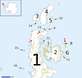
Map of Graham Land, showing Vega Island (7)
|
|
|
Location in Antarctica
|
|
| Geography | |
|---|---|
| Location | Antarctica |
| Coordinates | 63°50′S 57°25′W / 63.833°S 57.417°W |
| Archipelago | James Ross Island group |
| Width | 3 km (1.9 mi) |
| Administration | |
| Administered under the Antarctic Treaty System | |
| Demographics | |
| Population | Uninhabited |
Vega Island is a small island located near James Ross Island in Antarctica. It is separated from James Ross Island by a body of water called Herbert Sound. The island was named by Otto Nordenskjold, who led the Swedish Antarctic Expedition from 1901 to 1904. He named it after the ship Vega, which was the first ship to travel through the Northeast Passage in 1878-1879.
Vega Island is a very important place for studying fossils. Scientists have found many fossils of both land and sea animals here. These fossils come from a time when dinosaurs disappeared from Earth, at the end of the Cretaceous Period and the start of the Paleogene Period (which used to be called the Tertiary Period). Some of the fossils found on the island include hadrosaurs (duck-billed dinosaurs), plesiosaurs (long-necked marine reptiles), and mosasaurs (large marine lizards).
How Vega Island Was Formed
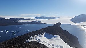
Vega Island is a special type of volcano called a tuya (pronounced TOO-yah). Tuyas are rare volcanoes that form when lava erupts under a thick ice cap. Vega Island was created in three main steps:
- Step 1: Under the Ice First, lava erupted deep under the ice cap. This hot lava met the cold ice and shattered into tiny pieces of glass, ash, and sand. Over time, these pieces turned into yellow rock layers.
- Step 2: Under a Lake Next, the lava kept erupting, but this time it flowed into a lake of melted ice water that was trapped inside the ice cap. This created rough volcanic rock and rounded, pillow-shaped lava formations.
- Step 3: Above the Ice Finally, the lake either drained away or boiled off. The lava then flowed on top of the earlier volcanic rocks, forming a hard caprock. This caprock is found along the northwest shore of the island. It's so solid that it doesn't let water through. This is why, on warmer days, you can see about sixty waterfalls flowing down the island's sides!
 In Spanish: Isla Vega para niños
 | Selma Burke |
 | Pauline Powell Burns |
 | Frederick J. Brown |
 | Robert Blackburn |


