Vicar Water facts for kids
Quick facts for kids Vicar Water |
|
|---|---|

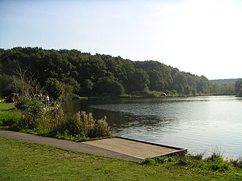
Vicar Pond, which is fed by Vicar Water
|
|
| Country | England |
| County | Nottinghamshire |
| Physical characteristics | |
| Main source | Clipstone Country Park |
| River mouth | River Maun Clipstone |
Vicar Water is a small river in Nottinghamshire, England. It is a tributary of the River Maun, which means it's a smaller stream that flows into a larger river. This river flows through an area that was once a royal hunting ground called Clipstone Park.
The river got its current name in the early 1800s. In 1870, a dam was built across it to create a lake for raising trout fish. These fish were then moved to the lakes at nearby Welbeck Abbey. After coal mining stopped in the area, much of Vicar Water became part of a country park. It is now a special place called a Local Nature Reserve, which helps protect its natural environment.
Contents
The History of Vicar Water
Vicar Water joins the River Maun near Clipstone. Close by is an old hunting lodge, built in 1164. This lodge was used by King John many years ago. Today, the ruins of the lodge are protected as a historic site.
How the River Got Its Name
When the hunting lodge was built, the river was called Warmebroke. It wasn't until the early 1800s that it became known as Vicar Water. In the 1600s, large areas of land, including the river, were given to important families like the Duke of Newcastle and the Duke of Portland. The river and its surroundings became part of the Duke of Portland's huge estate.
Creating the Trout Fishery
In the 1870s, the 5th Duke of Portland built a dam across the river. This created a lake, which was used to raise trout. These trout were then moved to stock the lakes at Welbeck Abbey. For example, records show that 600 fish were moved in 1873.
From Fishery to Fun Spot
About 30 years later, the lake became a popular place for swimming and boating. It was even used by soldiers during the First World War, as many as 20,000 soldiers were stationed nearby.
When Clipstone Colliery (a coal mine) opened in 1922, many new people moved to the area. About 2,000 residents came to live in the specially built village of New Clipstone. They also enjoyed the lake for swimming and boating. Fishing became popular too, and the Duke gave the fishing rights to the Clipstone Colliery Angling Club.
From Mine to Park
Over time, large piles of waste from the coal mine, called spoil tips, grew around the lake and river. This continued until 1976, when the mine stopped dumping waste.
After that, Nottinghamshire County Council started a project to clean up the area. They wanted to turn it into a country park. They planted about 25 acres (10 hectares) of woodland. The new park officially opened in 1982.
Ten years later, the park was taken over by the Newark and Sherwood District Council. They made more improvements with money from the county council and a European fund. A park ranger was hired in 1993 to help manage the site. This became a full-time job in 1999, thanks to funding from the coal mine owners.
The River's Journey
Vicar Water begins at several small lakes at the western edge of the country park. These lakes are where a much larger artificial lake used to be. Old maps from 1885 show that this larger lake had three gates, called sluices, that let water into the main river channel.
The river used to start even before this lake. However, this area was changed by railway construction. A big settling pond was built as part of the mine operations, right where the stream once flowed.
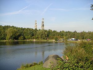
The river then flows along the southern edge of Clipstone and the northern edge of the country park. It reaches a "V"-shaped lake called Vicar Pond. This pond is now a popular place for coarse fishing, where people catch fish like carp and roach.
Below the pond, the river flows under several old railway bridges. These bridges were once used by the coal mine but are no longer active. The National Cycle Network Route 6, a path for bikes, runs right next to the river here.
At this point, the river turns north towards King's Clipstone. It passes under the B6030 Mansfield Road and finally joins the River Maun.
Water Quality of Vicar Water
The Environment Agency checks the water quality of rivers in England. They give each river system an overall ecological status. This status can be high, good, moderate, poor, or bad.
To decide this, they look at several things:
- Biological status: This checks the number and types of living things in the water, like small invertebrates (animals without backbones), flowering plants, and fish.
- Chemical status: This compares the amounts of different chemicals in the water to safe levels. Chemical status is either good or fail.
Here's how Vicar Water's quality was rated in 2015:
| Section | Ecological Status | Chemical Status | Overall Status | Length | Catchment |
|---|---|---|---|---|---|
| Vicar Water from Source to Maun | Poor | Good | Poor | 2.8 miles (4.5 km) | 6.10 square miles (15.8 km2) |
 | Jessica Watkins |
 | Robert Henry Lawrence Jr. |
 | Mae Jemison |
 | Sian Proctor |
 | Guion Bluford |


