Vicente Tofiño de San Miguel facts for kids
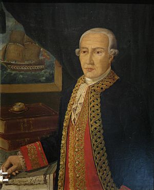
Vicente Tofiño de San Miguel y Vandewalle (born September 6, 1732, in Cádiz – died January 15, 1795, in San Fernando, Cádiz) was an important Spanish navigator and cosmographer. A cosmographer is someone who studies and maps the universe, including the Earth and its seas. He was known for creating detailed maps and charts of the Spanish coastlines.
Life and Work
Vicente Tofiño first studied experimental physics. Later, he joined the army, but he left it after a while.
In 1755, a famous scientist named Jorge Juan y Santacilia asked Tofiño to join the Academy of Marines in Cádiz. Here, Tofiño became a mathematics teacher. At the same time, he also joined the Spanish Navy, known as the Armada, as a second lieutenant.
Tofiño became the Director of the Academy in Cádiz in 1768. A few years later, in 1773, he also became the Director of the Academies in Ferrol and Cartagena.
He took part in important military actions. These included expeditions against Algiers in 1773 and the Great Siege of Gibraltar in 1782. He continued to rise in rank within the Navy. In 1784, he became a Brigadier of the Armada, and in 1789, he reached the rank of Rear Admiral.
Mapping the Seas
Tofiño was key in planning and working at the Royal Institute and Observatory of the Armada. This is where he made many important scientific observations. For example, he observed the "transit of Venus" across the Sun. This is when the planet Venus passes directly in front of the Sun, which is a rare event.
He also spent a lot of time at sea, which led to several important works. These included:
- Derrotero de las costas de España en el mar Mediterráneo y África (1787). This was like a pilot's guide for the coasts of Spain and Africa in the Mediterranean Sea.
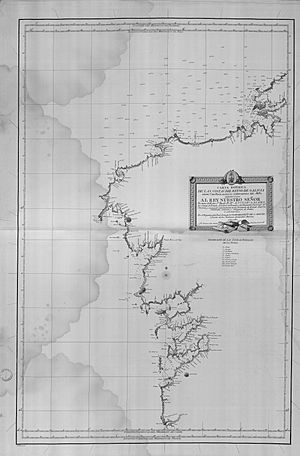
- His colección de cartas esféricas de las costas de España y África... (1788). This was a collection of nautical charts, which are special maps used by sailors.
- The Derrotero de las costas de España en el Océano Atlántico y de las islas Azores o Terceras... (1789). This was another pilot's guide, this time for the Atlantic Ocean and the Azores islands. These guides helped sailors understand and use his detailed charts.
Tofiño's Legacy
Because of a small mistake when copying one of Tofiño’s maps, a small island near Santander became known as Mouro Island.
In 1792, Spanish explorers Galiano and Valdés named Tofino Inlet after Admiral Tofiño. The town of Tofino in Canada later got its name from this inlet. Galiano had learned how to make maps, a skill called cartography, from Admiral Tofiño.
See also
 In Spanish: Vicente Tofiño de San Miguel para niños
 | Misty Copeland |
 | Raven Wilkinson |
 | Debra Austin |
 | Aesha Ash |


