Victoria Island structure facts for kids
| Impact crater/structure | |
|---|---|
| Confidence | probable |
| Diameter | 5.5 kilometers (3.4 mi) |
| Exposed | No |
| Drilled | No |
| Location | |
| Coordinates | 37°53′24″N 121°32′06″W / 37.89°N 121.535°W |
| Country | United States |
| State | California |
| District | San Joaquin County |
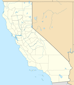
The Victoria Island structure is a large, bowl-shaped area about 5.5 kilometers (3.4 miles) wide. It is buried deep underground in soft rock called shale. This structure is located in the Sacramento-San Joaquin River Delta in California. It lies about 19 kilometers (12 miles) west of Stockton, California.
This circular area used to be part of the ocean floor. It is found very deep, about 1,490 to 1,600 meters (4,890 to 5,250 feet) below sea level.
Discovering the Victoria Island Structure
Scientists found the Victoria Island structure while they were looking for oil. They shared their discovery at a big meeting called the Lunar and Planetary Science Conference in Houston, Texas, in March 2007.
What is an Impact Crater?
Scientists believe the Victoria Island structure is a buried impact crater. This means it was formed when a space rock, like an asteroid or comet, crashed into Earth. This event happened a very long time ago, between 37 and 49 million years ago.
Where is Victoria Island?
The structure is named after Victoria Island, which is located in the San Joaquin River Delta. The exact spot of the buried structure isn't known more precisely than being under this island. Its coordinates are approximately 37°53′24″N 121°32′06″W / 37.890°N 121.535°W.
 | John T. Biggers |
 | Thomas Blackshear |
 | Mark Bradford |
 | Beverly Buchanan |


