Vilas, Colorado facts for kids
Quick facts for kids
Vilas, Colorado
|
|
|---|---|

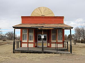
Former saloon on Main Street (2019)
|
|

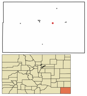
Location within Baca County and Colorado
|
|
| Country | United States |
| State | Colorado |
| County | Baca County |
| Incorporated | June 25, 1888 |
| Government | |
| • Type | Statutory Town |
| Area | |
| • Total | 0.13 sq mi (0.33 km2) |
| • Land | 0.13 sq mi (0.33 km2) |
| • Water | 0.00 sq mi (0.00 km2) |
| Elevation | 4,157 ft (1,267 m) |
| Population
(2020)
|
|
| • Total | 98 |
| • Density | 750/sq mi (297/km2) |
| Time zone | UTC−7 (MST) |
| • Summer (DST) | UTC−6 (MDT) |
| ZIP Code |
81087 (PO Box)
|
| Area code | 719 |
| FIPS code | 08-81030 |
| GNIS ID | 2413433 |
Vilas is a small town located in Baca County, Colorado, United States. In 2020, the census counted 98 people living there.
History of Vilas
Vilas got its name from William Freeman Vilas, who was a United States Senator from Wisconsin. A post office opened here way back in 1887. The town was officially made a municipality on June 25, 1888.
Geography of Vilas
Vilas is located in the eastern part of Baca County. A main road, U.S. Route 160, runs just north of the town. This road can take you west about 11 miles (18 km) to Springfield, which is the county seat. It can also take you east about 9 miles (14 km) to Walsh.
The town is quite small. It covers about 0.1 square miles (0.3 square kilometers) of land. There is no water area within the town limits.
Population Changes in Vilas
The number of people living in Vilas has changed over the years. Here's how the population has looked during different U.S. censuses:
| Historical population | |||
|---|---|---|---|
| Census | Pop. | %± | |
| 1940 | 129 | — | |
| 1950 | 132 | 2.3% | |
| 1960 | 107 | −18.9% | |
| 1970 | 83 | −22.4% | |
| 1980 | 118 | 42.2% | |
| 1990 | 105 | −11.0% | |
| 2000 | 110 | 4.8% | |
| 2010 | 114 | 3.6% | |
| 2020 | 98 | −14.0% | |
| U.S. Decennial Census | |||
See also
 In Spanish: Vilas (Colorado) para niños

