
Villahermosa facts for kids
Quick facts for kids
Villahermosa
|
||
|---|---|---|
|
State capital
|
||

From top to bottom, from left to right: Monument to Taabscoob, the lagoon of illusions, the Parque Museo La Venta, the church of the Immaculate Conception, the Grijalva river as it passes through Villahermosa, the main square, monumental letters and the Cathedral of the Lord of Tabasco.
|
||
|
||
| Nickname(s):
The Emerald of the Southeast
Spanish: La Esmeralda del Sureste |
||

Villahermosa
Location in Tabasco

Villahermosa
Location in Mexico

Villahermosa
Location in North America
|
||
| Country | Mexico | |
| State | Tabasco | |
| Founded | 24 June 1564 | |
| Area | ||
| • State capital | 61.177 km2 (23.62 sq mi) | |
| • Urban | 63.2 km2 (24.4 sq mi) | |
| • Metro | 1,612 km2 (622.4 sq mi) | |
| Elevation | 20 m (70 ft) | |
| Population
(2015 census)
|
||
| • State capital | 684,847 | |
| • Urban | 353,577 | |
| GDP (PPP, constant 2015 values) | ||
| • Year | 2023 | |
| • Total | $23.2 billion | |
| Time zone | UTC−6 (CST) | |
| • Summer (DST) | UTC−5 (CDT) | |
| Federal Routes | ||

Villahermosa is the capital and largest city of the Mexican state of Tabasco. It is also the main city for the surrounding area, known as a municipality. Located in Southeast Mexico, Villahermosa is important for its rich history, natural resources, and growing industries.
People often call Villahermosa "La Esmeralda del Sureste," which means "The Emerald of the Southeast." It is a modern city with roots going back to the early 1500s. The city's natural resources, like cacao, sugarcane, bananas, and tobacco, have attracted many businesses. Villahermosa is also a major center for oil and gas in Southern Mexico. It is even called the "Energy City of Mexico" because of oil discoveries nearby. Many large stores and banks operate here, making it a busy commercial hub.
Contents
What Does Villahermosa Mean?
In 1598, King Philip II of Spain named the city "Villa Hermosa of San Juan Bautista." He also gave it a special royal shield, which is still used today. Over time, the city's name changed many times. In 1916, the governor decided to keep only "Villahermosa."
Past Names of the City
Villahermosa has had many names throughout its history:
- Villa Carmona (1564): Named by Diego de Quijada when he founded the city.
- San Juan Bautista (1565): Honoring the city's patron saint.
- Villa Hermosa de San Juan Bautista (1598): A title given by King Philip II of Spain.
- San Juan de Villahermosa (1604): Named by the Viceroy Marquis de Montesclaros.
- Villahermosa del Puerto (1792): When it became a "minor port."
- San Juan Bautista de Tabasco (1826): By decree of the State Congress.
- Villahermosa (1916): The official name chosen by Governor Francisco J. Múgica.
City Symbols: The Coat of Arms
On July 24, 1598, King Philip II of Spain gave the village of San Juan Bautista the name Villa Hermosa of San Juan Bautista and a special Coat of Arms. In 1892, this coat of arms became the official shield for the state of Tabasco.
The shield has four main sections and a smaller shield in the middle. It shows the Spanish Imperial Crown, representing King Charles.
- The first section has four castle towers. These stand for different parts of Spain and its territories.
- The second section shows an arm with a sword. This represents Spain's power over its lands.
- The third section features an Aztec woman in a feathered skirt. She holds flower bouquets in her hands.
- The fourth section shows a crowned lion. This represents the ancient Kingdom of León in Spain.
The small shield in the center shows the Virgin Mary and the Pillars of Hercules. On the pillars, it says "Plus Ultra," meaning "further beyond." This reflects the discovery of America and Spain's expansion overseas.
Geography and Natural Beauty
Villahermosa is about 30 miles (50 km) south of the Gulf Coast. It is located in the center of Tabasco state, near several other municipalities. The city's coordinates are 17°59'N latitude and 92°55'W longitude.
The city area covers about 61 square kilometers. The larger municipality, which includes the city, is 1,612 square kilometers. This makes it the 7th largest municipality in Tabasco. Villahermosa is a modern city and a key business point between Mexico City and Cancún.
Rivers, Lagoons, and Green Spaces

Villahermosa sits between the Grijalva and Carrizal rivers. The city is about 10 meters (33 feet) above sea level. It also has several lagoons, with the largest being La Laguna de las Ilusiones (Illusions Lagoon).
Important roads in the city include Paseo Tabasco and Gregorio Méndez Avenue.
Climate and Weather
Villahermosa has a tropical monsoon climate. This means it is hot and humid for most of the year. During spring and summer, temperatures can reach over 40°C (104°F). Humidity is also high, making it feel even hotter. In its short "winter," temperatures drop to around 28°C (82°F), but it remains very humid.
In October 2007, Villahermosa experienced its worst flood ever. Many homes were flooded, and thousands of people had to leave their houses.
| Climate data for Villahermosa (1951–2010) | |||||||||||||
|---|---|---|---|---|---|---|---|---|---|---|---|---|---|
| Month | Jan | Feb | Mar | Apr | May | Jun | Jul | Aug | Sep | Oct | Nov | Dec | Year |
| Record high °C (°F) | 38.0 (100.4) |
38.0 (100.4) |
41.8 (107.2) |
43.1 (109.6) |
44.0 (111.2) |
41.7 (107.1) |
40.0 (104.0) |
40.0 (104.0) |
38.5 (101.3) |
37.5 (99.5) |
38.0 (100.4) |
35.5 (95.9) |
44.0 (111.2) |
| Mean daily maximum °C (°F) | 27.9 (82.2) |
29.2 (84.6) |
31.9 (89.4) |
33.9 (93.0) |
35.1 (95.2) |
34.4 (93.9) |
33.9 (93.0) |
34.0 (93.2) |
33.0 (91.4) |
31.2 (88.2) |
29.8 (85.6) |
28.3 (82.9) |
31.9 (89.4) |
| Daily mean °C (°F) | 23.6 (74.5) |
24.5 (76.1) |
26.6 (79.9) |
28.5 (83.3) |
29.6 (85.3) |
29.3 (84.7) |
28.9 (84.0) |
28.9 (84.0) |
28.4 (83.1) |
27.1 (80.8) |
25.7 (78.3) |
24.1 (75.4) |
27.1 (80.8) |
| Mean daily minimum °C (°F) | 19.3 (66.7) |
19.7 (67.5) |
21.3 (70.3) |
23.1 (73.6) |
24.2 (75.6) |
24.2 (75.6) |
23.8 (74.8) |
23.8 (74.8) |
23.8 (74.8) |
23.0 (73.4) |
21.5 (70.7) |
19.9 (67.8) |
22.3 (72.1) |
| Record low °C (°F) | 10.5 (50.9) |
12.4 (54.3) |
13.0 (55.4) |
15.0 (59.0) |
13.0 (55.4) |
19.0 (66.2) |
20.0 (68.0) |
20.0 (68.0) |
19.5 (67.1) |
17.0 (62.6) |
14.0 (57.2) |
10.9 (51.6) |
10.5 (50.9) |
| Average rainfall mm (inches) | 125.6 (4.94) |
79.0 (3.11) |
50.1 (1.97) |
44.6 (1.76) |
95.9 (3.78) |
208.5 (8.21) |
178.9 (7.04) |
216.8 (8.54) |
328.2 (12.92) |
299.9 (11.81) |
187.2 (7.37) |
145.0 (5.71) |
1,959.7 (77.15) |
| Average rainy days (≥ 0.1 mm) | 11.1 | 8.5 | 5.8 | 4.2 | 5.9 | 13.9 | 14.5 | 15.7 | 18.3 | 16.2 | 11.3 | 11.0 | 136.4 |
| Average relative humidity (%) | 76 | 75 | 73 | 73 | 71 | 72 | 72 | 75 | 77 | 79 | 81 | 81 | 75 |
| Mean monthly sunshine hours | 168 | 185 | 252 | 215 | 278 | 217 | 252 | 245 | 167 | 150 | 170 | 144 | 2,443 |
| Source 1: Servicio Meteorológico National (humidity 1981–2000) | |||||||||||||
| Source 2: Deutscher Wetterdienst (sun, 1961–1990) | |||||||||||||
A Look at Villahermosa's History

Villahermosa was officially founded on June 24, 1564, by the Spanish explorer Diego de Quijada. It was built on the banks of the Grijalva River. In 1826, the village became a city and was named San Juan Bautista de la Villa Hermosa.
During the French invasion of Mexico, French troops took over the city in 1863. In 1916, the governor of Tabasco, Francisco J. Múgica, changed the city's name back to Villahermosa.
Early Colonial Times
The first settlement was called Villa Carmona, then San Juan Bautista. It was divided into neighborhoods. The oldest was Esquipulas, named after a church with a black Christ statue.
In 1596, a fort called the Fort House or Royal Warehouse was built in San Juan Bautista. This was to protect the people and valuable goods from pirate attacks.
On July 24, 1598, the King of Spain gave the city the title Villa Hermosa de San Juan Bautista. He also granted it a royal shield, which is one of the oldest in America.
Because pirates kept attacking the old capital, Santa María de la Victoria, the authorities moved the capital to San Juan de Villahermosa in 1641. This made Villahermosa the new capital of Tabasco.
However, pirate attacks continued. In 1677, pirates attacked Villahermosa so fiercely that the authorities had to move the capital again, this time to Tacotalpa. Villahermosa was left nearly empty.
In 1711, English pirates attacked Villahermosa again, burning down the Royal Warehouse. The city was left in ruins. Finally, in 1785, local forces defeated the English pirates and drove them away from Carmen Island.
Villahermosa Becomes Capital Again
In 1795, the capital of Tabasco was moved back to Villahermosa from Tacotalpa. This happened on August 15, 1795, after 118 years.
The city grew with new neighborhoods like La Punta and La Santa Cruz. Villahermosa became a busy river port during the last years of the Spanish rule.
The 19th Century: Independence and Conflicts
In 1809, Villahermosa had its first local government, called the Town Hall.
During Mexico's fight for independence, there were some movements in Villahermosa. On July 5, 1821, independent fighters took the city. They declared independence in the main square. However, the Spanish forces soon took the city back.
On September 7, 1821, Colonel Juan Nepomuceno Fernández Mantecón entered the city. He defeated the Spanish army, and the last Spanish governor fled. The next day, on September 8, the local leaders officially joined the new nation of Mexico. This ended 302 years of Spanish rule in Tabasco.
In 1826, the city's name was officially changed to San Juan Bautista de Tabasco.
Challenges and Invasions
In 1833, a serious cholera epidemic hit the city, causing many deaths. This was followed by civil wars between different political groups. These conflicts left the city heavily damaged.
In 1846, U.S. forces invaded Tabasco. On October 25, they reached San Juan Bautista. The city's governor, John Baptist Traconis, refused to surrender. The U.S. forces bombed the city, destroying many buildings. But the brave defense by the local people prevented the U.S. from taking the city. This was a rare victory for Mexican forces against the Americans.
The U.S. forces then blocked the port to stop supplies from reaching the city. In June 1847, the Americans returned and bombed the city again. This time, with no supplies, the city fell. The authorities had to flee to Tacotalpa. However, local fighters continued to resist. After 35 days, the Americans left the city, but they burned and destroyed much of it before leaving.
French Invasion

In 1863 and 1864, French forces also caused great damage to San Juan. On June 18, 1863, the French army attacked the city. They bombed it heavily and took control. They set up their headquarters in a building called "The Principal."
Six months later, on December 2, 1863, Mexican forces began to fight back. They bombed the city and slowly gained ground. The final fight for the capital began on January 13, 1864. It was a street-by-street battle. By January 18, the Mexican forces were in the city center. The French retreated to "The Principal" building.
On February 27, the French invaders finally left the city. This was a proud moment for Mexico, as it was the first region from which the French were expelled. After this, churches and buildings had to be rebuilt again.
The 20th and 21st Centuries
The early 1900s saw Villahermosa grow. However, during the Mexican Revolution, there was much political instability. In 1916, the city was officially renamed "Villahermosa."
In 1923, a rebellion broke out in Tabasco. Rebel generals took Villahermosa, forcing the governor to flee. Federal forces later defeated the rebels.
Modern Growth
In the 1940s and 1950s, Villahermosa expanded as new neighborhoods were built. The city began to change as drains and new streets were added.
When Tabasco became a major oil region in the 1950s and 1960s, Villahermosa grew rapidly. Towns like Tamulté became part of the city. By 1970, Villahermosa was seen as a modern city.
The Tabasco 2000 area became a symbol of the city's progress. It has government offices, banks, hotels, and shopping centers. This area shows how much Villahermosa has developed.
Today, the city continues to grow. New housing developments are being built on the outskirts, creating a larger Metropolitan Area of Villahermosa.
Main Sights to See


One of the most important places to visit is the La Venta Museum-Park. It has a great collection of Olmec artifacts, including giant stone heads. There is also a small zoo there.
Other interesting places include:
- Esperanza Iris Theatre
- Plaza de Armas (the main square)
- Zona Luz (the city center with pedestrian streets)
- Catedral del Señor de Tabasco (Cathedral of the Lord of Tabasco)
- Tomás Garrido Canabal Park
- Yumká (a zoo where animals roam freely)
- Papagayo Children's Museum
Getting Around Villahermosa

The city has its own airport, the Carlos Rovirosa Pérez International Airport. It has flights to and from major cities in Mexico. This airport was the destination for the first flight of Mexicana Airlines in 1929. Villahermosa is also the closest city to the ancient Mayan ruins at Palenque.
Learning and Education


Villahermosa has many schools for all ages, from elementary to college. It is home to some of the most important universities in Tabasco, such as:
- Universidad Juárez Autónoma de Tabasco (UJAT)
- Instituto Tecnológico de Villahermosa
- Universidad Tecnológica de Tabasco
- Universidad del Valle de México
City Design and Development

Even though Villahermosa is an old city, it looks very modern. The old town keeps the colonial feel. This area has the oldest buildings, including the Main Park. Here you can find the Government Palace, the State Congress, and the High Court of Justice. The Church of the Conception, built in 1800, is also here, though it was rebuilt after being destroyed in past wars.
The heart of the historic center is the Light Zone. This area has pedestrian streets with cafes, restaurants, and shops. It is the main commercial area of the old city.
Outside the historic center, the city has modern buildings. Its fast growth since the 1970s led it to expand into areas that used to be lagoons or swamps. It also absorbed nearby communities, which are now busy neighborhoods.
Important roads like Paseo Tabasco and the Inner Circuit "Carlos Pellicer Camera" connect different parts of the city.

In the west, you will find Tabasco 2000, a major business and financial area. It was built in the 1980s due to the strong oil industry. It has large shopping centers, banks, hotels, and modern office buildings.
The city's growth has also led to new housing developments outside the main city. These areas are now part of the Metropolitan Area of Villahermosa.
Future City Projects
Villahermosa has several big projects planned or under construction to improve the city:
- Emerald City: A project that includes government offices, housing, hospitals, and shopping centers.
- New Convention Center: A large complex for exhibitions and events.
- Extension of the Internal Circuit Carlos Pellicer: Expanding this road from 4 to 8 lanes to handle more traffic.
- Libramiento de Villahermosa: A new 4-lane road to help reduce heavy traffic in the city.
- Road Distributor 'Tabscoob'' (Already built): A modern road junction to improve traffic flow in the east of the city.
- Road Distributor 'La Pigua'' (Completed): Another road junction to speed up traffic in the north, including new bridges.
- Villa Brisa: A new development with an artificial lake, apartments, and shops.
- Tabasco Diamante: A large project with many buildings and shops, still under construction.
Tourism and Events
Villahermosa is a popular place for congresses and conventions. In 2010, it hosted 61 events with over 40,000 attendees. It is also the permanent home of the "Mexico's International Petroleum Congress and Conference," which brings together thousands of people from around the world each year.
The city has many hotels, shopping centers, and restaurants for visitors. It is easy to reach by air, land, and even by sea through the port of Two Mouths.
Sister Cities
Villahermosa has two sister cities. These are cities that share a special bond to promote cultural and economic ties:
Images for kids
-
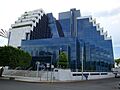
Regional operations center of Pemex

See also
 In Spanish: Villahermosa (Tabasco) para niños
