Wahta Mohawks facts for kids
Quick facts for kids
Wahta Mohawk Territory
|
|
|---|---|
| Wahta Mohawk Territory Indian Reserve | |
 |
|
| Country | |
| Province | |
| District municipality | Muskoka |
| First Nation | Wahta Mohawks |
| Area | |
| • Land | 61.17 km2 (23.62 sq mi) |
| Population | |
| • Total | 156 |
| Website | www.wahtamohawks.com |
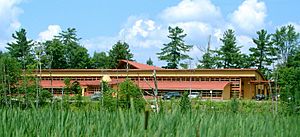
The Wahta Mohawks (Mohawk: Wáhtahró:non) are a group of Mohawk people. They are a First Nation in Ontario, Canada. Their home is the Wahta Mohawk Territory (Mohawk: Wáhta). This special area is also called an reserve.
The territory is located in the District Municipality of Muskoka, Ontario. It is close to the town of Bala. A big highway, Highway 400, runs along its western side. About one-third of the 831 Wahta Mohawk citizens live in the community of Wahta. Many others live nearby or in other places.
The land here is full of forests and lakes. This is typical of the rugged Canadian Shield area. Mohawk people from other reserves, like Kanesatake and Kahnewake in Quebec, use this land for hunting and fishing. The name "Wáhta" means "Maple" in the Mohawk language. It is also the name of an important Mohawk ceremony.
History of Wahta Mohawk Territory
The Wahta Mohawk Territory was created in 1881. A group called the Sulpician Order bought this land. They bought it for Mohawk people from the community of Kanesatake, Quebec. There had been disagreements over land rights in Kanesatake. About one-fifth of the Mohawk people from that community moved to this new area.
The Wahta Mohawks also share another reserve. It is called the Indian River Indian Reserve. They share it with the Chippewas of Rama First Nation.
In October 2023, a road in the territory got a new name. District Road 38 is now called Kanien’kehá:ka Iohatátie. This means "Mohawk Peoples Road" in the Mohawk language. This change happened with the help of the Muskoka District council and the province.
Highway 400 and the "Wahta Gap"
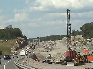
For some years, there was a problem with Highway 400. A part of the highway through Wahta could not be finished. This was because of a land claim dispute. A land claim is when a First Nation says they own land that others are using.
Because of this, there was an eight-kilometre "gap" in the freeway. This part of the road stayed a two-lane highway. This happened even after the rest of the freeway was built further north. In 2001, the government and the Wahta Mohawks almost reached an agreement.
However, there was another delay. The community needed a certain number of people to vote on the agreement. This is called reaching a quorum. Even though people voted in favor, not enough people voted for it to be official.
Finally, in 2003, an agreement was reached. This allowed the highway construction to go through the reserve lands. Work started in 2004 and was finished in 2008.
Population of Wahta
Here are some facts about the population of Wahta Mohawk Territory as of March 2018:
- Population: 156 people
- Area: 61.17 square kilometres
- Density: About 2.55 people per square kilometre
It is important to know that many Wahta Mohawks live outside the reserve. Out of 831 total Wahta Mohawks, 675 live off-reserve.
 | Delilah Pierce |
 | Gordon Parks |
 | Augusta Savage |
 | Charles Ethan Porter |


