War Down facts for kids
Quick facts for kids War Down |
|
|---|---|

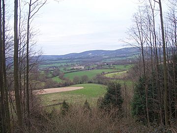
View across farmland at Stroud towards War Down and Butser Hill
|
|
| Highest point | |
| Elevation | 244 m (801 ft) > |
| Prominence | 90 m (300 ft) |
| Parent peak | Butser Hill |
| Listing | sub-HuMP |
| Geography | |
| Location | Hampshire, England |
| Parent range | South Downs |
| OS grid | SU726198 |
| Topo map | OS Landranger 197; Explorer 120. |
War Down is a notable hill located in Hampshire, England. It stands at about 244 meters (which is around 801 feet) tall. This makes it one of the highest hills in Hampshire! It's also the second tallest point in the Hampshire part of the beautiful South Downs area. Just a short distance away, about 1 kilometer to the northwest, is Butser Hill, which is even taller at 270 meters and is the highest point in the South Downs.
Exploring War Down
Much of War Down is covered by a mix of different types of trees, creating a lovely forest. This makes it a great place for nature walks and exploring.
What is a Trig Point?
At the very top of War Down, you'll find something called a "trig point." This is a special concrete pillar that was once used by mapmakers. They used these points to help them accurately measure and map the land. So, when you see a trig point, you know you're at a significant spot!
Paths and Parks
There's a special path, like a forest road, that goes right over the top of War Down. This makes it easy for people to explore the hill. War Down is also part of the Queen Elizabeth Country Park. This park is a large, protected area where people can enjoy nature, go hiking, and discover the local wildlife. It's a fantastic place for outdoor adventures!
 | Janet Taylor Pickett |
 | Synthia Saint James |
 | Howardena Pindell |
 | Faith Ringgold |

