Waterloo Corner, South Australia facts for kids
Quick facts for kids Waterloo CornerAdelaide, South Australia |
|||||||||||||||
|---|---|---|---|---|---|---|---|---|---|---|---|---|---|---|---|

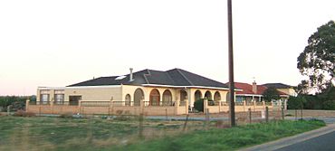
House on Port Wakefield Road, Waterloo Corner
|
|||||||||||||||
| Postcode(s) | 5110 | ||||||||||||||
| LGA(s) |
|
||||||||||||||
| State electorate(s) | Taylor | ||||||||||||||
| Federal Division(s) | Spence | ||||||||||||||
|
|||||||||||||||
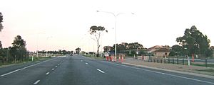
Waterloo Corner is a place in South Australia. It is about 22 kilometers north of Adelaide, the capital city. Most of the land here is used for farming. Farmers grow crops like wheat, olives, grapes, and tomatoes. A major road, Port Wakefield Road, goes through Waterloo Corner. This means many large trucks travel through the area.
History of Waterloo Corner
Long ago, there was a place called the Waterloo Inn. It stood where St Kilda Road and Port Wakefield Road meet. The area we now call Waterloo Corner started in 1960. A company named Southern Estates Ltd helped set it up.
There was also an Elim Chapel and a cemetery here once. These buildings are gone now. Part of Waterloo Corner is even in the City of Playford. The local post office in Waterloo Corner closed in 1972.
Some people think Waterloo Corner got its name from a famous battle. This battle was called the Battle of Waterloo. It happened in 1815 in a country now known as Belgium.
 | Madam C. J. Walker |
 | Janet Emerson Bashen |
 | Annie Turnbo Malone |
 | Maggie L. Walker |


