Waterville, Minnesota facts for kids
Quick facts for kids
Waterville, Minnesota
|
|
|---|---|
|
Small Town
|
|
| Motto(s):
"A Town of Friendly People"
|
|

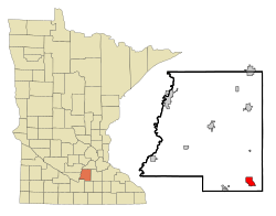
Location of Waterville, Minnesota
|
|
| Country | United States |
| State | Minnesota |
| County | Le Sueur |
| Government | |
| • Type | Mayor - Council |
| Area | |
| • Total | 2.06 sq mi (5.35 km2) |
| • Land | 1.69 sq mi (4.37 km2) |
| • Water | 0.38 sq mi (0.98 km2) |
| Elevation | 1,004 ft (306 m) |
| Population
(2020)
|
|
| • Total | 1,750 |
| • Density | 1,037.96/sq mi (400.74/km2) |
| Time zone | UTC-6 (Central (CST)) |
| • Summer (DST) | UTC-5 (CDT) |
| ZIP code |
56096
|
| Area code(s) | 507 |
| FIPS code | 27-68584 |
| GNIS feature ID | 2397212 |
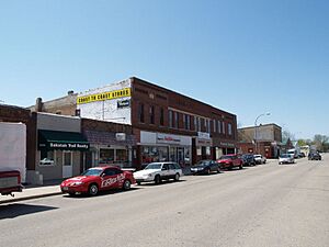
Waterville is a small town in Le Sueur County, Minnesota, United States. In 2020, about 1,750 people lived there. It is located near Sakatah Lake State Park and the Cannon River.
Every year in early June, Waterville hosts a fun event called "Bullhead Days." People in the town gather for food, games, a parade, a carnival, and fireworks. It is a big celebration for the community!
Contents
A Look Back: Waterville's History
Waterville was first planned out in 1856 by nine people from New England. They named the town "Waterville" after Waterville, Maine, which was the hometown of one of the group members, E.I. Wright. The name also fits because the town is located between Lake Tetonka and Lake Sakatah. A post office has been open in Waterville since 1856. The town officially became a city in 1898.
Where is Waterville?
According to the United States Census Bureau, Waterville covers a total area of 2.34 square miles (6.06 km2). Most of this area, 1.70 square miles (4.40 km2), is land, and 0.64 square miles (1.66 km2) is water, like lakes.
Two important roads, Minnesota State Highways 13 and 60, run through the city. These highways help people travel in and out of Waterville.
Who Lives in Waterville?
| Historical population | |||
|---|---|---|---|
| Census | Pop. | %± | |
| 1880 | 498 | — | |
| 1890 | 937 | 88.2% | |
| 1900 | 1,260 | 34.5% | |
| 1910 | 1,273 | 1.0% | |
| 1920 | 1,211 | −4.9% | |
| 1930 | 1,419 | 17.2% | |
| 1940 | 1,600 | 12.8% | |
| 1950 | 1,627 | 1.7% | |
| 1960 | 1,623 | −0.2% | |
| 1970 | 1,539 | −5.2% | |
| 1980 | 1,717 | 11.6% | |
| 1990 | 1,771 | 3.1% | |
| 2000 | 1,833 | 3.5% | |
| 2010 | 1,868 | 1.9% | |
| 2020 | 1,750 | −6.3% | |
| U.S. Decennial Census 2018 Estimate |
|||
In 2010, there were 1,868 people living in Waterville. They lived in 785 homes, and 486 of these were families. The average age of people in the city was about 42 years old. Around 23% of the residents were under 18 years old.
Learning in Waterville
Public schools in Waterville are part of the Waterville-Elysian-Morristown School District.
Famous Faces from Waterville
- A. B. Rogers (1829–1889) was a railway surveyor. He is famous for discovering Rogers Pass in British Columbia, Canada. While he wasn't born in Waterville, he lived there later in his life.
- Adolf Dehn (1895–1968) was a well-known artist, especially famous for his lithographs (a type of printmaking). He was born in Waterville, Minnesota, and later became one of the most important lithographers of the 20th century. He won the Guggenheim Fellowship award twice.
See also
 In Spanish: Waterville (Minnesota) para niños
 | Emma Amos |
 | Edward Mitchell Bannister |
 | Larry D. Alexander |
 | Ernie Barnes |


