
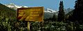
Rogers Pass (British Columbia) facts for kids
Quick facts for kids Rogers Pass |
|
|---|---|
.jpg)
Snow shed construction, Rogers Pass, 1887.
|
|
| Elevation | 1,330 m (4,364 ft) |
| Traversed by | Trans Canada Highway CP (formerly) |
| Location | Revelstoke / Donald |
| Range | Selkirk Mountains |
| Coordinates | 51°18′05″N 117°28′35″W / 51.3014°N 117.4764°W |

Location in British Columbia
|
|
Rogers Pass is a high mountain pass in the Selkirk Mountains of British Columbia, Canada. It's not just the pass itself, but also the paths used by the Canadian Pacific Railway (CP) and the Trans-Canada Highway. Located in the middle of Glacier National Park, it has been a popular place for visitors since 1886. Today, it is also a National Historic Site.
Contents
Exploring Rogers Pass: A Mountain Journey
Rogers Pass offers the lowest way to travel between the Sir Donald and Hermit mountain ranges in the Selkirks. It creates a shortcut along the southern edge of the Big Bend of the Columbia River. This route connects Revelstoke in the west to Donald, near Golden, in the east.
The pass is formed by the beginnings of two rivers. The Illecillewaet River starts on the west side, and the Beaver River starts on the east. Both of these rivers flow into the Columbia River, which curves north.
The Railway Story
Planning the Transcontinental Line
In the 1870s, people were planning a railway across Canada. The first idea was to go through the Yellowhead Pass in the Canadian Rockies. But after the contract was given, the Canadian Pacific Railway (CP) changed the route to the Kicking Horse Pass. Looking back, many believe the Yellowhead Pass and CP's later Crowsnest Pass would have been better choices. This decision caused long-term problems for both the railway and the highway.
Discovering the Pass

As the railway moved across the prairies, CP needed to find a way over the unexplored Selkirk Mountains. In April 1881, CP offered Major A.B. Rogers $5,000 and the right to name the pass if he could find one. Another engineer, Walter Moberly, had found Eagle Pass nearby. Based on Moberly's ideas, Rogers started from what is now Revelstoke, following the Illecillewaet River.
Rogers and his team almost reached the top but had to turn back because they ran out of food. They felt sure a pass existed. In 1882, Rogers returned from the east and reached the spot where he had stopped before. This confirmed the pass's location. Rogers didn't cash the $5,000 cheque. He framed it until CP General Manager William Cornelius Van Horne gave him a gold watch to encourage him to cash it. Many stories have been told about this event over the years.

Like other passes in British Columbia, Rogers' "discovery" was actually a rediscovery. First Nations people had known about and crossed the pass decades earlier. Some Shuswap guides were even part of Rogers' group. Walter Moberly said that a European named Albert Perry had found the pass in 1866.
Building the Railway
Rogers first thought the pass would be easy to build through. But by May 1883, the railway had only reached Medicine Hat. There was still time to find another route if the Kicking Horse Pass was too difficult. Moberly suggested Howse Pass. However, by the time a good route through Kicking Horse and the Selkirks was found, the railway had already moved too far east. It was too late to use Howse Pass, which needed access from the North Saskatchewan River Valley.
Building the railway through the Selkirks was expensive. CP had to balance immediate costs with future savings. They made decisions to keep initial costs low. In 1885, CP faced a shortage of money. Workers went unpaid, and there were small strikes. Captain Steele and his police force protected the construction manager, Ross, from angry workers. When Steele left for the Riel Rebellion, Ross formed his own armed police group.
To save money, the railway was built with the bare minimum. They used wooden bridges instead of stronger ones. The tracks were narrow, and they didn't add gravel (ballast) under them. No snow sheds were built at first, even though they were badly needed. Ballasting only happened three years later.
In early February 1885, three avalanches hit the construction sites. At MacKenzie camp, a worker was buried. At McDermot camp, three buried men were never found. At the summit, three people escaped through a camp store window. Later that month, avalanches completely destroyed the store and buried six more men. These slides, along with heavy summer rain, slowed down the work. CP had to abandon part of the damaged track on the western slope and build new switchback "Loops" to avoid avalanche paths.
The railway tracks reached the summit in August 1885. After the last spike ceremony that November, the line closed for the winter. After repairs, the railway opened for trains the following June.

How the Railway Operated
CP's predictions about train traffic were mostly right. At first, two extra locomotives (called "pusher locomotives") were needed on each side of the pass to help trains climb the steep hills. This was expensive. Most loaded freight trains, if longer than 9 cars, needed one pusher. Special turning areas (wyes) were at Beavermouth (east) and Albert Canyon (west). At the summit, there was a roundhouse and a train yard.
Sometimes no freight trains passed, but after a ship arrived in Vancouver, many trains might head east for several days. From 1907, trains started using two locomotives at the front instead of one at the front and one at the back. Local train traffic was very small.
Passenger trains usually didn't need pushers. Until 1902, there was daily service with 5 to 9 cars. Sometimes, trains were as long as 12 cars. The average speed in the mountains increased over time. By 1913, 9-car trains needed a pusher to keep their speed. Trains had scheduled stops for meals at Field, Glacier House, and North Bend. Albert Canyon was a stop for sightseeing.
In 1905, CP installed a water-powered system to fill coal hoppers. The next year, the engine house was made bigger to hold more locomotives. In 1907, the track was moved to create more yard space for increased freight. Rogers Pass became an important hub, like a "divisional point," with many staff and equipment. The most powerful locomotives were assigned to the Selkirk section. In 1912, locomotives in the mountains were changed to run on oil instead of coal. This meant fewer firemen were needed and trains could pull more weight.
One year after a new tunnel opened, the old railway path over the pass was given to the Parks Department for a wagon road. The snow sheds were removed. Some parts of the old railway tracks later became walking trails in Glacier National Park.
The Danger of Avalanches
.jpg)
The amount and cost of building snow sheds were greatly underestimated. Snow shed construction continued until 1890, but only in areas with constant problems. Sheds were checked in winter for avalanche damage and in summer for fires started by train smokestacks. More workers were hired to shovel out snow slides and drifts. Special snowplows were used, but they couldn't handle avalanches with rocks or wood. These efforts usually cleared blockages within hours after 1889.
A total of 31 snow sheds were built, covering about 6.5 km (4.0 mi). In the first 25 years of the railway, 200 people died in avalanches. Single avalanches killed 6 employees in 1887, 7 or 8 in 1899, and about 60 in the terrible 1910 disaster. This happened because snow sheds were not rebuilt after a track change, and an existing shed was not strong enough. Avalanches hit passenger trains at least four times in the pass, but luckily, no passengers were hurt.
During summer, trains ran on separate tracks outside the sheds. Even after a tunnel was built to avoid some avalanche danger, the problem continued in nearby areas.
The Rogers Pass Community
In 1886, Rogers Pass was a busy construction town. It had 15 hotels, where drinking and gambling were common. One police officer tried to keep order. Over time, the town became more respectable, with formal dances. The small community of about 50 people included two general stores, two hotels, a butcher, a barber, and a CP boarding house.
When the train station moved, the community buildings moved with it. Public events were first held in the CP boarding house. Residents later built a new boarding house for the manager after she was fired for not housing strikebreakers during a strike.
C.D. Morris opened a store in a tent in 1901, then built a permanent store, boarding house, and hall. This hall was used for meetings, church services, and public gatherings. In 1904, he added more bedrooms and a bathroom to the boarding house for workers and tourists. A fire in 1910 destroyed this hotel/boarding house, though the store was saved but damaged. Another fire in 1916 destroyed the Morris store and home. After this, the community moved to a new place called Glacier, near the west entrance of the new tunnel. The school also moved.
New Tunnels Under the Pass
Two long railway tunnels now run beneath Rogers Pass. The 8.0 km (5.0 mi) Connaught Tunnel (built in 1916) and the 14.7 km (9.1 mi) Mount Macdonald Tunnel (built in 1988). The Connaught Tunnel was once the longest railway tunnel in North America, and the Mount Macdonald Tunnel still holds that title. The Connaught Tunnel is used for eastbound trains, and the Mount Macdonald Tunnel is for westbound trains.
The Trans-Canada Highway
Planning the Highway
In 1908, a new wagon road was built from Laggan. Twenty years later, a proper highway connected Lake Louise and Golden. The route chosen for the Golden–Revelstoke link was the longer Big Bend route, not over the Selkirks. This was because of how difficult it was to clear snow in the pass. This road finally opened in 1940.
A plan to upgrade the road to Trans-Canada Highway standards a decade later found that the Selkirks route would be cheaper. It also wouldn't interfere with plans for hydro-electric power on the Columbia River.
Building and Opening the Highway
The highway was built between 1956 and 1962. The main office for the four construction camps was about one-quarter mile (400 m) from the Glacier train station. The old schoolhouse became the dining hall, a former railway house was the office, and workers lived in prefabricated cabins. Radio reception was poor. To watch movies or get a haircut, workers had to travel by train to nearby towns. All supplies also came by train for the about 500 workers who built the 28-mile (45 km) highway.
West of the summit, much of the original route was used. To the east, digging uncovered parts of the old roundhouse that was destroyed by an avalanche in 1899. The provincial government held an official opening ceremony in July 1962, and the federal government held theirs the following September. This beautiful route cut bus travel time by five hours.

Controlling Avalanches
Before 1962, snow sheds were the only way to control avalanches. Three concrete sheds are still on the eastern slope. To keep the highway and railway open in winter, the Royal Canadian Artillery now uses 105-millimetre (4.1 in) howitzers (a type of cannon) to safely trigger unstable snow. This helps reduce avalanche dangers. Stopping your car is not allowed in high-risk areas.
Facilities for Visitors
Glacier park facilities include camping, cabins, and an information centre. The Northlander Motor Hotel, which opened in 1964, was later renamed Glacier Park Lodge. This lodge, with its restaurant and gas station, was the only place for services for about 150 kilometres (93 mi). The gas station closed in 2009, and the lodge closed in 2012. Both were taken down in 2018.
Climate in Rogers Pass
Rogers Pass has a subarctic climate (Köppen Dfc). This means it has cold winters and mild summers. The average high temperature in January is about −7 °C (19 °F), and in July it's about 20 °C (68 °F). With an average of 9.3 m (31 ft) of snowfall each year, Rogers Pass is one of the snowiest places in Canada. There are 134 individual avalanche paths in the steep terrain, so avalanches are very common in winter.
| Climate data for Rogers Pass, British Columbia | |||||||||||||
|---|---|---|---|---|---|---|---|---|---|---|---|---|---|
| Month | Jan | Feb | Mar | Apr | May | Jun | Jul | Aug | Sep | Oct | Nov | Dec | Year |
| Mean daily maximum °C (°F) | −7.3 (18.9) |
−3.6 (25.5) |
1.6 (34.9) |
6.6 (43.9) |
11.0 (51.8) |
15.9 (60.6) |
19.6 (67.3) |
19.4 (66.9) |
13.3 (55.9) |
5.0 (41.0) |
−2.9 (26.8) |
−7.2 (19.0) |
5.9 (42.7) |
| Daily mean °C (°F) | −9.7 (14.5) |
−6.6 (20.1) |
−2.5 (27.5) |
1.9 (35.4) |
5.6 (42.1) |
9.9 (49.8) |
12.8 (55.0) |
12.6 (54.7) |
7.9 (46.2) |
1.8 (35.2) |
−4.9 (23.2) |
−9.4 (15.1) |
1.6 (34.9) |
| Mean daily minimum °C (°F) | −12.1 (10.2) |
−9.6 (14.7) |
−6.5 (20.3) |
−2.8 (27.0) |
0.2 (32.4) |
3.9 (39.0) |
5.9 (42.6) |
5.8 (42.4) |
2.3 (36.1) |
−1.4 (29.5) |
−6.8 (19.8) |
−11.6 (11.1) |
−2.7 (27.1) |
| Average precipitation mm (inches) | 223.1 (8.78) |
156.4 (6.16) |
112.2 (4.42) |
74.6 (2.94) |
70.9 (2.79) |
95.9 (3.78) |
92.1 (3.63) |
91.6 (3.61) |
90.0 (3.54) |
130.3 (5.13) |
196.6 (7.74) |
213.4 (8.40) |
1,547.3 (60.92) |
| Average snowfall cm (inches) | 216.9 (85.4) |
151.8 (59.8) |
95.2 (37.5) |
41.0 (16.1) |
8.5 (3.3) |
0.2 (0.1) |
0 (0) |
0 (0) |
2.1 (0.8) |
44.7 (17.6) |
165.3 (65.1) |
206.8 (81.4) |
932.5 (367.1) |
Images for kids
-
Summit, Rogers Pass, 2005
