
Webster Township, Michigan facts for kids
Quick facts for kids
Webster Township, Michigan
|
|
|---|---|

Township Hall on Webster Church Road
|
|

Location within Washtenaw County
|
|

Webster Township, Michigan
Location in Michigan

Webster Township, Michigan
Location in the United States
|
|
| Country | United States |
| State | Michigan |
| County | Washtenaw |
| Established | 1833 |
| Area | |
| • Total | 35.89 sq mi (92.95 km2) |
| • Land | 34.09 sq mi (88.29 km2) |
| • Water | 0.80 sq mi (2.07 km2) |
| Elevation | 922 ft (281 m) |
| Population
(2020)
|
|
| • Total | 6,575 |
| • Density | 183.20/sq mi (70.737/km2) |
| Time zone | UTC-5 (Eastern (EST)) |
| • Summer (DST) | UTC-4 (EDT) |
| ZIP code(s) | |
| Area code(s) | 734 |
| FIPS code | 26-85100 |
| GNIS feature ID | 1627237 |
| Old Webster Township Hall | |
|---|---|
 |
|
| Location | 5001 Gregory Road Dexter, Michigan |
| Built | 1871 |
| Designated | November 16, 1982 |
Webster Township is a community located in Washtenaw County, Michigan. It's a type of local government area called a civil township. In 2020, about 6,575 people lived here.
Contents
Communities in Webster Township
The main community within the township is also called Webster. It's an unincorporated community, which means it doesn't have its own separate city government.
History of Webster Community
The first person to settle in this area was Thomas Alexander in May 1826. More settlers arrived later that year. When the township was officially created in 1833, it was named after a famous American statesman, Daniel Webster. The community also took the same name.
A post office opened in Webster on May 11, 1833. It moved and changed names a few times before closing for good in 1900.
Geography and Nature
Webster Township is located in Michigan. In 2010, the township covered about 35.89 square miles (92.95 square kilometers). Most of this area, about 34.09 square miles (88.29 square kilometers), is land. The rest, about 0.80 square miles (2.07 square kilometers), is water.
Changes in Area
A small part of Webster Township's land and population changed after 2010. This happened when the nearby village of Dexter became its own city in 2014.
Parks and Trails
A small part of the Hudson Mills Metropark is located in the southwest corner of Webster Township. This park is a great place to enjoy nature. It also includes a short section of the Border-to-Border Trail that runs along the Huron River. This trail is perfect for walking, running, or biking.
People of Webster Township
In 2000, there were 5,198 people living in Webster Township. Most people lived in families, with many having children under 18 at home. The average family size was about three people.
Population Details
The population was spread out across different age groups:
- About 30.5% were under 18 years old.
- About 29.4% were between 25 and 44 years old.
- About 29.0% were between 45 and 64 years old.
- About 7.1% were 65 years or older.
The average age of people in the township was 39 years old.
Education in Webster Township
Students in Webster Township attend schools from four different public school districts. This means that depending on where you live in the township, you might go to a different school system.
School Districts Serving the Township
- Most of the township is served by the Dexter Community School District, located to the southwest in Dexter.
- The southeast part of the township is served by Ann Arbor Public Schools.
- Very small parts of the eastern border are served by Whitmore Lake Public Schools in Whitmore Lake.
- The northwest corner, near Base Line Lake, is served by Pinckney Community Schools from Livingston County.
Images for kids
-

St. Joseph Catholic Church
-
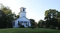
Webster United Church of Christ
-

Independence Lake
,_Michigan_-_panoramio.jpg)


See also
 In Spanish: Municipio de Webster (Míchigan) para niños
