Weets Hill facts for kids
Quick facts for kids Weets Hill |
|
|---|---|

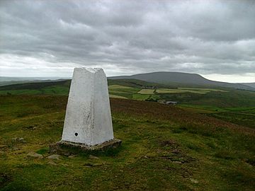
Summit of Weets Hill
|
|
| Highest point | |
| Elevation | 397 m (1,302 ft) |
| Parent peak | Pendle Hill |
| Geography | |
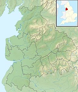
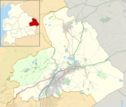
| Location | Lancashire, England |
| OS grid | SD857449 |
| Topo map | OS Landranger 103 |
Weets Hill is a cool hill located in the West Craven area of Pendle, Lancashire, England. It's a great spot for exploring and enjoying amazing views!
Weets Hill: Where Is It?
Weets Hill is about 2.5 miles (4 km) southwest of the town of Barnoldswick. It's also about 4 miles (6.4 km) northeast of the famous Pendle Hill.
Even though Weets Hill is now part of Lancashire for local government, it used to be in the traditional county of Yorkshire. This change happened in 1974.
What Can You See from the Top?
The very top of Weets Hill has a special marker called a Triangulation Pillar. This pillar is like a survey point used to create maps.
From the summit, you can see far and wide! You'll get incredible views over much of eastern Lancashire. You can also spot the northern Ribble Valley, the northern Aire Valley, and parts of the beautiful Yorkshire Dales.
The top of Weets Hill is about 250 meters (820 feet) higher than the nearby towns. These towns include Barnoldswick, Salterforth, Earby, Kelbrook, and Gisburn.
Water and Old Roads
A stream called Stock Beck starts its journey from the northern side of Weets Hill.
To the west of the summit, there's an old path called Gisburn Old Road. This path is paved until it reaches a building called Weets House. After that, it becomes a track that goes over the side of Weets Hill.
This road used to connect the towns of Colne and Gisburn. However, a new road was built in the 1800s, replacing the old one. Weets House was once known as "Stoops House" on maps. "Stoops" were guide posts that helped people find their way at junctions on roads crossing open moorland.
 | William L. Dawson |
 | W. E. B. Du Bois |
 | Harry Belafonte |


