Weir, Kansas facts for kids
Quick facts for kids
Weir, Kansas
|
|
|---|---|

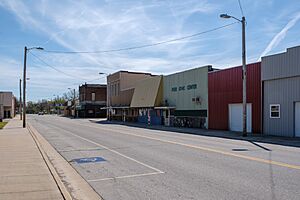
Downtown Weir (2024)
|
|

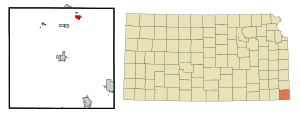
Location within Cherokee County and Kansas
|
|

|
|
| Country | United States |
| State | Kansas |
| County | Cherokee |
| Founded | 1872 |
| Incorporated | 1875 |
| Named for | T. M. Weir |
| Area | |
| • Total | 1.14 sq mi (2.95 km2) |
| • Land | 1.14 sq mi (2.95 km2) |
| • Water | 0.00 sq mi (0.01 km2) |
| Elevation | 919 ft (280 m) |
| Population
(2020)
|
|
| • Total | 569 |
| • Density | 499.1/sq mi (192.9/km2) |
| Time zone | UTC−6 (CST) |
| • Summer (DST) | UTC−5 (CDT) |
| ZIP Code |
66781
|
| Area code | 620 |
| FIPS code | 20-76350 |
| GNIS ID | 485657 |
Weir is a small city located in Cherokee County, Kansas, in the United States. In 2020, about 569 people lived there.
Contents
Weir's Early Days: A City's History
Weir was started in 1872. It got its name from T. M. Weir, a landowner who gave 40 acres of his land to create the town. The first post office in Weir opened in 1875.
Mining and Industry in Weir
In 1873, the Weir City Zinc Company opened the first zinc smelter in Weir. This was an important step for the town's industry. Weir was also one of the first places in Kansas where coal was dug up for sale.
Much of the land under Weir has coal mines about 30 feet deep. The coal veins were about 4 feet thick. In 1899, more than 200 African-American miners came to Weir from Pana, Illinois. They had faced attacks during a coal mining strike there. These miners were looking for work and did not want to go back to Alabama, where they had been recruited from.
Where is Weir? Geography and Climate
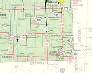
Weir is located south of U.S. Route 400. You can also find it on K-103, which is a Kansas highway.
Weir's Weather: Understanding the Climate
The weather in Weir has hot and humid summers. The winters are usually mild to cool. According to the Köppen Climate Classification system, Weir has a "humid subtropical climate." This is often shown as "Cfa" on climate maps.
Weir's Population Over Time
| Historical population | |||
|---|---|---|---|
| Census | Pop. | %± | |
| 1880 | 376 | — | |
| 1890 | 2,138 | 468.6% | |
| 1900 | 2,977 | 39.2% | |
| 1910 | 2,289 | −23.1% | |
| 1920 | 1,945 | −15.0% | |
| 1930 | 1,115 | −42.7% | |
| 1940 | 1,038 | −6.9% | |
| 1950 | 819 | −21.1% | |
| 1960 | 694 | −15.3% | |
| 1970 | 740 | 6.6% | |
| 1980 | 705 | −4.7% | |
| 1990 | 730 | 3.5% | |
| 2000 | 780 | 6.8% | |
| 2010 | 686 | −12.1% | |
| 2020 | 569 | −17.1% | |
| U.S. Decennial Census | |||
Weir's Community in 2010
In 2010, there were 686 people living in Weir. These people lived in 266 households, and 176 of those were families. The city had about 730 people per square mile. There were 309 homes in total.
Most of the people in Weir were White (94.5%). A smaller number were Native American (2.6%) or African American (0.3%). Some people were from other backgrounds (0.9%) or a mix of two or more races (1.7%). About 2.2% of the population identified as Hispanic or Latino.
About 31.2% of the households had children under 18 living with them. Half of the households (50.0%) were married couples. About 10.5% had a female head of household without a husband, and 5.6% had a male head of household without a wife. About 26.3% of households were made up of people living alone. Of these, 10.6% were people aged 65 or older.
The average age in Weir was 38.8 years. About 25.8% of residents were under 18. About 8.4% were between 18 and 24. People aged 25 to 44 made up 24.7% of the population. Those aged 45 to 64 were 27.2%. Finally, 14.1% of residents were 65 years or older. The city had slightly more males (50.3%) than females (49.7%).
See also
 In Spanish: Weir (Kansas) para niños
 | Delilah Pierce |
 | Gordon Parks |
 | Augusta Savage |
 | Charles Ethan Porter |

