Wells, Texas facts for kids
Quick facts for kids
Wells, Texas
|
|
|---|---|
| Nickname(s):
"The city between two rivers"
|
|

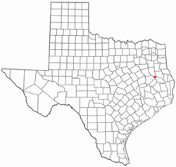
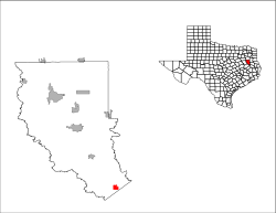
Location of Wells, Texas
|
|
 |
|
| Country | United States |
| State | Texas |
| County | Cherokee |
| Area | |
| • Total | 1.92 sq mi (4.96 km2) |
| • Land | 1.92 sq mi (4.96 km2) |
| • Water | 0.00 sq mi (0.00 km2) |
| Elevation | 331 ft (101 m) |
| Population
(2020)
|
|
| • Total | 853 |
| • Density | 413.58/sq mi (159.67/km2) |
| Time zone | UTC-6 (Central (CST)) |
| • Summer (DST) | UTC-5 (CDT) |
| ZIP code |
75976
|
| Area code(s) | 936 |
| FIPS code | 48-77176 |
| GNIS feature ID | 2413465 |
Wells is a small town located in Cherokee County, Texas, in the United States. In 2020, about 853 people lived there. This makes it a close-knit community.
Contents
The History of Wells, Texas
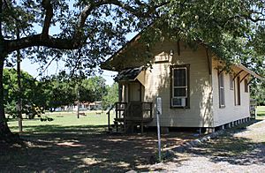
Wells is found where U.S. Highway 69 and Farm to Market Road 1247 meet. It's in the very southern part of Cherokee County. The town started in 1885. It was a stop on the new Kansas and Gulf Short Line Railroad. The town was named after Major E. H. Wells, who was a civil engineer for the railroad.
Early Days and Growth
A post office opened in Wells in 1886. By 1890, the town had a sawmill, a hotel, and a Methodist church. There were also three general stores. About 50 people lived in Wells at that time.
Soon after the railroad was finished, the state prison set up a camp nearby. This camp made charcoal for the state's iron works in Rusk. The prison camp made some people not want to move to Wells. So, the town stayed small until after 1900, when the charcoal camp closed.
Boom Times and Modern Wells
In the 1910s, Wells grew a lot. The First State Bank of Wells opened in 1913. The next year, the population reached 300 people. In the 1920s, Wells officially became a town. By 1936, there were 475 residents and twenty businesses.
After World War II, the population kept growing. It reached 761 people by 1990. However, the number of businesses slowly went down. In 1952, there were 26 businesses, but only seven in 1990. Today, the main jobs in Wells are in farming, raising cattle, and lumber.
Where is Wells Located?
Wells is in the very southern part of Cherokee County in East Texas. It is about 65 kilometers (40 miles) south of Tyler. It is also about 17 kilometers (11 miles) north of Lufkin on U.S. Highway 69.
Nacogdoches is about 20 kilometers (12 miles) northeast of Wells. Dallas is about 267 kilometers (166 miles) to the north and west. Houston is about 221 kilometers (137 miles) to the south and west. The town covers an area of about 4.96 square kilometers (1.92 square miles), and all of it is land.
People Living in Wells
The number of people living in Wells has changed over the years. Here's a quick look at how the population has grown and shrunk:
| Historical population | |||
|---|---|---|---|
| Census | Pop. | %± | |
| 1930 | 475 | — | |
| 1940 | 696 | 46.5% | |
| 1950 | 718 | 3.2% | |
| 1960 | 544 | −24.2% | |
| 1970 | 671 | 23.3% | |
| 1980 | 926 | 38.0% | |
| 1990 | 761 | −17.8% | |
| 2000 | 769 | 1.1% | |
| 2010 | 790 | 2.7% | |
| 2020 | 853 | 8.0% | |
| U.S. Decennial Census | |||
In 2020, there were 853 people living in Wells. This was more than in 2000 (769 people) and 2010 (790 people). Most people in Wells are White. There are also many African American residents. Some people are of mixed races, and some are Hispanic or Latino.
Education in Wells
In the past, most children had to walk to school. Because of this, small schoolhouses were built about every 8 kilometers (5 miles) in Cherokee County. In the 1870s, there were about 50 of these small schools. They were often in a church or a single-room building. Many of these schools started near sawmills.
Early Schools in the Area
Some of the first schools near Wells were in communities like Shook's Bluff, Mt. Hope, Pleasant Hill, Damascus, Forest, and Sweet Union. In 1884, new school districts were created. Cherokee County ended up with 69 new school districts.
The Shook's Bluff school started in 1861. It was a simple, unpainted, one-room building. By 1920, people began moving closer to Wells. So, the Shook's Bluff school moved about 3 kilometers (2 miles) west of Wells. This school joined with the Wells school in 1928.
Forest School began in 1888 in the Forest Baptist Church. Later, it moved to its own building. In 1922, Forest School combined with Wildhurst School. A new building was built for them. Forest School later joined with Wells ISD in 1949.
There were two Mt. Hope Methodist church schools. The first one started in 1875. The other Mt. Hope school was a single 6 by 6 meter (20 by 20 foot) room. One teacher taught all grades there. Classes were held for three months in winter and two months in summer.
Wells Independent School District
When Wells grew because of the railroad, the Mt. Hope school moved to the Methodist church in town. Later, classes moved to a two-story brick building where the current school is. This building burned down in 1917. A new building was put up, but it had problems. When a crack appeared, it was made into a single-story building. Around that time, Damascus and Crossroads schools joined with Wells. High school grades were added.
The Wells Independent School District was officially formed on June 12, 1921. The first group of students to finish all four years of high school graduated in 1930. The school was approved by the Texas Education Agency in 1934.
As transportation got better, all the small school districts in the county slowly joined larger ones. Today, there are five main school districts in the county: Wells, Alto, Rusk, Jacksonville, and New Summerfield.
See also
 In Spanish: Wells (Texas) para niños


