West Brook (West Branch Delaware River tributary) facts for kids
Quick facts for kids West Brook |
|
|---|---|
|
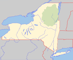
Location of mouth within New York
|
|
| Country | United States |
| State | New York |
| County | Delaware |
| Physical characteristics | |
| Main source | Delaware County, New York 42°16′23″N 75°09′05″W / 42.2731391°N 75.1512805°W |
| River mouth | West Branch Delaware River Walton 1,181 ft (360 m) 42°10′01″N 75°08′17″W / 42.1670296°N 75.1379465°W |
| Basin features | |
| Basin size | 28.2 sq mi (73 km2) |
| Tributaries |
|
West Brook is a small river that flows into the West Branch Delaware River. It joins the larger river near the village of Walton in New York State. This brook is part of the larger Delaware River system.
Contents
About West Brook
West Brook is located in Delaware County, New York. It is one of the many streams and rivers that help form the beautiful landscapes of New York. The water from West Brook eventually makes its way to the Atlantic Ocean.
Where Does the Water Go?
The water in West Brook travels a journey. It starts in Delaware County and flows into the West Branch Delaware River. This larger river then joins with other rivers to become the main Delaware River. The Delaware River is a very important waterway in the eastern United States.
How Big is West Brook?
The area of land that drains into West Brook is called its drainage basin. West Brook's drainage basin covers about 28.2 sq mi (73 km2). This means that all the rain and snow that falls on this area will eventually flow into West Brook.
West Brook also has smaller streams that flow into it. These are called tributaries. On its right side, West Brook receives water from Kerrs Creek and Third Brook.
Measuring the Water Flow
Scientists keep an eye on how much water flows in rivers and streams. This helps them understand the environment and predict floods.
What is a Stream Gauge?
The United States Geological Survey (USGS) is an agency that studies the Earth. They have a special tool called a stream gauge on West Brook. This gauge is like a measuring station for the river. It helps scientists know how much water is flowing at any given time.
The stream gauge on West Brook is located in Austin Lincoln Park. It is about one mile (1.6 km) upstream from where the brook meets the West Branch Delaware River. This station has been recording data since 2017.
Water Flow Records
The stream gauge records the discharge of the river. Discharge is the amount of water flowing past a certain point in the river each second. It's measured in cubic feet per second (cuft/s).
- The highest amount of water recorded flowing in West Brook was 804 cubic feet (22.8 m3) per second. This happened on August 14, 2018. This usually happens after heavy rain or snowmelt.
- The lowest amount of water recorded was 3.2 cubic feet (0.091 m3) per second. This low flow happened on July 21–22, 2018, likely during a dry period.
These measurements help scientists understand the health of the river and how it changes with the weather.
 | Victor J. Glover |
 | Yvonne Cagle |
 | Jeanette Epps |
 | Bernard A. Harris Jr. |


