West Lomond facts for kids
Quick facts for kids West Lomond |
|
|---|---|

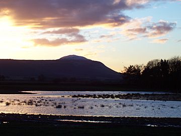
West Lomond from the Howe of Fife at sunset
|
|
| Highest point | |
| Elevation | 522 m (1,713 ft) |
| Prominence | 405 m (1,329 ft) |
| Parent peak | Ben Cleuch |
| Listing | Marilyn |
| Geography | |
|
Lua error in Module:Location_map at line 420: attempt to index field 'wikibase' (a nil value).
|
|
| Parent range | Lomond Hills |
| OS grid | NO197066 |
| Topo map | OS Landranger 58 |
West Lomond is the tallest mountain in Fife, Scotland. It's also the highest point in the Lomond Hills. This mountain has a cool cone shape at the top. This shape is actually what's left of an ancient volcanic plug.
The mountain stands tall over a steep slope called an escarpment. This slope is made of layers of Carboniferous sandstone and limestone. On top of these layers is a hard rock called quartz-microgabbro. West Lomond and its neighbor, East Lomond, are easy to spot from far away. This might be why they are called the 'Lomond' or 'beacon' hills. At the very top of West Lomond, you can find the remains of an Iron Age hill fort. Imagine people living up there long ago!
Exploring West Lomond
Many people enjoy hiking up West Lomond. It's a great way to see amazing views of the Scottish countryside.
Climbing West Lomond
The most common way to climb West Lomond starts from the Craigmead car park. This car park is already quite high up, almost 300 meters (about 984 feet) above sea level. It's located on the road between Falkland and Leslie.
Another path begins at a cool rock formation called the Bunnet Stane. This route is a bit tougher because it starts much lower down. It climbs steeply up the north side of the mountain's slope. It goes through a gap in the cliffs and then reaches the flat area near the summit. No matter which way you go, reaching the top is a rewarding adventure!
 | James Van Der Zee |
 | Alma Thomas |
 | Ellis Wilson |
 | Margaret Taylor-Burroughs |

