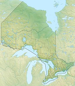
West Tripoli Lake (Ontario) facts for kids
Quick facts for kids West Tripoli Lake |
|
|---|---|
| Location | Algoma District, Ontario |
| Coordinates | 48°27′43″N 84°50′29″W / 48.46194°N 84.84139°W |
| Primary outflows | Unnamed creek to Tripoli Lake |
| Basin countries | Canada |
| Max. length | 2.5 km (1.6 mi) |
| Max. width | 0.6 km (0.37 mi) |
| Surface elevation | 424 m (1,391 ft) |
West Tripoli Lake is a beautiful lake located in the Algoma District of Ontario, Canada. It's part of the huge Lake Superior drainage basin. This means all the water from West Tripoli Lake eventually flows into Lake Superior.
The lake is about 2.5 kilometers (1.6 miles) long and 0.6 kilometers (0.4 miles) wide. It sits at an elevation of 424 meters (1,391 feet) above sea level. Imagine being that high up!
About West Tripoli Lake
West Tripoli Lake is a natural body of water found in the northeastern part of Ontario. It's surrounded by the wild and scenic landscapes of the Algoma District. This area is known for its many lakes, forests, and outdoor activities.
Where is it?
This lake is located in a pretty remote area of Ontario. You can find it in the Algoma District, which is a large region in the province. A major Canadian Pacific Railway train line, which crosses Canada, even passes right by the northeast edge of the lake. This shows how vast and connected the Canadian landscape is.
How Water Flows Out
The water from West Tripoli Lake doesn't just stay there. It has a path it follows! The main way water leaves the lake is through a small, unnamed creek. This creek flows into another nearby lake called Tripoli Lake.
From Tripoli Lake, the water continues its journey through Tripoli Creek. This creek then joins the Magpie River. Finally, the Magpie River carries all this water directly into Lake Superior, one of the largest freshwater lakes in the world! This whole system is a great example of how lakes and rivers are connected.
 | Valerie Thomas |
 | Frederick McKinley Jones |
 | George Edward Alcorn Jr. |
 | Thomas Mensah |


