
Westley, California facts for kids
Quick facts for kids
Westley
|
|
|---|---|

Historic RR water tank in Westley, CA
|
|

Location in Stanislaus County and the state of California
|
|
| Country | |
| State | |
| County | Stanislaus |
| Area | |
| • Total | 1.743 sq mi (4.515 km2) |
| • Land | 1.743 sq mi (4.515 km2) |
| • Water | 0 sq mi (0 km2) 0% |
| Elevation | 89 ft (27 m) |
| Population
(2020)
|
|
| • Total | 575 |
| • Density | 329.9/sq mi (127.35/km2) |
| Time zone | UTC-8 (Pacific (PST)) |
| • Summer (DST) | UTC-7 (PDT) |
| ZIP code |
95387
|
| Area code(s) | 209 |
| FIPS code | 06-84480 |
| GNIS feature ID | 0237554 |
Westley is a small community in Stanislaus County, California. It is known as a census-designated place (CDP). This means it's a settled area that the government counts for its population, but it's not an officially incorporated city. In 2020, about 575 people lived in Westley. It is part of the larger Modesto Metropolitan Statistical Area.
Contents
History of Westley
Westley has an interesting history, especially concerning a very large pile of old tires.
The Oxford Tire Pile Story
For many years, a company called Oxford Energy was involved with a huge pile of old tires near Westley. This pile was one of the biggest collections of waste tires on the West Coast.
People started dumping used tires here even before the I-5 highway was built nearby. Oxford Energy had been adding to these piles since the 1950s.
By 1984, the tire pile was causing problems. It looked bad and was not good for the environment. Oxford Energy suggested a project to turn the tires into energy. However, this idea was not approved because of environmental concerns.
In 1957, about 10,000 to 20,000 tires were being added to the pile every day. It was even guarded 24 hours a day.
About 40 years later, the tire dump had grown to around 6 million tires. In 1997, the state government decided it was time to get rid of them.
Soon after a photographer took pictures of the tire pile, a lightning strike caused a huge fire. It took many weeks to put out this fire.
Westley's Geography
Westley is located at coordinates 37°32′54″N 121°12′5″W / 37.54833°N 121.20139°W. It covers an area of about 1.7 square miles (4.5 square kilometers), and all of it is land.
Westley sits at the bottom of the Diablo Range mountains. It is also close to Ingram Creek. Not too far away is the San Joaquin Fault, which is a crack in the Earth's crust.
Population and People
This section shares facts about the people who live in Westley.
Population Changes Over Time
- 2010: The population was 603 people.
- 2020: The population was 575 people.
Westley in 2010
In 2010, Westley had 603 people. Most people lived in homes, with only a few in group housing.
There were 149 households in Westley. Many of these households (66.4%) had children under 18 living there. Most households (64.4%) were married couples.
The people in Westley came from different backgrounds. About 35.2% were White, and a large number (61.0%) were from other races. About 96.0% of the people were of Hispanic or Latino background.
The average age in Westley was 25.9 years old. About 40.1% of the people were under 18 years old.
Westley in 2000
In 2000, Westley had 747 people. There were 139 households.
About 67.6% of households had children under 18. Most households (76.3%) were married couples.
The racial makeup was 39.36% White, and 53.82% from other races. About 83.94% of the people were of Hispanic or Latino background.
The average age was 26 years. About 36.8% of the people were under 18 years old.
Images for kids
-
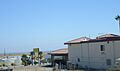
A view of Westley, California.

See also
 In Spanish: Westley (California) para niños
