Whakamaru to Brownhill Road transmission line facts for kids
Quick facts for kids Whakamaru to Brownhill Road transmission line |
|
|---|---|

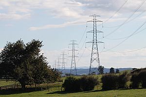
Whakamaru to Brownhill Road transmission line near Te Kauwhata
|
|
| Location | |
| Country | New Zealand |
| General direction | South-North |
| From | Whakamaru Power Station, southern Waikato |
| To | Brownhill Road switching station, southeastern Auckland |
| Ownership information | |
| Owner | Transpower New Zealand |
| Operator | Transpower New Zealand |
| Construction information | |
| Construction started | February 2010 |
| Commissioned | 30 October 2012 |
| Technical information | |
| Type | Overhead transmission line |
| Type of current | HVAC |
| Total length | 186 km (116 mi) |
| Power rating | 2700 MVA per circuit at 400 kV |
| AC voltage | 400 kV design 220 kV initially |
| No. of circuits | Two |
The Whakamaru to Brownhill Road transmission line is a huge power line built by Transpower. It helps bring more electricity to Auckland and the northern parts of New Zealand. This line is designed to carry a lot of power, up to 400,000 volts (400 kV), but it started working at 220,000 volts (220 kV).
The line stretches for 186 kilometres (116 mi) (about 115 miles). It starts near the Whakamaru Power Station in the southern Waikato region. It ends at a new station called Brownhill Road, close to Whitford in southeastern Auckland. From Brownhill Road, the power travels through special underground cables to another station in Pakuranga. Building this line was a big project and caused some debate, but it was finished on October 30, 2012. It's a key part of a larger plan to improve New Zealand's power grid.
Contents
Why This Power Line Was Needed
This power line was a big upgrade for New Zealand's National Grid. It was built to make sure Auckland and Northland had enough electricity and a secure power supply. The line helps move more power from the Waikato River hydro stations to Auckland. It also reduces the stress on older power lines.
Before this new line, all the main power lines into Auckland ended at one place, the Ōtāhuhu substation. This was risky because if something happened there, a large part of Auckland could lose power. The new line connects to the Pakuranga substation instead. This means Auckland now has power coming from different directions, making the supply much safer.
The line was built to handle 400 kV, but it started operating at 220 kV. In the future, it could be upgraded to 400 kV. This would need new equipment, but it would allow even more power to flow.
Powering the North Island
Most of New Zealand's electricity is made in the south, especially from power stations on the Waikato River and the Huntly Power Station. There are not many power stations north of Auckland. This means Auckland and Northland rely on power coming from the south.
Before this new line, Auckland got its power from several older lines. These lines were built a long time ago, some in the 1970s. Since then, the population in the upper North Island has more than doubled, and electricity use has tripled! This put a lot of strain on the old lines.
During times when a lot of electricity was needed, or if one of the old lines had a problem, there could be issues. For example, one line breaking down could overload another. The new Whakamaru to Brownhill Road line helps solve these problems. It increases the amount of power that can be sent to Auckland. It also makes the existing lines work more easily.
Building the Power Line: A Timeline
Building such a large power line takes a lot of planning and time. Here are some key moments in the project:
- 2004: Transpower first announced plans for a 400 kV line from Whakamaru to Auckland. It was estimated to cost $500 million.
- July 2004: A group called New Era Energy Inc. was formed. They were against the 400 kV plan and wanted other options.
- 2005-2006: Transpower sent different plans to the Electricity Commission, which checks big power projects. The Commission initially didn't approve the first plans.
- October 2006: Transpower suggested a new plan. The line would be able to handle 400 kV but would start at 220 kV. It would end south of Auckland, with underground cables going to Pakuranga.
- July 2007: The Electricity Commission finally approved the plan.
- August 2007: A government minister decided the project was very important for the country. He set up a special group to look at all the details and public feedback.
- March 2008 - October 2008: The special group held hearings to listen to everyone's opinions.
- May 2009: The High Court supported the Electricity Commission's decision to approve the project.
- September 2009: The special group gave its final approval for the project.
- May 2010: The first new power towers were built.
- October 2011: Workers started putting up the power cables.
- May 2012: Transpower announced the project would cost more, reaching $894 million. This was due to higher building costs and buying land rights.
- October 30, 2012: The power line officially started working at 220 kV. The final cost was $894 million.
The Power Line's Journey
The power line begins at a new substation called Whakamaru North. This is just outside the Whakamaru village. A short line connects it to the older main Whakamaru substation.
From Whakamaru, the line travels about 186 kilometres (116 mi) north. It goes through several districts like South Waikato, Waipa, Matamata-Piako (passing west of Morrinsville), Waikato, and Franklin. The overhead line finishes at the new Brownhill Road substation, near Whitford.
From Brownhill Road, the power goes underground. Two sets of thick cables, each about 160 millimetres (6.3 in) (6 inches) wide, connect to the Pakuranga substation. These underground cables are about 11 kilometres (6.8 mi) (7 miles) long. They follow roads like Brownhill Road, Sandstone Road, and Caldwells Road, going through suburban areas to reach the Pakuranga substation.
Key Locations Along the Route
Here are some important places the power line passes or connects to:
- Whakamaru (main) substation: 38°25′09″S 175°48′01″E / 38.41908°S 175.80037°E
- Crossing Lake Karapiro and State Highway 1: 37°57′04″S 175°37′10″E / 37.95117°S 175.61946°E
- Crossing State Highway 26: 37°39′57″S 175°30′19″E / 37.66578°S 175.50534°E
- Crossing State Highway 2: 37°14′46″S 175°11′45″E / 37.24605°S 175.19592°E
- Brownhill Road substation: 36°58′21″S 174°57′40″E / 36.97259°S 174.96113°E
- Pakuranga substation: 36°55′33″S 174°54′24″E / 36.92594°S 174.90666°E
How the Power Line Is Built
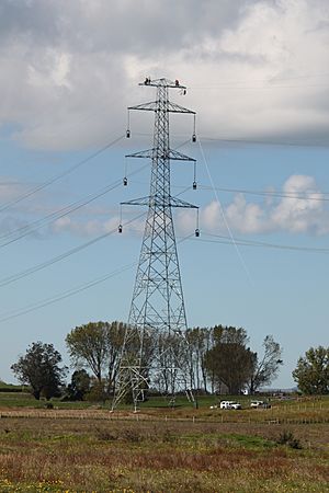
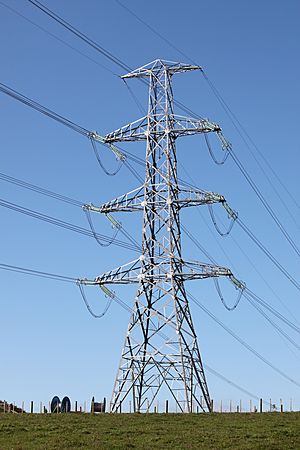
This power line has two circuits, meaning it can carry power in two separate paths. Most of the line is supported by tall steel lattice towers. There are 426 of these structures along the 186 kilometres (116 mi) route. The towers are usually about 60 metres (200 ft) (200 feet) tall, but some are up to 70 metres (230 ft) (230 feet). The distance between towers is usually about 437 metres (1,434 ft) (1,430 feet), with the longest gap being 824 metres (2,703 ft) (2,700 feet).
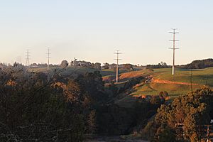
In the Lake Karapiro area, special single-pole structures called monopoles were used instead of the usual lattice towers. This was because the area is considered a "Special Landscape Character Area," and the monopoles look nicer.
The power line uses a special type of cable called "Sulphur" conductor. It's made from an all-aluminium alloy. This material is strong, light, and good at conducting electricity. It also resists rust better than older types of cables. Each Sulphur cable is about 33.8 millimetres (1.33 in) (1.3 inches) thick.
When the line operates at 400 kV, each circuit can carry a huge amount of power, 2700 MVA. Even at 220 kV, it can carry a lot, usually around 851-890 MVA, and even more if needed.
The underground cables from Brownhill Road to Pakuranga are very thick, about 160 millimetres (6.3 in) (6 inches) in diameter. Each one weighs about 40 kilograms per metre (81 lb/yd) (27 pounds per foot). Each set of underground cables can carry 660 MVA of power.
As part of this project, an older 110 kV power line from Arapuni to Pakuranga, built in 1940, was removed. This meant taking down 460 old towers.


