Wheatland, Iowa facts for kids
Quick facts for kids
Wheatland, Iowa
|
|
|---|---|
 |
|

Location of Wheatland, Iowa
|
|
| Country | |
| State | |
| County | Clinton |
| Area | |
| • Total | 0.57 sq mi (1.49 km2) |
| • Land | 0.57 sq mi (1.49 km2) |
| • Water | 0.00 sq mi (0.00 km2) |
| Elevation | 689 ft (210 m) |
| Population
(2020)
|
|
| • Total | 775 |
| • Density | 1,350.17/sq mi (521.63/km2) |
| Time zone | UTC-6 (Central (CST)) |
| • Summer (DST) | UTC-5 (CDT) |
| ZIP code |
52777
|
| Area code(s) | 563 |
| FIPS code | 19-84945 |
| Website | www.cityofwheatland.org |
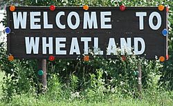
Wheatland is a small city in Clinton County, Iowa, United States. It's a friendly place with a population of 775 people, according to the 2020 census. Wheatland is known for its quiet community life.
Contents
History of Wheatland
Wheatland was officially planned and laid out in 1858. This planning was led by a person named John Bennett. The town got its name from the estate of President James Buchanan. His estate was also called Wheatland and was located in Lancaster, Pennsylvania.
In 1850, the area around Wheatland had only 101 white residents. By 1860, this number grew to 756 people. Many of the first settlers came from a village in central Germany called Wunderthausen. These German settlers started the first church in town in 1857. It was a Presbyterian church at first. Later, in 1861, they formed St. Paul's German Reformed Church. Today, this church is known as St. Paul's United Church of Christ. Wheatland officially became a city on July 13, 1869.
Geography and Location
Wheatland is located in Iowa. You can find it at these coordinates: 41°49′58″N 90°50′22″W / 41.83278°N 90.83944°W. These numbers help pinpoint its exact spot on a map.
The United States Census Bureau says that Wheatland covers a total area of about 0.61 square miles (1.58 square kilometers). All of this area is land, meaning there are no large bodies of water like lakes or rivers within the city limits.
Population of Wheatland
The population of Wheatland has changed over the years. Here's a look at how many people have lived there during different census counts:
| Historical population | |||
|---|---|---|---|
| Census | Pop. | %± | |
| 1870 | 788 | — | |
| 1880 | 616 | −21.8% | |
| 1890 | 569 | −7.6% | |
| 1900 | 475 | −16.5% | |
| 1910 | 539 | 13.5% | |
| 1920 | 549 | 1.9% | |
| 1930 | 539 | −1.8% | |
| 1940 | 535 | −0.7% | |
| 1950 | 568 | 6.2% | |
| 1960 | 643 | 13.2% | |
| 1970 | 832 | 29.4% | |
| 1980 | 840 | 1.0% | |
| 1990 | 723 | −13.9% | |
| 2000 | 772 | 6.8% | |
| 2010 | 764 | −1.0% | |
| 2020 | 775 | 1.4% | |
| U.S. Decennial Census | |||
Recent Population Details
In 2020, there were 775 people living in Wheatland. There were 317 households in the city. A household is a group of people living together in one home. Most of the people living in Wheatland are White. About 1.3% of the population identified as Hispanic or Latino.
The average age of people in Wheatland in 2020 was about 35.9 years old. Many residents were under 20 years old (28.8%). Also, a good number of people were 65 years or older (21.0%). The city has slightly more females than males.
Education in Wheatland
Students in Wheatland attend schools operated by the Calamus–Wheatland Community School District. This school district was formed in 1985. It combined the school districts of Calamus and Wheatland. Calamus–Wheatland High School is located right in Wheatland. It serves students for all four years of high school.
Notable Person
- Elmer George Homrighausen (1900–1982) was a famous person from Wheatland. He was the Dean of Princeton Theological Seminary. He held this important position from 1954 to 1970.
See also
 In Spanish: Wheatland (Iowa) para niños
 | Roy Wilkins |
 | John Lewis |
 | Linda Carol Brown |


