White Hall, Illinois facts for kids
Quick facts for kids
White Hall
|
|
|---|---|

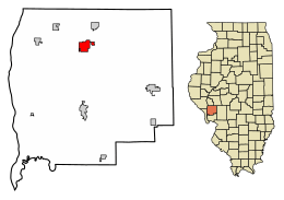
Location of White Hall in Greene County, Illinois.
|
|

Location of Illinois in the United States
|
|
| Country | United States |
| State | Illinois |
| County | Greene |
| Area | |
| • Total | 2.63 sq mi (6.82 km2) |
| • Land | 2.58 sq mi (6.68 km2) |
| • Water | 0.06 sq mi (0.15 km2) |
| Elevation | 574 ft (175 m) |
| Population
(2020)
|
|
| • Total | 2,295 |
| • Density | 890.57/sq mi (343.82/km2) |
| Time zone | UTC−6 (CST) |
| • Summer (DST) | UTC−5 (CDT) |
| ZIP Code(s) |
62092
|
| Area code(s) | 217 |
| FIPS code | 17-81256 |
| GNIS feature ID | 2397302 |
| Wikimedia Commons | White Hall, Illinois |
White Hall is a city located in Greene County, Illinois, in the United States. In 2020, about 2,295 people lived there.
Contents
A Look Back: The History of White Hall
A post office opened in White Hall in 1827. This means people could send and receive mail there early on.
In 1830, a man named David Barrow built the first house in the area. Two years later, he bought more land to help create the town. White Hall officially became a town in 1836.
The town got its name from a special building. There was a long, white tavern (like an inn or hotel) owned by James Allen. It was the only hotel between Carrollton, Illinois and Jacksonville, Illinois. When a stagecoach was coming, the driver would shout, "Next stop, the White Hall!"
Pottery: A Key Industry in White Hall
White Hall became very famous for its pottery. Making things from clay was one of the town's most important jobs for a long time.
Between 1825 and 1948, there were 39 different pottery businesses in White Hall. Some of the first potters included John Neff Ebey and William Heath.
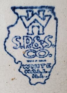
Other well-known pottery makers were George Ebey, David Brunk, and the Davis brothers. The White Hall Sewer Pipe & Stoneware Company was also very important. Today, collectors still look for stoneware made by A. D. Ruckel's White Hall Pottery Works and the White Hall Sewer Pipe and Stoneware Company.
Where is White Hall? Geography and Location
White Hall is located at 39°26′22″N 90°23′57″W / 39.43944°N 90.39917°W. This is its exact spot on a map.
The city covers a total area of about 2.63 square miles (6.82 square kilometers). Most of this area, about 2.58 square miles (6.68 square kilometers), is land. A small part, about 0.06 square miles (0.15 square kilometers), is water.
Who Lives in White Hall? Population and People
| Historical population | |||
|---|---|---|---|
| Census | Pop. | %± | |
| 1870 | 1,200 | — | |
| 1890 | 1,961 | — | |
| 1900 | 2,030 | 3.5% | |
| 1910 | 2,854 | 40.6% | |
| 1920 | 2,954 | 3.5% | |
| 1930 | 2,928 | −0.9% | |
| 1940 | 3,025 | 3.3% | |
| 1950 | 3,082 | 1.9% | |
| 1960 | 3,012 | −2.3% | |
| 1970 | 2,979 | −1.1% | |
| 1980 | 2,935 | −1.5% | |
| 1990 | 2,814 | −4.1% | |
| 2000 | 2,629 | −6.6% | |
| 2010 | 2,520 | −4.1% | |
| 2020 | 2,295 | −8.9% | |
| U.S. Decennial Census | |||
In 2020, the city of White Hall had 2,295 people living there. There were 944 households and 572 families.
The population density was about 871 people per square mile. This means that many people live in a small area.
Most people in White Hall are White (about 95.77%). A small number of people are from other racial backgrounds. About 0.70% of the population is Hispanic or Latino.
Households and Families
Out of all the households, about 27% had children under 18 living with them. About 39.62% were married couples.
About 13.56% of households had a female head of the house with no husband present. Also, 34.53% of all households were made up of people living alone. About 16.95% of these were people aged 65 or older living by themselves.
The average household had about 3.17 people. The average family had about 2.41 people.
Age in White Hall
The people in White Hall are of different ages. About 23.8% of the population was under 18 years old. About 19.1% were 65 years or older.
The median age in White Hall was 46.0 years. This means half the people were younger than 46, and half were older.
Income and Economy
The median income for a household in White Hall was $42,596. For families, the median income was $51,250.
The average income per person in the city was $23,208. About 11.2% of all people in White Hall lived below the poverty line. This included 8.6% of children under 18.
Famous People from White Hall
White Hall has been home to some notable people:
- Edward B. Giller: A general in the United States Air Force.
- Chappie McFarland: A baseball pitcher who played for teams like the St. Louis Cardinals.
- Monte McFarland: Another baseball pitcher who played for the Chicago Colts.
See also
 In Spanish: White Hall (Illinois) para niños
 | Frances Mary Albrier |
 | Whitney Young |
 | Muhammad Ali |


