White Mountain (Wyoming) facts for kids
Quick facts for kids White Mountain |
|
|---|---|

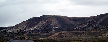
White Mountain's highest point (minus Pilot Butte) located near Rock Springs, Wyoming
|
|
| Highest point | |
| Elevation | 7,623 ft (2,323 m) |
| Geography | |
| Location | Sweetwater County, Wyoming, U.S. |
| Climbing | |
| Easiest route | Roads from Rock Springs and Green River |
White Mountain is a big mountain in Sweetwater County, Wyoming. It's close to the cities of Rock Springs and Green River. This mountain is part of a special rock area called the Green River Formation. It has tall towers for communication and ancient carvings called Petroglyphs on its cliffs. These carvings are between 200 and 1,000 years old! There's also a place called Pilot Butte right on top of White Mountain, and you can reach it by road.
Contents
What is White Mountain Made Of?
White Mountain is part of the Green River Formation. This formation was created a very long time ago, during the Eocene epoch, when a big lake called Lake Gosiute covered the area. The mountain is also part of something called the Rock Springs Uplift.
The mountain is about 7,623 feet (2,323 meters) high. It's about 5.4 miles (8.7 kilometers) from Rock Springs and 8.85 miles (14.24 kilometers) from Green River.
How White Mountain Helps Us Communicate
White Mountain is home to many radio towers. These towers help people communicate across the area.
- One tower broadcasts a religious radio station, K299AG, on 107.7 FM.
- The tallest tower belongs to Sweetwater Television, a local cable company. You can see this tower in the picture above.
- K28JU-D, a local PBS TV station, also broadcasts from this tall tower.
- The local BLM office uses transmitters here.
- There's also a tower for cell phones, owned by Union Wireless.
On the side of the mountain facing Green River, there are two more radio towers:
- One tower is used for talking to airplanes at the nearby airport.
- The other tower, owned by Verizon Wireless, is also used for cell phone signals.
Discovering Pilot Butte

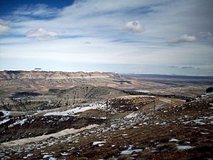
Pilot Butte is a special spot right on top of White Mountain. Early travelers named it "Pilot Butte" because it told them they were getting close to the Green River.
Pilot Butte is also part of a "Wild Horse tour." You might even see herds of wild horses roaming free in the area! This butte is the second highest point nearby, reaching about 7,949 feet (2,423 meters) high. You can hike up the butte. It used to have a steel ladder to help people reach the very top.
Ancient Art: The Petroglyphs
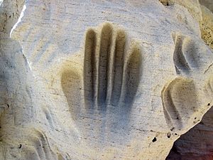
Hundreds of amazing carved figures are found on the sandstone cliffs at the White Mountain Petroglyph site. These carvings were made by people between 200 and 1,000 years ago.
Some of the figures show bison and elk hunts. Others are geometric shapes or tiny footprints. There are even handprints worn into the rock. These handprints help us feel a connection to the people who used this special place long ago.
 | Aaron Henry |
 | T. R. M. Howard |
 | Jesse Jackson |


