Whiteflat, Texas facts for kids
Quick facts for kids
Whiteflat, Texas
|
|
|---|---|

Abandoned Whiteflat School
|
|
| Country | |
| State | |
| County | Motley |
| Region | South Plains |
| Established | 1890 |
| Elevation | 2,411 ft (735 m) |
| Population
(2000)
|
|
| • Total | 3 |
| Time zone | UTC-6 (CST) |
| Area code | 806 |
| Website | Whiteflat from the Handbook of Texas Online |
Whiteflat is a ghost town in Motley County, Texas, United States. In 2000, only about 3 people lived there. A ghost town is a place where most people have left, and many buildings are empty or falling apart.
Contents
The Story of Whiteflat
Whiteflat started as a small camp on the Matador Ranch. This area was named "Whiteflat" because of the white needlegrass that grew on the flat prairie.
Early Days and Growth
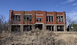
In 1890, Whiteflat got its own post office. A small one-room school also opened that same year. As the community grew, a bigger four-room school was built in 1908. By 1922, a large two-story brick building became the Whiteflat School. This building was very important. It was not just a school, but also a place where the community gathered for events.
Challenges and Decline
Whiteflat faced tough times in the 1930s. This was during the Great Depression, a period when many people lost their jobs and money. It was also the time of the Dust Bowl. The Dust Bowl was when severe dust storms hit the American prairies. These storms made it very hard for farmers to grow crops. Many families had to leave their homes.
Because of these challenges, Whiteflat began to shrink. The school closed in 1946. Its students then went to school in Matador, about 11 miles south. The churches in Whiteflat closed in the 1960s. The post office shut down in 1966 after the last postmistress, Ida Morriss, passed away. The last store, which was a grocery and gas station, closed in 1968. By 2000, only three people were estimated to be living in Whiteflat.
Where is Whiteflat?
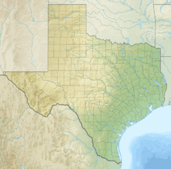
Whiteflat is located on a flat, raised area. It sits between the Middle Pease River and Tom Ball Creek. This area is part of a region called the "Rolling Plains." It is about 12 miles east of the Caprock Escarpment. The Caprock Escarpment is a steep cliff that marks the edge of the Llano Estacado, a large flat area of land.
Learning in Whiteflat's Area
Today, students from the Whiteflat area attend school through the Motley County Independent School District. This school district is located in Matador, Texas. The district has one main school, Motley County School. It serves students from pre-kindergarten all the way through twelfth grade. This district covers almost all of Motley County. A small part of the county in the north is served by a different school district.
 | Jewel Prestage |
 | Ella Baker |
 | Fannie Lou Hamer |


