Wieringen facts for kids
Quick facts for kids
Wieringen
|
|||
|---|---|---|---|
|
Former municipality
|
|||
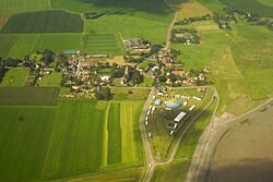
Aerial photograph of Oosterland
|
|||
|
|||
 |
|||
| Country | Netherlands | ||
| Province | North Holland | ||
| Municipality | Hollands Kroon | ||
| Area
(2006)
|
|||
| • Total | 212.50 km2 (82.05 sq mi) | ||
| • Land | 26.77 km2 (10.34 sq mi) | ||
| • Water | 185.73 km2 (71.71 sq mi) | ||
| Population
(1 January 2007)
|
|||
| • Total | 8,705 | ||
| • Density | 325/km2 (840/sq mi) | ||
| Source: CBS, Statline. | |||
| Time zone | UTC+1 (CET) | ||
| • Summer (DST) | UTC+2 (CEST) | ||
| Website | www.wieringen.nl | ||
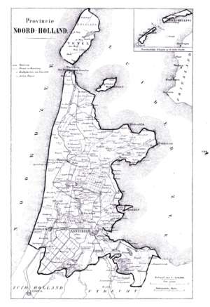
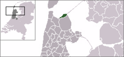
Wieringen is a special place in the Netherlands, located in the province of North Holland. It used to be its own town (called a municipality) until 2012. Now, it's part of a bigger area called Hollands Kroon.
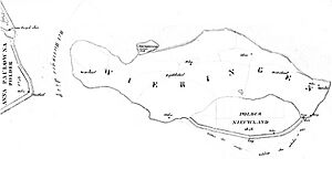
Wieringen has a long history. It was first mentioned in old records from the 700s and 800s. Around the year 1200, it became an island. This happened because of big storms in the Middle Ages that changed the coastline. But Wieringen didn't stay an island forever! From 1924 to 1932, people built dikes and filled in land. This connected Wieringen back to the mainland.
In 2003, there was a plan to make Wieringen an island again. The idea was to create a big lake for fun activities. This project was called the Wieringerrandmeer. However, the plan was stopped in 2010 because it was too expensive.
Contents
Exploring Wieringen's Villages
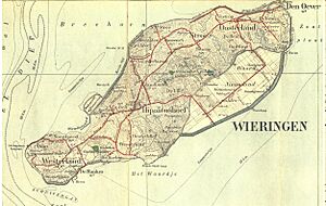
The area that used to be the town of Wieringen includes several small villages and hamlets. These are like tiny communities or neighborhoods. Some of them are Dam, De Elft, De Haukes, De Hoelm, Den Oever, Hippolytushoef, Hollebalg, Noordburen, Oosterklief, Oosterland, Smerp, Stroe, Vatrop, Westerklief, and Westerland.
Wieringen's Ancient History
The land in Wieringen isn't completely flat. It has special hills made of "boulder clay." These hills were formed a very long time ago during the Saale Ice Age, when huge glaciers covered the land. The name Wieringen likely comes from an old language called Old Frisian. In that language, wîr means "height," which makes sense because of these hills. Some people used to think the name came from "wier," which means "seaweed" in Dutch, but that's not correct.
Vikings and Hidden Treasures
In the 800s, fierce warriors called Vikings attacked and settled in parts of the Netherlands, including areas where the Frisians lived. We know this because of an amazing discovery made in 1996. A farmer found a hidden treasure, called a hoard, in a field near Westerklief.
The Viking Hoard Discovery
This treasure was huge! It weighed 1.7 kilograms (about 3.7 pounds) and contained silver coins, metal bars (ingots), and beautiful jewelry. Experts believe it was hidden by Vikings in the 800s. Today, you can see this incredible find at the Rijksmuseum van Oudheden (National Museum of Antiquities) in Leiden. Later, smaller Viking treasures were also found in the same area.
How Wieringen Became an Island
A very powerful storm flood in 1170, known as the All Saints' Flood (1170), caused a lot of damage. This flood was so strong that it separated Wieringen and Texel from the mainland, turning them into islands.
From Frisian Rule to Dutch Control
The area was first home to the Frisians, a group of people with their own culture. But in 1184, a Dutch leader named Floris III made the people of Wieringen part of his territory. After this, the area saw more changes. In 1284, another leader, Floris V, took control. By 1299, Wieringen became part of a region called Westfriesland, which was part of the County of Holland.
In 1432, the entire island of Wieringen was officially recognized as one township and was given "city rights." This meant it had special privileges and could govern itself more. However, as more land in Holland and Westfriesland was developed, Wieringen became less important.
Wieringen's Place in New Provinces
In 1798, a new government called the Batavian Republic was formed in the Netherlands. The province of Holland was divided, and Wieringen became part of a new area called the département of Texel. Later, in 1807, under the rule of Napoleon, the province was split into two new provinces. But this didn't last long. In 1815, Wieringen became part of the province of Holland again. Then, in 1840, it became part of the new province of North Holland, where it still is today.
A Prince in Exile
In November 1918, a very important person, the German crown prince Wilhelm, came to the Netherlands. He was given "political asylum," which means he was allowed to stay safely in the country because of political reasons in his own land. He lived in Wieringen from November 1918 until November 1923, when he returned to Germany.
Reconnecting Wieringen to the Mainland
Big engineering projects changed Wieringen forever. On July 31, 1924, a short dam called the Amsteldiepdijk was built to close off a water channel called the Amsteldiep. Then, in 1930, another large dike, the Eastern Wieringermeerdijk, was finished in the Zuiderzee (a large inland sea). This dike helped create new land called the Wieringermeer.
The biggest project was completed in 1932: the Afsluitdijk. This is a huge dike that connects Wieringen with another province called Friesland. Building this dike finally made Wieringen part of the mainland again. The Afsluitdijk starts at a place called Den Oever in Wieringen.
 | Sharif Bey |
 | Hale Woodruff |
 | Richmond Barthé |
 | Purvis Young |


