Wilberforce Park facts for kids
Quick facts for kids Wilberforce Park |
|
|---|---|
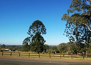
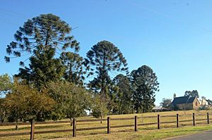
Vista over Wilberforce Park looking Southeast from Macquarie Road
|
|
| Location | 47 George Road, Wilberforce, City of Hawkesbury, New South Wales, Australia |
| Built | 1810– |
| Architect | Governor Macquarie (Designer 1810); James Meehan (Surveyor 1811) |
| Official name: Wilberforce Park; Great Square; Wilberforce; Reserved Square; Recreation Ground; Wilberforce | |
| Type | state heritage (landscape) |
| Designated | 18 November 2011 |
| Reference no. | 1868 |
| Type | Urban Park |
| Category | Parks, Gardens and Trees |
| Lua error in Module:Location_map at line 420: attempt to index field 'wikibase' (a nil value). | |
Wilberforce Park is a special public park in Wilberforce, Australia. It was created way back in 1810 by Governor Lachlan Macquarie. A surveyor named James Meehan mapped it out in 1811. People also know it as the Great Square, Reserved Square, or the Recreation Ground. This park is so important that it was added to the New South Wales State Heritage Register on November 18, 2011.
Contents
A Park's Story
The town of Wilberforce is located on high ground, just above the Hawkesbury River. For thousands of years, Aboriginal people lived here, enjoying the rich natural resources. Then, in the late 1700s, European settlers started farming the land.
Why the Park Was Created
In 1810, Governor Macquarie saw a big problem: the Hawkesbury River often flooded, washing away farms and homes. He decided to build five new towns on higher ground. These towns would be safe places for farmers and their families to go during floods. Wilberforce was one of these special towns. It's the only one of the five towns built on the inland side of the river.
The spot chosen for Wilberforce in 1810 was good because it was close to the river farms but mostly above flood levels. However, it was built on a slope, which was unusual for Macquarie's towns.
Laying Out the Town
Surveyor James Meehan began planning Wilberforce on January 5, 1811. He designed it with three rows, each having five sections. The Great Square, which is now Wilberforce Park, took up the entire middle section. When Governor Macquarie visited on January 11, 1811, the town's name was put on a sign in the middle of the Square.
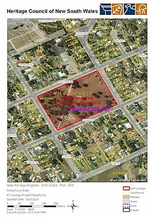
The Square was surrounded by new streets: Macquarie Road to the north, George Road to the south, Duke Road to the west, and Church Road to the east. Over time, buildings like the Macquarie schoolhouse/chapel (built in 1819) and later St John's Anglican Church (built in 1860) were built near the park.
How the Park Was Used
Unlike some other parks from that time, Wilberforce Square was not a market place. Its sloped ground also made it hard for team sports like cricket. For many years, there wasn't a specific group in charge of the park. It's likely that animals like cattle and sheep sometimes grazed there.
In 1895, Macquarie's Great Square was officially named a Recreation Ground. Its size was measured, and a group of local people were chosen as Trustees to look after it.
Looking After the Park
The local government, the Colo Shire Council, started in 1906. For a long time, the Trustees continued to manage the park. In 1946, the Council decided to get the community involved. They held a meeting to discuss improving the park for "sports and recreation." The local people wanted to keep the Macquarie Square and formed a committee to plan for its future.
Over the years, some sports facilities were added, like cricket practice nets and a tennis court. These were later removed around the 1980s. A playground for children was also added and has been updated with new equipment. There's even a public barbecue area!
Remembering Our Heroes
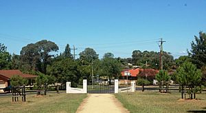
Wilberforce Park has become an important place for remembering those who served in wars. In 1947, memorial gates were put up at the corner of Duke and George Roads. These gates honor the men and women from the Wilberforce area who served in World War II. A path lined with trees leads from these gates up to Macquarie Road. More trees were planted in 1995 and 1994 to remember local families and important anniversaries.
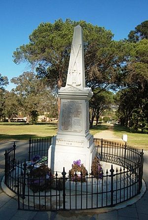
A World War I Memorial, first built in 1918, was moved to the park in 1966. It's a tall structure with names of soldiers from World War I, World War II, the Korean War, and the Vietnam War. Since 1966, the park has been the main spot for ANZAC Day ceremonies, where the community gathers to remember and honor service members.
The community really values the park as a peaceful place. When there were plans to build a new community center in the park in 1991, people strongly disagreed. They wanted to keep the park as an open, recreational space. Because of this, Wilberforce Park has kept its original design and purpose, making it a truly "Reserved Square."
Today, Wilberforce Park is special because it still looks very much like Governor Macquarie planned it over 200 years ago. It's one of the best-preserved examples of his early town planning in New South Wales.
What the Park Looks Like
Wilberforce Park is a rectangular grassy area with many trees, covering about 3.6 hectares. The land slopes down from Macquarie Road to the corner of George and Duke Roads. Some parts of the park have been leveled out.
You can see areas where old structures like a tennis court or cricket nets used to be. There's a small shelter with a barbecue and a children's playground in the south-west part of the park.
The park has unique trees, including rows of pine trees like Stone Pines and Bunya Pines, which form two avenues. There are also old native gum trees.
The park is surrounded by a modern wooden fence. A path cuts diagonally across the park, leading from Macquarie Road to the memorial gates at George and Duke Roads. Near the top of this path is the tall World War I Memorial.
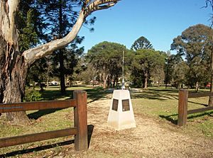
At the north end of the path, there's a concrete marker from 2008 with bronze plaques that tell the park's history.
Wilberforce Park still has the exact size and purpose that Governor Macquarie planned in 1810. It's the best-preserved of all the "squares" he designed for his new towns.
Why Wilberforce Park is Special
Wilberforce Park is important because it's the best example of the large town squares created by Governor Macquarie 200 years ago. It shows how early towns were planned in New South Wales.
This park is still a great place for quiet activities and thinking. Its location next to the historic Macquarie Schoolhouse/chapel and St John's Church, and its views over the Hawkesbury flood-plain, make it even more significant.
The park is also special because it's home to the district's war memorials. These memorials have encouraged the planting of many shade trees, creating a beautiful memorial avenue.
Wilberforce Park was added to the New South Wales State Heritage Register on November 18, 2011, because it meets several important criteria:
- It shows how history unfolded: The park is a strong example of early town planning in New South Wales. It has kept its original design for 200 years, making it a unique historical site.
- It's linked to important people: The park is directly connected to Governor Macquarie, who chose its location, and James Meehan, who surveyed it. Their work was key to shaping the young colony.
- It has a beautiful design: The park is a vital part of the view from the nearby historic churches. With its many trees and wide views, it makes the town more beautiful and provides an important open space.
- It's important to the community: The people of Wilberforce have worked hard to keep the park peaceful and free from too much development. They also value it as a central place for remembering war service, especially on ANZAC Day.
- It's rare: Wilberforce Park is the best-preserved of the three Macquarie town squares that still exist and serve their original purpose. Its untouched state is unique among all towns planned by Macquarie.
- It represents a type of place: The park is a great example of Governor Macquarie's vision for the first country towns in Australia.


