Wilburton, Oklahoma facts for kids
Quick facts for kids
Wilburton, Oklahoma
|
|
|---|---|

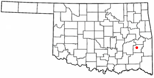
Location of Wilburton within Oklahoma
|
|
| Country | United States |
| State | Oklahoma |
| County | Latimer |
| Government | |
| • Type | Aldermanic |
| Area | |
| • Total | 3.13 sq mi (8.10 km2) |
| • Land | 3.11 sq mi (8.05 km2) |
| • Water | 0.02 sq mi (0.05 km2) |
| Elevation | 659 ft (201 m) |
| Population
(2020)
|
|
| • Total | 2,285 |
| • Density | 735.20/sq mi (283.84/km2) |
| Time zone | UTC-6 (CST) |
| • Summer (DST) | UTC-5 (CDT) |
| ZIP code |
74578
|
| Area code | 539/918 |
| FIPS code | 40-81000 |
| GNIS ID | 1099754 |
Wilburton is a city in Latimer County, Oklahoma, United States. It is the main city, also called the county seat, of Latimer County. In 2020, about 2,285 people lived there. A fun place called Robbers Cave State Park is about 5 miles (8 km) north of Wilburton.
Contents
History of Wilburton
Wilburton started as a small group of homes around Riddle's Station. This station was a stop for the Butterfield Overland Mail stagecoach. Stagecoaches were like old-time buses that carried mail and people. This route connected Fort Smith, Arkansas to Fort Worth, Texas from 1857 to 1861.
There are two ideas about how Wilburton got its name. One idea is that it was named after Will Burton. He was a builder who helped plan the town. He also helped build a railway line. Another idea is that it was named after Elisha Wilbur. He was the president of a railroad company. The town's post office opened in 1891. At that time, Wilburton was part of the Choctaw Nation, a Native American territory.
Wilburton has faced some tough times. In 1926, a coal mine explosion happened. Sadly, 91 people lost their lives. Later, in 1960, a powerful tornado hit the city. It injured over 100 people and caused 13 deaths.
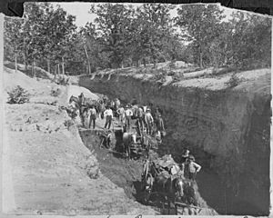
At first, the town's economy was mostly about raising and shipping cattle. But in the 1890s, coal mining became very important. It was the biggest industry in Wilburton. In 1909, a school called the Oklahoma School of Mines and Metallurgy was started here. Today, this school is known as Eastern Oklahoma State College.
Geography of Wilburton
Wilburton is located at 34°55′6″N 95°18′38″W / 34.91833°N 95.31056°W. The city covers a total area of about 3.0 square miles (8.1 square kilometers). Most of this area is land, with a very small part being water.
Population Changes
| Historical population | |||
|---|---|---|---|
| Census | Pop. | %± | |
| 1910 | 2,277 | — | |
| 1920 | 2,226 | −2.2% | |
| 1930 | 1,524 | −31.5% | |
| 1940 | 1,925 | 26.3% | |
| 1950 | 1,939 | 0.7% | |
| 1960 | 1,772 | −8.6% | |
| 1970 | 2,504 | 41.3% | |
| 1980 | 2,996 | 19.6% | |
| 1990 | 3,092 | 3.2% | |
| 2000 | 2,972 | −3.9% | |
| 2010 | 2,843 | −4.3% | |
| 2020 | 2,285 | −19.6% | |
| U.S. Decennial Census | |||
The population of Wilburton has changed over the years. In 2000, there were about 2,972 people living in the city. The population included people from different backgrounds. About 24.4% of the people were under 18 years old. The average age in the city was 30 years.
Parks and Fun Places
Wilburton has places for outdoor activities and fun.
- The Gary Rosebure Recreational Park is a city park.
- Sycamore Springs Golf Course is a 9-hole golf course. It opened in 1970.
- Robbers Cave State Park is a large park located north of town. It has three lakes: Lake Carlton, Lake Wayne Wallace, and Coon Creek Lake.
- Lloyd Church Lake is another lake located south of town.
Education in Wilburton
Local Schools
The Wilburton Public School District manages the schools for younger students.
- Grace Russell Elementary School
- John G. Shero Middle School
- Nancy W. Taylor High School
Colleges and Training
Wilburton is home to two important places for older students:
- Eastern Oklahoma State College: This college was once known as the Oklahoma School of Mines and Metallurgy.
- Kiamichi Technology Center: This center offers training for different jobs and skills.
Getting Around Wilburton
Roads and Highways
Wilburton is connected by major roads.
- US Route 270
- Oklahoma State Highway 2
Public Transportation
The KI BOIS Area Transit System (KATS) helps people get around. It's a low-cost bus and van service. KATS helps people in southeast Oklahoma reach places like grocery stores, doctors, and jobs.
Air Travel
Wilburton Municipal Airport (FAA ID: H05) is west of town. It has a paved runway for small planes. For bigger flights, people use Fort Smith Regional Airport. This airport is about 70 miles (113 km) northeast of Wilburton.
Train Service
The town has train service for moving goods. The Arkansas-Oklahoma Railroad carries freight. This line connects to other major railways, like the Kansas City Southern Railway and the Union Pacific Railway.
See also
 In Spanish: Wilburton (Oklahoma) para niños
 | Misty Copeland |
 | Raven Wilkinson |
 | Debra Austin |
 | Aesha Ash |


