Willoughby River facts for kids
Quick facts for kids Willoughby River |
|
|---|---|
|
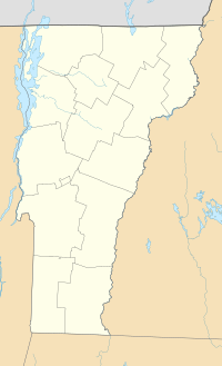
Location of mouth within Vermont
|
|
| Country | United States |
| State | Vermont |
| County | Orleans County |
| Physical characteristics | |
| Main source | Lake Willoughby Westmore, Vermont, Orleans County, Vermont, United States 1,168 ft (356 m) 44°44′53″N 72°03′34″W / 44.74806°N 72.05944°W |
| River mouth | Barton River Orleans, Vermont, Orleans County, Vermont, United States 715 ft (218 m) 44°49′03″N 72°12′14″W / 44.81750°N 72.20389°W |
| Length | 11.6 mi (18.7 km) |
| Basin features | |
| Tributaries |
|
The Willoughby River is a river in Vermont, United States. It flows for about 18.6 kilometers (11.6 miles) in Orleans County. This river is a tributary of the Barton River. A tributary is a smaller stream or river that flows into a larger one.
The Willoughby River flows through different towns like Westmore, Vermont, Orleans, and Brownington. As it travels, it passes through forests, farms, and even some town areas.
Where the River Starts and Flows
The Willoughby River begins at the northwest side of Lake Willoughby. This lake is quite long, about 6.9 kilometers (4.3 miles). The southern part of the lake is surrounded by the Willoughby State Forest. This forest is a natural park with three mountains: Mount Pisgah, Mount Hor, and Mount Bartlett.
From Lake Willoughby, the river flows for about 18.6 kilometers (11.6 miles) in a few different directions:
- It flows northwest through the town of Westmore, Vermont. Here, it meets a stream called Lord Brook.
- Next, it continues northwest into the town of Brownington, Vermont. It then joins another stream called Brownington Branch.
- After that, the river turns southwest and crosses into Orleans. It passes by a small lake.
- Finally, it flows northwest again in Orleans. It goes through a valley and a flat area before joining the Barton River.
What's in a Name?
The name "Willoughby" comes from an old English family name. The official name "Willoughby River" was recognized on October 29, 1980.
 | Victor J. Glover |
 | Yvonne Cagle |
 | Jeanette Epps |
 | Bernard A. Harris Jr. |


