Wilmington Island, Georgia facts for kids
Quick facts for kids
Wilmington Island, Georgia
|
|
|---|---|

Wilmington Island as seen from Skidaway Island - Eureka Club-Farr's Point is on the right, which is on the National Register of Historic Places.
|
|

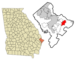
Location in Chatham County and the state of Georgia
|
|
| Country | United States |
| State | Georgia |
| County | Chatham |
| Area | |
| • Total | 9.65 sq mi (24.99 km2) |
| • Land | 8.30 sq mi (21.50 km2) |
| • Water | 1.34 sq mi (3.48 km2) |
| Elevation | 10 ft (3 m) |
| Population
(2020)
|
|
| • Total | 15,129 |
| • Density | 1,822.33/sq mi (703.63/km2) |
| Time zone | UTC-5 (Eastern (EST)) |
| • Summer (DST) | UTC-4 (EDT) |
| ZIP code |
31410
|
| Area code(s) | 912 |
| FIPS code | 13-83168 |
| GNIS feature ID | 1867248 |
Wilmington Island is a special kind of community in Chatham County, Georgia. It's called an unincorporated community because it doesn't have its own city government. It's also a census-designated place (CDP), which means the U.S. Census Bureau counts its population separately.
In 2020, about 15,129 people lived on Wilmington Island. It's part of the larger Savannah metropolitan area. Many people who live here work in Savannah. The island is located to the east of Savannah, nestled between the town of Thunderbolt and the beach city of Tybee Island.
Contents
Island Location and Size
Wilmington Island is found at these coordinates: 32°00′12″N 80°58′31″W / 32.003463°N 80.975224°W.
The United States Census Bureau measures the size of different places. Wilmington Island covers a total area of about 9.5 square miles (24.7 square kilometers). Most of this area, about 8.2 square miles (21.2 square kilometers), is land. The rest, about 1.3 square miles (3.4 square kilometers), is water. This means about 14% of the island's total area is water.
Island Population Changes
The population of Wilmington Island has grown quite a bit over the years. It was first counted as a census-designated place in 1970.
| Historical population | |||
|---|---|---|---|
| Census | Pop. | %± | |
| 1970 | 3,284 | — | |
| 1980 | 7,546 | 129.8% | |
| 1990 | 11,230 | 48.8% | |
| 2000 | 14,213 | 26.6% | |
| 2010 | 15,138 | 6.5% | |
| 2020 | 15,129 | −0.1% | |
| U.S. Decennial Census 1850-1870 1870-1880 1890-1910 1920-1930 1940 1950 1960 1970 1980 1990 2000 2010 2020 |
|||
Who Lives on Wilmington Island?
The table below shows the different groups of people living on Wilmington Island. The U.S. Census counts people based on their race and whether they are of Hispanic or Latino origin.
| Race / Ethnicity (NH = Non-Hispanic) | Pop 2000 | Pop 2010 | Pop 2020 | % 2000 | % 2010 | % 2020 |
|---|---|---|---|---|---|---|
| White alone (NH) | 12,969 | 13,477 | 13,052 | 91.25% | 89.03% | 86.27% |
| Black or African American alone (NH) | 559 | 553 | 406 | 3.93% | 3.65% | 2.68% |
| Native American or Alaska Native alone (NH) | 15 | 32 | 23 | 0.11% | 0.21% | 0.15% |
| Asian alone (NH) | 355 | 393 | 444 | 2.50% | 2.60% | 2.93% |
| Pacific Islander alone (NH) | 4 | 2 | 8 | 0.03% | 0.01% | 0.05% |
| Some Other Race alone (NH) | 21 | 20 | 55 | 0.15% | 0.13% | 0.36% |
| Mixed race or Multiracial (NH) | 102 | 197 | 599 | 0.72% | 1.30% | 3.96% |
| Hispanic or Latino (any race) | 188 | 464 | 542 | 1.32% | 3.07% | 3.58% |
| Total | 14,213 | 15,138 | 15,129 | 100.00% | 100.00% | 100.00% |
In 2020, there were 15,129 people living on Wilmington Island. These people lived in 6,478 households, and 4,322 of these were families.
Schools on the Island
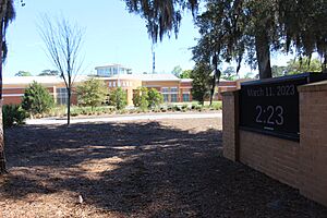
Wilmington Island has one public school called May Howard Elementary School. It is managed by the Savannah-Chatham County Public Schools system. Many students from the island also go to schools on nearby Whitemarsh Island.
There are also two private schools on Wilmington Island:
- St. Andrews School is a private school that helps students get ready for college.
- Saint Peter the Apostle School is a Catholic school. It used to be called Nativity of Our Lord School.
Images for kids
See also
 In Spanish: Wilmington Island para niños
 | Jewel Prestage |
 | Ella Baker |
 | Fannie Lou Hamer |


