Wilton, Alabama facts for kids
Quick facts for kids
Wilton, Alabama
|
|
|---|---|

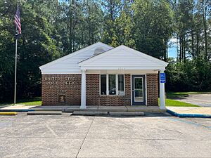
Wilton Post Office
|
|

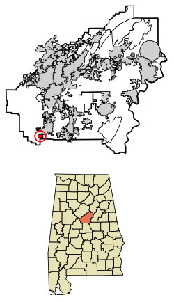
Location of Wilton in Shelby County, Alabama.
|
|
| Country | United States |
| State | Alabama |
| County | Shelby |
| Area | |
| • Total | 0.96 sq mi (2.49 km2) |
| • Land | 0.96 sq mi (2.48 km2) |
| • Water | 0.01 sq mi (0.01 km2) |
| Elevation | 397 ft (121 m) |
| Population
(2020)
|
|
| • Total | 587 |
| • Density | 613.38/sq mi (236.71/km2) |
| Time zone | UTC-6 (Central (CST)) |
| • Summer (DST) | UTC-5 (CDT) |
| ZIP code |
35187
|
| Area code(s) | 205, 659 |
| FIPS code | 01-82872 |
| GNIS feature ID | 0154006 |
Wilton is a small town in Shelby County, Alabama, United States. It was officially made a town in 1918. Wilton is part of the larger Birmingham–Hoover–Cullman Combined Statistical Area. In 2020, about 587 people lived there.
Contents
A Brief History of Wilton
Wilton has had a few different names over the years. It was first called Birmingham Junction. This name came from where the Southern Railroad met the Alabama and Tennessee River Railroad.
How Wilton Got Its Name
After Birmingham Junction, the town was called Bismark. This name honored Otto von Bismarck, a famous German leader. Next, it was known as Catoosa, named after Catoosa County, Georgia. Finally, the town became Wilton. This name was chosen to honor Wilton, England.
Historic Buildings in Wilton
There is one special building in Wilton called the Woods-Cleveland-Cooling House. It is located on the Head-Cleveland farm. This house is listed on the Alabama Register of Landmarks and Heritage. This means it is an important historical place in Alabama.
Where is Wilton Located?
Wilton is located in the state of Alabama. You can find it at these coordinates: 33 degrees, 4 minutes, 54 seconds North and 86 degrees, 52 minutes, 46 seconds West.
Wilton's Size
The U.S. Census Bureau says that Wilton covers an area of about 0.8 square miles (2.1 square kilometers). All of this area is land.
People of Wilton
| Historical population | |||
|---|---|---|---|
| Census | Pop. | %± | |
| 1920 | 522 | — | |
| 1930 | 562 | 7.7% | |
| 1940 | 422 | −24.9% | |
| 1950 | 413 | −2.1% | |
| 1960 | 428 | 3.6% | |
| 1970 | 573 | 33.9% | |
| 1980 | 642 | 12.0% | |
| 1990 | 602 | −6.2% | |
| 2000 | 580 | −3.7% | |
| 2010 | 687 | 18.4% | |
| 2020 | 587 | −14.6% | |
| U.S. Decennial Census 2013 Estimate |
|||
In 2000, there were 580 people living in Wilton. These people lived in 222 households. About 166 of these households were families.
Population Details
The population density was about 697 people per square mile. There were 253 housing units in the town. The average household had about 2.61 people. The average family had about 3.07 people.
The median age in Wilton was 33 years old. About 24.8% of the people were under 18 years old. About 10.2% of the people were 65 years or older.
Income in Wilton
In 2000, the average income for a household in Wilton was $33,750. For families, the average income was $40,833. The average income per person in the town was $15,056.
See also
 In Spanish: Wilton (Alabama) para niños
 | Stephanie Wilson |
 | Charles Bolden |
 | Ronald McNair |
 | Frederick D. Gregory |

