Windham Bay facts for kids
Windham Bay is a beautiful place located about 45 miles southeast of Juneau in Alaska. It's a special area, partly protected as the Chuck River Wilderness. This wilderness was created in 1990 by the United States Congress and covers a huge area of 74,506 acres (about 30,152 hectares). The Chuck River flows into Windham Bay, which is a safe spot for boats to anchor. Long ago, a place called the Chuck Mining Camp used to be here.
Contents
A Glimpse into Windham Bay's Past
The very first time gold was found and taken out in Alaska was right here in Windham Bay and nearby Sumdum Bay. This happened in 1870-71, after gold was first discovered in these areas in 1869. A company called the Windham Bay Gold Mining Company had nine gold claims, known as the "Red Wing" group, located about 0.75 miles from the bay on the slopes of Spruce Creek.
Exploring the Geography of Windham Bay
Windham Bay is where the Chuck River meets the sea. The Chuck River is about 7 miles long and flows into the bay north of Port Houghton. The bay has a calm, flat area that fills and empties with the tides, creating marshy lands and river mouths. It's a safe place for boats coming from Stephens Passage to anchor.
The land around the bay changes a lot, from sea level right up to mountains that are about 5,000 feet (1,524 meters) high. The bay itself is a narrow inlet, about 8 miles long. Its entrance is 1.5 miles wide, but it quickly gets narrower to just 0.2 miles wide. This narrow part connects to a deeper inner part of the bay, which is almost 4 miles long and 0.5 miles wide. At the very end of the bay, there's a large flat area that is covered and uncovered by the tides.
The small settlement of Windham is on the northeast side of the bay. From the southeast side of the inner bay, a wide flat area stretches south for 2 miles, continuing into the Chuck River valley. The mountains around Windham Bay are the same ones that border the south side of Endicott Arm, with peaks reaching between 3,000 and 5,000 feet (914 to 1,524 meters) high.
The Rocks and Land of Windham Bay
The geology of Windham Bay is quite interesting. It's located about 7 miles southwest of a type of rock called diorite, which forms part of the Coast Range mountains. The upper parts of the Chuck River enter a band of schist rock, which can also be seen along the south shore of Endicott Arm.
At the head of the bay, there's a band of slate rock that seems to continue over the hills to Sanford Cove and south up the Chuck River valley. To the west of these slate beds, you'll find a mix of slate and greenstone rocks. These rocks make up the cliffs along the shore at the entrance of Windham Bay. There are also some separate areas of diorite rock that have pushed into the inlet.
Amazing Animals and Plants of Windham Bay
The area along the Chuck River, from its source down to the bay, is covered in thick forests. The Chuck River Wilderness, located at the head of the bay, is a protected area established in 1990. It's about 70 miles southeast of Juneau and is managed by the Forest Service.
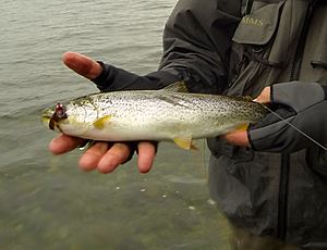
Many different animals live here. In the water, you can find marine mammals like harbor seals. The bay and river are also home to many fish, including different kinds of salmon and trout. The salmon species found here are sockeye, pink, coho, chum, and chinook salmon. You can also find steelhead and Dolly Varden trout.
During the winter months, many water fowl gather in the bay. In the mountainous areas of the valley, you might spot black bears, wolves, and mountain goats.
 | Selma Burke |
 | Pauline Powell Burns |
 | Frederick J. Brown |
 | Robert Blackburn |


