Woodstock, Virginia facts for kids
Quick facts for kids
Woodstock, Virginia
|
||
|---|---|---|
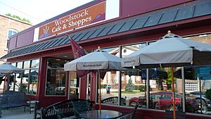
The Woodstock Cafe and Shoppes in Woodstock's historic district
|
||
|
||
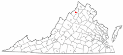
Location of Woodstock in Virginia
|
||
| Country | United States | |
| State | Virginia | |
| County | Shenandoah | |
| Government | ||
| • Type | Town Council/Mayor | |
| Area | ||
| • Total | 3.82 sq mi (9.89 km2) | |
| • Land | 3.81 sq mi (9.87 km2) | |
| • Water | 0.01 sq mi (0.02 km2) | |
| Elevation | 784 ft (239 m) | |
| Population
(2010)
|
||
| • Total | 5,097 | |
| • Estimate
(2019)
|
5,258 | |
| • Density | 1,379.33/sq mi (532.52/km2) | |
| Time zone | UTC−5 (Eastern (EST)) | |
| • Summer (DST) | UTC−4 (EDT) | |
| ZIP Code |
22664
|
|
| Area code(s) | 540 | |
| FIPS code | 51-87712 | |
| GNIS feature ID | 1500352 | |
Woodstock is a town in Virginia, United States. It is the main town, or county seat, of Shenandoah County. In 2017, about 5,212 people lived there.
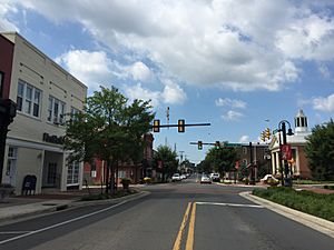
Woodstock covers about 3.2 square miles. It is located near the "Seven Bends" of the North Fork of the Shenandoah River. While some say it's the fourth oldest town in Virginia, it was officially started in 1761. Woodstock was one of the first towns built west of the Blue Ridge Mountains.
The Massanutten Military Academy is in Woodstock. The town is also home to the River Bandits baseball team. This team plays in the Valley Baseball League. Woodstock also has the main campus for Shenandoah County Public Schools and the Shenandoah County Fairgrounds.
Contents
History of Woodstock
The town of Woodstock was officially created in March 1761. It was part of what was then Frederick County. The land was given by Lord Fairfax. The town was first called Muellerstadt (Miller Town) in 1752, named after its founder, Jacob Miller. George Washington helped get the town's charter approved in Virginia's House of Burgesses.
Since 1772, Woodstock has been the county seat for Shenandoah County. This means it's where the county government is located.
In the late 1770s, John Muhlenberg was a pastor at a Lutheran church in Woodstock. A famous story says that on January 21, 1776, he gave his last sermon. At the end, he took off his church robes to show a military uniform underneath. He then called for people to join the 8th Virginia Regiment, which he would lead.
In 1795, a courthouse was built in Woodstock. It was designed by Thomas Jefferson and made from local limestone. This courthouse, on Main Street, is the oldest courthouse still used west of the Blue Ridge Mountains.
Two important buildings in Woodstock, Lantz Hall and the Shenandoah County Courthouse, are listed on the National Register of Historic Places. This means they are recognized for their historical importance.
Population and People
| Historical population | |||
|---|---|---|---|
| Census | Pop. | %± | |
| 1860 | 998 | — | |
| 1870 | 859 | −13.9% | |
| 1880 | 1,000 | 16.4% | |
| 1890 | 1,068 | 6.8% | |
| 1900 | 1,069 | 0.1% | |
| 1910 | 1,314 | 22.9% | |
| 1920 | 1,580 | 20.2% | |
| 1930 | 1,552 | −1.8% | |
| 1940 | 1,546 | −0.4% | |
| 1950 | 1,816 | 17.5% | |
| 1960 | 2,083 | 14.7% | |
| 1970 | 2,338 | 12.2% | |
| 1980 | 2,627 | 12.4% | |
| 1990 | 3,182 | 21.1% | |
| 2000 | 3,952 | 24.2% | |
| 2010 | 5,097 | 29.0% | |
| 2019 (est.) | 5,258 | 3.2% | |
| U.S. Decennial Census | |||
In 2000, there were 3,952 people living in Woodstock. There were 1,685 households. About 25.7% of these households had children under 18. The average age of people in Woodstock was 43 years old.
Woodstock's Location and Weather
Woodstock is located at 38°52′37″N 78°30′41″W / 38.87694°N 78.51139°W.
The United States Census Bureau says the town has a total area of 3.2 square miles (8.4 km²). All of this area is land.
The weather in Woodstock has hot, humid summers. Winters are usually mild to cool. This type of weather is called a humid subtropical climate.
Fun Things to Do
Seven Bends State Park
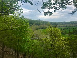
Seven Bends State Park is a large park located just outside Woodstock. It covers 1,066 acres. The park opened in 2019. It is in the special "Seven Bends" area of the North Fork of the Shenandoah River. The park lets people get to the river, which has a four-mile-long shoreline. Part of the park also borders the George Washington-Jefferson National Forest.
Woodstock Tower
The Woodstock Tower was built in 1935 by the Civilian Conservation Corps. It sits on a mountain that is 2,000 feet high. The tower is a popular spot for sightseeing. From the tower, you can see amazing views of the valleys and the seven bends of the North Fork of the Shenandoah River.
Shenandoah County Fair
Every year in August or September, Woodstock hosts the Shenandoah County Fair. This fair takes place at the Shenandoah County Fairgrounds. It includes concerts, horse races, crafts, and farm exhibits. The Shenandoah County Fair has been held here since 1917. The Fairgrounds also host horse harness races in September and October, called Shenandoah Downs.
Local Wineries and Breweries
The Shenandoah Valley has a good climate for growing grapes. It has warm days and cool nights, which helps make good wine. The soil, which has a lot of limestone, is also good for grapes. This area is known as an American Viticultural Area (AVA) for wine. It was Virginia's first AVA, named in 1982.
The Valley is drier than other parts of Virginia. This is because the mountains block some of the rain. These conditions are good for growing certain types of grapes. There are several wineries near Woodstock. Muse Vineyards is in Woodstock itself. Other nearby wineries include Cave Ridge Vineyard and Shenandoah Vineyards. Shenandoah Vineyards is one of the oldest active wineries in Virginia, started in 1976.
Besides wineries, Woodstock also has a brewpub called the Woodstock Brewhouse. It opened in 2015 in an old denim factory building.
Jobs and Economy
As of 2016, the biggest employers in Woodstock were the Shenandoah County School Board and Shenandoah County government. Other large employers included Valley Health Care System, Walmart, Food Lion, and Lowe's.
Getting Around Woodstock
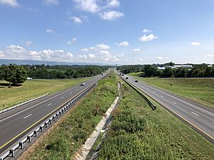
Interstate 81 is the main highway that goes through Woodstock. This highway goes south to Tennessee and north to New York. Virginia State Route 42 also goes through Woodstock.
U.S. Route 11 is another important road. It runs through Woodstock as Main Street. This route follows an old historical path through the Shenandoah Valley. It was once called the Indian Road and later the Great Wagon Road. Route 11 now connects many towns in the Valley.
There is a railroad line that runs through Woodstock. It is owned by Norfolk Southern. Train service on this line has stopped. There are talks about turning part of the old rail line in Woodstock into a walking and biking trail.
A commuter bus service is available for people who work in Northern Virginia and Washington, D.C.. These buses pick up passengers from Woodstock and other towns in Shenandoah County.
Famous People from Woodstock
- Robert Allen, a U.S. Congressman from Virginia.
- Charles B. Gatewood, a United States Army officer.
- Mia Khalifa, a media personality.
- John Magruder, a Brigadier General in the U.S. Army.
- Jim Moran, a publicist.
- Sandie Pendleton, a lieutenant colonel in the C.S. Army, who died in Woodstock.
- Alfred C. Richmond, a Commandant of the United States Coast Guard.
- Jason F. Wright, an author.
- Benjamin C. Freakley, a Lieutenant General in the U.S. Army.
Images for kids
See also
 In Spanish: Woodstock (Virginia) para niños


