Woronora facts for kids
Quick facts for kids WoronoraSydney, New South Wales |
|||||||||||||||
|---|---|---|---|---|---|---|---|---|---|---|---|---|---|---|---|

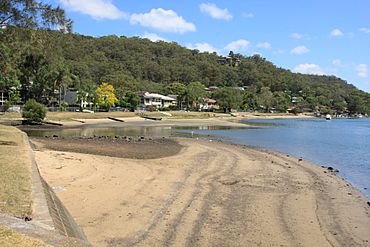
Woronora, on the banks of the Woronora River
|
|||||||||||||||
| Population | 2,201 (2016 census) | ||||||||||||||
| Postcode(s) | 2232 | ||||||||||||||
| Elevation | 8 m (26 ft) | ||||||||||||||
| Location | 27 km (17 mi) from Sydney CBD | ||||||||||||||
| LGA(s) | Sutherland Shire | ||||||||||||||
| State electorate(s) | Heathcote | ||||||||||||||
| Federal Division(s) | Hughes | ||||||||||||||
|
|||||||||||||||
Woronora is a suburb located in southern Sydney, New South Wales, Australia. It is about 27 kilometres south of the main city centre of Sydney. Woronora is part of the Sutherland Shire local government area. Nearby, you'll find Woronora Heights, which is a separate suburb.
Contents
What Does the Name Woronora Mean?
The name 'Woronora' comes from an Aboriginal language. Over time, its spelling has changed a bit. Some of the earliest spellings were Wooloonora and Wolonora. The name was first used for the Woronora River, which flows into the Georges River. Later, it was used for the area and eventually the suburb itself.
People have suggested different meanings for the name 'Woronora'. Some ideas include:
- 'black rock' or 'black rocks'
- 'river-of-no-sharks'
Local people have also suggested meanings like 'black cliffs' and 'sharkless waters'. The original Aboriginal language spoken here was Dharug, also known as the Sydney Language. Sadly, much of this language has been lost. This makes it hard to know the exact original meaning of 'Woronora' for sure.
Woronora's Geography
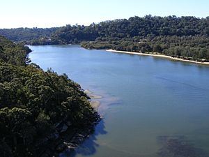
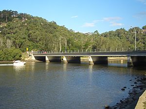
Woronora is built along both sides of the Woronora River. The Woronora River Bridge marks the northern edge of the houses. Further south, a footbridge crosses the river, showing where the houses end on the western side. Some homes on the eastern side can only be reached by walking paths or by boat.
The suburb is surrounded by beautiful bushland. Only one road leads into Woronora. Many people living here love this, as it helps the area feel special and keeps it from becoming too busy like other suburbs. This also helps create a strong sense of community.
The Woronora River here is affected by the tides. The amount of water and its quality can also change when water is released from the Woronora Dam, which is upstream from the suburb.
The Woronora Plateau is a higher area next to the Sydney Plain. It's made of a type of rock called Hawkesbury Sandstone. The Woronora River flows through this plateau, creating deep valleys, and eventually reaches the Georges River.
Getting Around Woronora
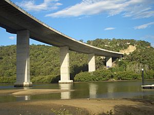
The Woronora River Bridge was built to make it easier for cars to travel between Sutherland and Menai. Before this bridge, the roads were very steep. The new bridge is about 600 metres long and was finished in 2001. It has a public path underneath the road, which is great for walking and cycling. You can get onto this path from Menai Road (on the Bangor side) or from Prince Edward Park Road or River Road (on the Sutherland side).
Woronora Fire Trail
There is a fire trail that connects Woronora and Woronora Heights. This trail is closed to all cars and trucks. It can only be used by people walking, cycling, or by emergency vehicles. The trail has stayed closed because many local residents were worried that if it opened to general traffic, it would bring too many cars from Engadine looking for a shortcut to Menai and Sutherland. They felt this would cause traffic jams and change the quiet feel of their suburb. In 2006, a decision was made to keep the fire trail closed to public transport.
Local Features and Facilities
Woronora has many useful and fun places for its residents. These include:
- An RSL Club
- A boatshed
- A rugby league football oval (which also becomes a cricket ground in summer)
- A caravan park
- A primary school, which opened in 1942
- A cafe and a riverside restaurant
- A fire station
- A hairdresser
- A bottle shop and a general store
- The Sutherland Region Guides Hall, located by the Woronora River
Woronora is also home to Australia's only floating fire station. This special station helps residents who live in areas that don't have road access.
Prince Edward Park is a lovely park located between the Woronora River and Sutherland. Part of the park is a clear area for fun activities like boating and fishing. It's also where the Guides Hall and the Woronora Life Saving Club are located. The part of the park closer to Sutherland is dense bushland with walking trails to explore.
Gallery
 | Aaron Henry |
 | T. R. M. Howard |
 | Jesse Jackson |


