Woronora Heights facts for kids
Quick facts for kids Woronora HeightsSydney, New South Wales |
|||||||||||||||
|---|---|---|---|---|---|---|---|---|---|---|---|---|---|---|---|

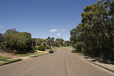
Warrangaree Drive
|
|||||||||||||||
| Population | 2,980 (2011 census) | ||||||||||||||
| Postcode(s) | 2233 | ||||||||||||||
| Elevation | 120 m (394 ft) | ||||||||||||||
| Location | 29 km (18 mi) from Sydney CBD | ||||||||||||||
| LGA(s) | Sutherland Shire | ||||||||||||||
| State electorate(s) | Heathcote | ||||||||||||||
| Federal Division(s) | Hughes | ||||||||||||||
|
|||||||||||||||
Woronora Heights is a suburb located in the southern part of Sydney, New South Wales, Australia. It is about 29 kilometres south of the main city centre of Sydney. Woronora Heights is part of the Sutherland Shire, which is a local government area. You might notice that many streets here are named after different kinds of birds!
Contents
History of Woronora Heights
The name Woronora comes from an Aboriginal word, wooloonora. This word means 'black rock'. It is thought that a surveyor named Dixon gave the area this name back in 1828.
Natural Landmarks
Woronora Heights is surrounded by some interesting natural features. To the west, you'll find the Woronora River. The northern edge is marked by the top of a steep slope called an escarpment.
Woronora River and Reservoir
The Woronora River is an important waterway in the area. The Woronora Reservoir is a large dam on this river. It helps supply water to the homes in Sydney.
Woronora Plateau
The Woronora Plateau is a higher area of land next to the Sydney Plain. It is made mostly of a type of rock called Hawkesbury Sandstone. Because it's higher, the Woronora Plateau can be hotter in summer and colder in winter than Sydney itself. The Woronora River flows through this plateau, creating deep valleys. It eventually joins the Georges River.
Fire Trail Discussions
For a while, there were talks about opening a special path called a fire trail. This path connects Woronora Heights to the Woronora valley. Some people wanted it open for buses and other traffic, while others wanted it to stay closed.
Why the Fire Trail Stayed Closed
In 2006, a group looked into the idea of opening the fire trail for buses. They listened to people who wanted it open and those who didn't. In the end, they all agreed that opening the trail was not good for the public. Around the same time, the government said the fire trail area was "environmentally protected." This meant it was against the rules to build or open it for traffic.
In 2014, the Sutherland Shire Council voted to keep the fire trail closed to regular traffic. It can only be used for emergencies. This decision was supported by all the councillors.
Sport
Woronora Heights is home to a local soccer team called Bosco FC. They play their games at the Woronora Heights Oval.
Transport
If you need to get around, U-Go Mobility runs bus route 993. This bus can take you to places like Engadine and Westfield Miranda, which is a large shopping centre.
 | Laphonza Butler |
 | Daisy Bates |
 | Elizabeth Piper Ensley |

