Worthville, Pennsylvania facts for kids
Quick facts for kids
Worthville, Pennsylvania
|
|
|---|---|
|
Borough
|
|

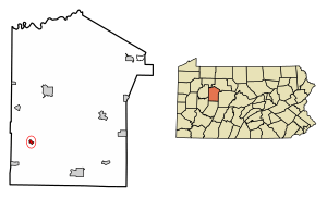
Location of Worthville in Jefferson County, Pennsylvania.
|
|
| Country | United States |
| State | Pennsylvania |
| County | Jefferson |
| Government | |
| • Type | Borough Council |
| Area | |
| • Total | 0.35 sq mi (0.90 km2) |
| • Land | 0.34 sq mi (0.88 km2) |
| • Water | 0.01 sq mi (0.02 km2) |
| Elevation | 1,194 ft (364 m) |
| Population
(2020)
|
|
| • Total | 80 |
| • Density | 230.27/sq mi (88.91/km2) |
| Time zone | UTC-5 (Eastern (EST)) |
| • Summer (DST) | UTC-4 (EDT) |
| ZIP code |
15784
|
| Area code(s) | 814 |
| FIPS code | 42-86568 |
Worthville is a small borough located in Jefferson County, Pennsylvania, United States. A borough is like a small town with its own local government. In 2020, about 80 people lived there. Worthville is known for being the smallest municipality (or local government area) in Jefferson County.
The borough gets its name from General William Jenkins Worth.
Contents
History of Worthville
Worthville was not always called by its current name. It was first known as "Geistown." A person named Daniel Geist planned out the town, and it was named after him.
Later, in 1854, the name was officially changed to Worthville.
Famous People from Worthville
One notable person born in Worthville is Jimmy Slagle. He was a professional baseball player in Major League Baseball.
Geography and Location
Worthville is found in the southwestern part of Jefferson County. It sits in a valley near Little Sandy Creek. This creek flows west and eventually joins Redbank Creek, which is part of the larger Allegheny River system.
According to official measurements, Worthville covers a total area of about 0.90 square kilometers (0.35 square miles). Most of this area, about 0.88 square kilometers (0.34 square miles), is land. A small part, about 0.02 square kilometers (0.01 square miles), is water.
Population Changes Over Time
| Historical population | |||
|---|---|---|---|
| Census | Pop. | %± | |
| 1880 | 174 | — | |
| 1890 | 176 | 1.1% | |
| 1900 | 154 | −12.5% | |
| 1910 | 121 | −21.4% | |
| 1920 | 91 | −24.8% | |
| 1930 | 102 | 12.1% | |
| 1940 | 105 | 2.9% | |
| 1950 | 73 | −30.5% | |
| 1960 | 83 | 13.7% | |
| 1970 | 100 | 20.5% | |
| 1980 | 87 | −13.0% | |
| 1990 | 65 | −25.3% | |
| 2000 | 85 | 30.8% | |
| 2010 | 67 | −21.2% | |
| 2020 | 80 | 19.4% | |
| Sources: | |||
The population of Worthville has changed quite a bit over the years. For example, in 2000, there were 85 people living in the borough. By 2010, the population had decreased to 67 people. However, it grew again to 80 people by the 2020 census.
In 2000, there were 31 households in Worthville, and 24 of these were families. The population density was about 464 people per square mile. Most of the people living there were White.
About 35.5% of the households had children under 18 years old. Many households were married couples living together. The average household had about 2.74 people.
The age of the people in Worthville varied. About 28.2% were under 18 years old. The median age, which is the middle age of all residents, was 36 years old.
The median income for a household in Worthville in 2000 was $35,625. This means half the households earned more than this amount, and half earned less. For families, the median income was $28,750. The average income per person was $14,542. A very small number of people, about 2.2% of the population, lived below the poverty line. This means their income was below a certain level considered necessary for basic needs.
See also
 In Spanish: Worthville (Pensilvania) para niños
 | Jessica Watkins |
 | Robert Henry Lawrence Jr. |
 | Mae Jemison |
 | Sian Proctor |
 | Guion Bluford |


