Wubin, Western Australia facts for kids
Quick facts for kids WubinWestern Australia |
|
|---|---|

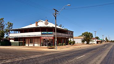
Great Northern Highway, Wubin, 2018
|
|
| Established | 1913 |
| Postcode(s) | 6612 |
| Elevation | 326 m (1,070 ft) |
| Area | [convert: needs a number] |
| Location |
|
| LGA(s) | Shire of Dalwallinu |
| State electorate(s) | Moore |
| Federal Division(s) | Durack |
Wubin is a small town in the Wheatbelt area of Western Australia. It is about 272 kilometers (169 miles) north-east of Perth. The town is also 21 kilometers (13 miles) north of Dalwallinu.
Discovering Wubin
How Wubin Began
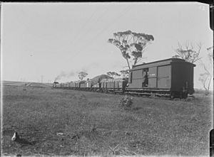
Wubin started as a railway stop in April 1913. It was part of a new railway line planned to connect Wongan Hills to Mullewa. Land was set aside for the town at the same time.
The first pieces of land in Wubin were sold in June 1914. The railway line officially opened in 1915. The town's name comes from an Aboriginal word. It was named after a nearby water source called Woobin Well. A surveyor first wrote down this name in 1907. The spelling "Wubin" was chosen to follow the rules for Aboriginal names.
Farming and Transport
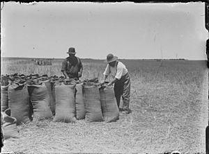
In 1936, a company called Co-operative Bulk Handling Ltd changed how grain was handled in Wubin. They installed special machines called bucket elevators. These machines used diesel power to move grain. This made it much easier than people having to lift heavy bags of grain onto trains.
After World War II, Wubin grew like many farming towns. A new road was built across Lake Moore to Paynes Find. This road made travel much faster to the mining areas in the Murchison and Pilbara regions. Today, this road is part of the Great Northern Highway. It is very important for the town's economy.
Wubin Primary School
The Wubin Primary School opened on August 18, 1919. However, the school closed down in 2007. This happened because fewer students were enrolling there.
 | Valerie Thomas |
 | Frederick McKinley Jones |
 | George Edward Alcorn Jr. |
 | Thomas Mensah |


