Yah-ta-hey, New Mexico facts for kids
Quick facts for kids
Yah-ta-hey, New Mexico
|
|
|---|---|

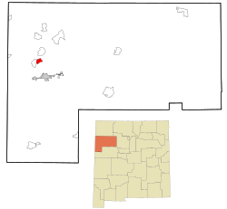
Location in McKinley County and the state of New Mexico
|
|
| Country | United States |
| State | New Mexico |
| County | McKinley |
| Area | |
| • Total | 3.44 sq mi (8.90 km2) |
| • Land | 3.44 sq mi (8.90 km2) |
| • Water | 0.00 sq mi (0.00 km2) |
| Elevation | 6,667 ft (2,032 m) |
| Population
(2020)
|
|
| • Total | 757 |
| • Density | 220.38/sq mi (85.09/km2) |
| Time zone | UTC-7 (Mountain (MST)) |
| • Summer (DST) | UTC-6 (MDT) |
| ZIP code |
87375
|
| Area code(s) | 505 |
| FIPS code | 35-85860 |
| GNIS feature ID | 2409634 |
Yah-ta-hey is a small community in McKinley County, New Mexico, in the United States. It is called a census-designated place (CDP). This means it's an area that the government counts for population, but it's not officially a city or town.
In 2020, about 757 people lived in Yah-ta-hey. This was an increase from 590 people in 2010. The name "Yah-ta-hey" sounds like a friendly greeting in the Navajo language. However, the actual Navajo name for this place means "just like a devil." This nickname came from a store owner named J.B. Tanner, who ran a trading post here. Some local people thought his business practices were unfair.
Where is Yah-ta-hey?
Yah-ta-hey is located in the western part of McKinley County. It is about 8 miles north of Gallup, which is the main city of the county.
The community is mainly found along New Mexico State Road 264. This road goes west for about 18 miles to Window Rock, Arizona. Another important road, U.S. Route 491, is just east of Yah-ta-hey. US 491 goes south to Gallup and north to Shiprock.
The area of Yah-ta-hey is about 3.4 square miles, and it's all land. Water from places like Burned Death Wash flows south into Defiance Draw. This water eventually joins the Puerco River.
Who Lives in Yah-ta-hey?
| Historical population | |||
|---|---|---|---|
| Census | Pop. | %± | |
| 2000 | 580 | — | |
| 2010 | 590 | 1.7% | |
| 2020 | 757 | 28.3% | |
| U.S. Decennial Census | |||
In 2000, there were 580 people living in Yah-ta-hey. By 2020, the population had grown to 757 people.
Most of the people living in Yah-ta-hey are Native American. There are also people who identify as White, Asian, or from other backgrounds. Some residents are also Hispanic or Latino.
Many households in Yah-ta-hey have children under 18 living with them. The average household has about 3 to 4 people. The community has a mix of ages, with many young people. The median age in 2000 was 27 years old.
Schools in Yah-ta-hey
Students in Yah-ta-hey attend schools that are part of the Gallup-McKinley County Public Schools district.
The local elementary school is Chee Dodge Elementary School, which is right in Yah-ta-hey. For middle school, students go to Chief Manualito Middle School in Gallup. High school students attend Gallup High School.
See also
 In Spanish: Yah-ta-hey (Nuevo México) para niños
 | John T. Biggers |
 | Thomas Blackshear |
 | Mark Bradford |
 | Beverly Buchanan |


