Zimornitsa Peak facts for kids
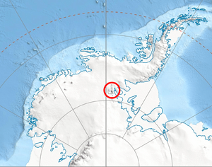
Zimornitsa Peak is a mountain peak that stands 1,700 meters (about 5,577 feet) tall. It's located in a very cold place called Antarctica, which is the southernmost continent on Earth. This peak is part of the Ellsworth Mountains, specifically in an area known as the Maglenik Heights within the north-central Sentinel Range.
From Zimornitsa Peak, you can look down over two large ice rivers, called glaciers. To the northwest, there's the Kopsis Glacier, and to the southeast, you can see the Young Glacier.
What is Zimornitsa Peak?
Zimornitsa Peak is a significant point in the icy landscape of Antarctica. A "peak" is the highest point of a mountain. This peak is part of a larger group of mountains called the Ellsworth Mountains, which are the highest mountains in Antarctica.
The peak is located in a specific part of these mountains known as the Sentinel Range. Think of a range as a long chain of mountains. Within the Sentinel Range, Zimornitsa Peak is found in the Maglenik Heights, which is like a higher area or plateau.
How did it get its name?
This peak was named after a small town in Southern Bulgaria called Zimornitsa. Many places in Antarctica are named by different countries to honor their own towns, scientists, or explorers. This helps to map and identify the many features of the continent.
Where is Zimornitsa Peak located?
Zimornitsa Peak is found at a specific spot in Antarctica: 78°05′35″S, 85°12′13″W. To help you understand its location better, here are some distances to other nearby peaks:
- It is about 7.9 kilometers (4.9 miles) northeast of Mount Gozur.
- It is about 11.43 kilometers (7.1 miles) southeast of Fucha Peak.
- It is about 3.46 kilometers (2.15 miles) southwest of Mirovyane Peak.
- It is about 17.87 kilometers (11.1 miles) northwest of Mount Besch.
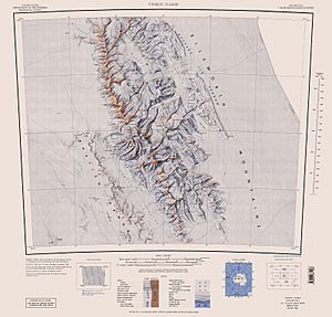
The area around Zimornitsa Peak was first mapped by the United States in 1961, and these maps were updated again in 1988.
 | James Van Der Zee |
 | Alma Thomas |
 | Ellis Wilson |
 | Margaret Taylor-Burroughs |


