Maglenik Heights facts for kids
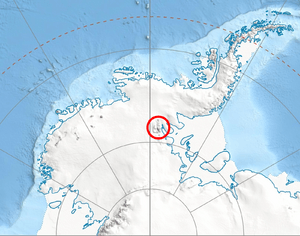
Maglenik Heights are a group of tall mountains in Antarctica. They are part of the Sentinel Range in the Ellsworth Mountains. These heights stretch about 26 kilometers (16 miles) from north to south and 20 kilometers (12 miles) from east to west.
The highest point in Maglenik Heights is Mount Gozur, which reaches 2,980 meters (9,777 feet) high. Other important peaks here include Roberts Peak, Chapman Peak, Ichera Peak, Voysil Peak, Zimornitsa Peak, and Mirovyane Peak.
The name 'Maglenik Heights' comes from Maglenik Ridge, a place in Southern Bulgaria.
Where are Maglenik Heights?
Maglenik Heights are located in the north-central part of the Sentinel Range. They are surrounded by several large glaciers. To the south and west, you'll find Ellen Glacier. The Embree Glacier and Kopsis Glacier are to the north. To the east are the Rutford Ice Stream and Arapya Glacier.
These heights are connected to other mountain areas. Panicheri Gap links them to Bangey Heights in the northwest. Dropla Gap connects them to Barnes Ridge in the east.
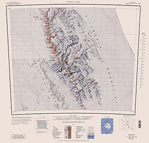
The exact center of Maglenik Heights is at 78°10′00″S 85°14′00″W. Maps of this area were first made by the United States in 1961 and updated in 1988.
What are Glaciers?
Glaciers are huge, slow-moving rivers of ice. They form over many years as layers of snow pile up and get compressed. In Antarctica, glaciers cover most of the land. They are very important for shaping the landscape, carving out valleys and peaks like those in Maglenik Heights.
 | Jackie Robinson |
 | Jack Johnson |
 | Althea Gibson |
 | Arthur Ashe |
 | Muhammad Ali |


