Bangey Heights facts for kids
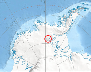
The Bangey Heights are a group of tall hills or mountains in Antarctica. They are located in the north-central part of the Sentinel Range, which is a large mountain chain within the Ellsworth Mountains. These heights reach up to 2,900 meters (about 9,500 feet) at their highest point, called Bezden Peak.
The Bangey Heights stretch for about 12 kilometers (7.5 miles) from southwest to northeast. They are also about 10 kilometers (6 miles) wide from northwest to southeast. Several large ice rivers, known as glaciers, surround these heights. The Patleyna Glacier is to the west, while the Embree Glacier is to the northwest and northeast. The Kopsis Glacier lies to the southeast.
Inside the Bangey Heights, two other glaciers, the Marsa Glacier and the Padala Glacier, help drain the area. The heights are connected to Probuda Ridge by a lower area called Chepino Saddle. They are also linked to Maglenik Heights by Panicheri Gap, another low pass.
These heights were named after a small town in northern Bulgaria called Bangeytsi.
Where Are the Bangey Heights?
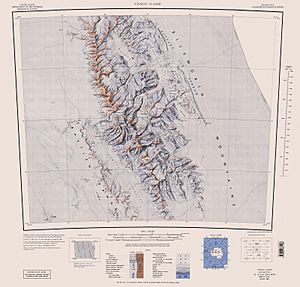
The Bangey Heights are located at a specific point in Antarctica: 78°02′30″S 85°34′00″W / 78.04167°S 85.56667°W. This location was first mapped by the United States in 1961, and the maps were updated in 1988. This helps scientists and explorers find and study this remote part of the world.
Maps of the Area
Maps are very important for exploring and understanding places like the Bangey Heights. They show the shape of the land, where the glaciers are, and how different peaks and ridges connect. These maps help us learn more about the amazing geography of Antarctica.
 | Georgia Louise Harris Brown |
 | Julian Abele |
 | Norma Merrick Sklarek |
 | William Sidney Pittman |


