2016 Te Araroa earthquake facts for kids
| UTC time | 2016-09-01 16:37:57 |
|---|---|
| ISC event | 611830479 |
| USGS-ANSS | ComCat |
| Local date | 2 September 2016 |
| Local time | 4:37:55 am NZST |
| Magnitude | 7.1 Mw |
| Depth | 22 km (14 mi) |
| Epicenter | 36°59′S 179°31′E / 36.98°S 179.52°E |
| Type | Oblique-slip |
| Areas affected | New Zealand |
| Max. intensity | VI (Strong) |
| Tsunami | 30 cm at East Cape and Great Barrier Island |
The 2016 Te Araroa earthquake was a strong earthquake that happened near Te Araroa, a town in New Zealand. It measured 7.1 on the moment magnitude scale, which is how scientists measure the strength of an earthquake. This earthquake struck early in the morning on September 2, 2016, at 4:37:55 am New Zealand Standard Time (NZST).
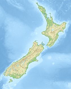
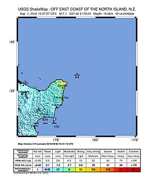
The earthquake's epicentre (the point on the Earth's surface directly above where the earthquake started) was about 125 kilometers (78 miles) north-east of Te Araroa. This area is off the East Cape of New Zealand's North Island. The earthquake happened about 22 kilometers (14 miles) deep inside the Earth. Many people across the North Island and in the upper part of the South Island felt the shaking. Luckily, no one was hurt, and buildings generally had only minor damage.
Contents
Understanding the Te Araroa Earthquake
Earthquakes happen when parts of the Earth's outer layer, called tectonic plates, suddenly move. This movement releases a lot of energy, causing the ground to shake. The moment magnitude scale helps scientists compare the size of different earthquakes. A 7.1 magnitude earthquake is considered quite powerful.
What is a Foreshock?
Sometimes, smaller earthquakes happen before a main, larger earthquake. These are called foreshocks. One day before the main Te Araroa earthquake, on September 1, 2016, a magnitude 5.7 earthquake was recorded. This was a foreshock to the bigger event. It happened at 10:04:35 am NZST.
Here's a quick look at that foreshock:
| Date | Local time (NZST) |
Magnitude | Hypocenter depth |
Epicenter | ||
|---|---|---|---|---|---|---|
| Location | Latitude | Longitude | ||||
| 1 September 2016 | 10:04:35 | 5.7 | 26 km (16 mi) | 100 km north-east of Te Araroa | −37.06 | 179.21 |
What are Aftershocks?
After a big earthquake, there are often many smaller earthquakes that follow. These are known as aftershocks. The 2016 Te Araroa earthquake had a series of aftershocks. The strongest one measured magnitude 6.2 and happened shortly after the main quake, at 5:15:05 am NZST on September 2.
Many other smaller aftershocks also occurred. By early November 2016, 18 of these aftershocks were magnitude 5.0 or greater. Scientists at GeoNet study these events. They predicted there was a chance of more aftershocks, but the chance of another earthquake as big as 7.0 was quite low.
What Happened After the Earthquake?
After the earthquake, New Zealand's Ministry of Civil Defence & Emergency Management (MCDEM) issued a tsunami warning. A tsunami is a series of very large ocean waves caused by underwater earthquakes or other big disturbances. This warning was for parts of the North Island's coast.
Small waves, about 30 centimeters (12 inches) high, were measured by tide gauges (instruments that measure sea level) at East Cape and Great Barrier Island. Even though the warning was later canceled, people were still advised to be careful of strong currents and unusual changes in sea level.
Some areas experienced temporary power outages, meaning the electricity went out. About 300 homes near Rototahi and Waimata, north of Gisborne, lost power. KiwiRail, the company that manages New Zealand's railways, also temporarily stopped trains in part of Auckland as a safety measure.
While there were no serious injuries or major damage, the Earthquake Commission received claims for damage. Most of the damage was in coastal towns close to where the earthquake happened. For example, in Te Puia Springs, a historic building called Puketiti Homestead and Stable had some damage to its chimney and fireplace.
 | Chris Smalls |
 | Fred Hampton |
 | Ralph Abernathy |


