Aisén Fjord facts for kids
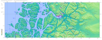
The Aysén Fjord is a long, narrow arm of the sea, like a deep inlet, found in Chile. It stretches about 70 kilometers (around 43 miles) eastward from a group of small islands and rocky areas called the Moraleda Channel. This channel separates the Chonos Archipelago from the mainland of Chile. The fjord is located at 45.26° South and 73.00° West. It connects to the big Pacific Ocean through another waterway called the Darwin Channel. The Aysén River flows into the very end of the Aysén Fjord.
Contents
Towns on the Fjord
Two important towns are located near the Aysén Fjord.
Puerto Chacabuco
Puerto Chacabuco is a port town right on the shores at the head of the fjord. It's a key place for boats and ships.
Puerto Aysén
Puerto Aysén is a bit further inland. It sits on the Aysén River, about 4 kilometers (2.5 miles) upstream from where the river meets the fjord. Puerto Aysén is the main city for the Aysén Province.
Weather and Water
The Aysén Fjord area has very strong tides. The water level can change by as much as 8 meters (about 26 feet) between high and low tide.
Lots of Rain
This region gets a lot of rain, between 4,000 and 7,000 millimeters (157 to 275 inches) every year! This is because of strong winds and ocean currents.
The area is near the West Wind Drift. This is a big ocean current that brings warm water. When this warm water meets the coast of Chile, it causes a lot of water to evaporate into the air.
Strong Winds
The moisture in the air is then pushed onto the land by strong westerly winds. These winds are known as the "Roaring Forties" because they are very powerful and are found around 40 degrees latitude in the Southern Hemisphere. When the moist air hits the Andes mountains, it cools down and falls as heavy rain.
Exploring the Fjord
The Aysén Fjord was first explored in 1870 by a person named Enrique Simpson. He sailed on a ship called the Chacabuco. Simpson discovered that the fjord was very useful. It provided a way for ships to travel further inland into the country.
Recent Events
In recent times, there have been a couple of notable events around the Aysén Fjord.
Factory Plans
From the 1990s until 2003, there were plans to build a large factory, an aluminium smelter, in Puerto Chacabuco. However, some local businesses, especially those that raise salmon in the fjord, were worried. They thought the factory might cause water pollution.
Earthquakes
Between January and April 2007, the area around the fjord experienced a series of small earthquakes. These were natural events that caused some shaking in the region.
See also
 In Spanish: Fiordo de Aysén para niños
 | Selma Burke |
 | Pauline Powell Burns |
 | Frederick J. Brown |
 | Robert Blackburn |


