Akershus facts for kids
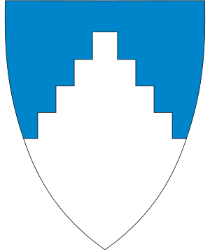
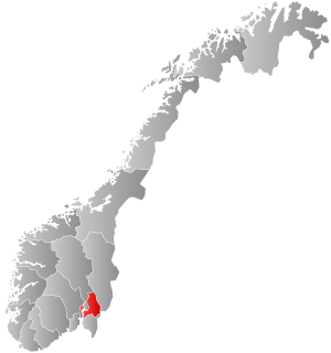
Akershus was a county in Norway. It was located near Oslo, the capital city. Akershus was the second largest county in Norway by population, with over half a million people living there. It shared borders with several other counties like Hedmark, Oppland, Buskerud, Oslo, and Østfold. It even had a small border with Sweden. The county got its name from the famous Akershus Fortress. Interestingly, the main office for Akershus county was in Oslo, even though Oslo was a separate county itself.
On January 1, 2020, Akershus joined with Buskerud and Østfold to form a new, larger county called Viken.
Contents
Exploring Akershus's Landscape
Most of Akershus was made up of two main areas: Follo and Romerike. There were also two smaller areas called Asker and Bærum. These were located west of Oslo. This happened after the area of Aker, which surrounded Oslo, became part of Oslo in 1948.
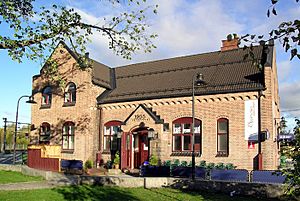
Akershus included parts of the large lake Mjøsa and parts of the river Glomma. Because many of Oslo's suburbs, like Bærum, were in Akershus, a lot of people lived in a small space. Major railway lines going into Oslo passed through Akershus. Many stations were along these lines, such as Asker, Ullensaker, Ski, and Lillestrøm.
The county also included the historical place called Eidsvoll. This town is about 48 kilometers (30 miles) north of Oslo. In 1814, the Norwegian National Assembly voted for the country's constitution here. South of Eidsvoll is the Oslo Airport at Gardermoen, which is an international airport. The home of the crown prince is located in Asker.
Important Buildings
Akershus was home to some important buildings. It had a major international airport, the Oslo Airport. It also had two university hospitals. These were the Akershus University Hospital and the Sunnaas Hospital.
A Look at Akershus's History
Akershus became a fief (an area of land controlled by a lord) in the 16th century. Back then, it was much larger. It included the areas that are now the counties of Hedmark, Oppland, Buskerud, and Oslo. It also included some towns in the county of Østfold.
Over time, parts of Akershus became separate counties.
- In 1685, Buskerud was separated.
- In 1768, Hedmark and Oppland also became separate.
- In 1842, Christiania (which is now Oslo) became its own separate area.
- In 1948, the Aker area was moved from Akershus to the county of Oslo.
Where the Name Akershus Comes From
The county was named after the Akershus Fortress. This fortress was built in 1299. Its name means "the (fortified) house of (the district) Aker."
Towns and Communities
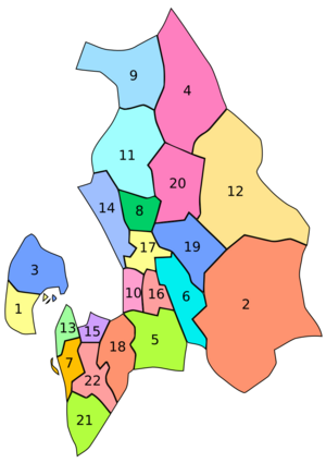
Here are the municipalities (local communities) that were part of Akershus:
- Asker
- Aurskog-Høland
- Bærum
- Eidsvoll
- Enebakk
- Fet
- Frogn
- Gjerdrum
- Hurdal
- Lørenskog
- Nannestad
- Nes
- Nesodden
- Nittedal
- Oppegård
- Rælingen
- Skedsmo
- Ski
- Sørum
- Ullensaker
- Vestby
- Ås
See also
 In Spanish: Provincia de Akershus para niños
 | Stephanie Wilson |
 | Charles Bolden |
 | Ronald McNair |
 | Frederick D. Gregory |


