Alamo, Indiana facts for kids
Quick facts for kids
Alamo, Indiana
|
|
|---|---|
 |
|
| Country | United States |
| State | Indiana |
| County | Montgomery |
| Township | Ripley |
| Area | |
| • Total | 0.06 sq mi (0.16 km2) |
| • Land | 0.06 sq mi (0.16 km2) |
| • Water | 0.00 sq mi (0.00 km2) |
| Elevation | 814 ft (248 m) |
| Population
(2020)
|
|
| • Total | 66 |
| • Density | 1,064.52/sq mi (409.27/km2) |
| Time zone | UTC−5 (Eastern (EST)) |
| • Summer (DST) | UTC−5 (EST) |
| ZIP code |
47916
|
| Area code | 765 |
| FIPS code | 18-00784 |
| GNIS ID | 2397421 |
Alamo is a small town in Ripley Township, Montgomery County, in the state of Indiana, United States. In 2020, the town had 66 people living there. This number was the same as in 2010.
Contents
History of Alamo
Alamo was planned and officially marked out in 1837. It quickly became a small place for local farms to trade goods. In 1859, a road was built connecting Alamo to Crawfordsville. Also, the Yountsville Covered Bridge was built around that time. The town got its name from the famous Alamo Mission in San Antonio, Texas.
Alamo has had a post office helping its residents since 1844.
Where is Alamo? (Geography)
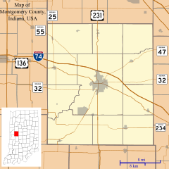
Alamo is located in the western part of Montgomery County. It is about 13 miles (21 km) southwest of Crawfordsville, which is the main city of the county.
According to the U.S. Census Bureau, Alamo covers a total area of 0.06 square miles (0.16 square kilometers). All of this area is land. The town is on high ground. Water from Alamo flows east into streams that lead to Sugar Creek. Water also flows west into streams that join Stillwater Creek. All these creeks are part of the Sugar Creek watershed, which eventually flows into the Wabash River.
Who Lives in Alamo? (Demographics)
This section tells us about the people who live in Alamo.
Alamo's Population Over Time
The number of people living in Alamo has changed over many years. Here is a look at how the population has grown and shrunk:
| Historical population | |||
|---|---|---|---|
| Census | Pop. | %± | |
| 1880 | 220 | — | |
| 1890 | 272 | 23.6% | |
| 1900 | 241 | −11.4% | |
| 1910 | 209 | −13.3% | |
| 1920 | 167 | −20.1% | |
| 1930 | 163 | −2.4% | |
| 1940 | 155 | −4.9% | |
| 1950 | 163 | 5.2% | |
| 1960 | 144 | −11.7% | |
| 1970 | 145 | 0.7% | |
| 1980 | 178 | 22.8% | |
| 1990 | 112 | −37.1% | |
| 2000 | 137 | 22.3% | |
| 2010 | 66 | −51.8% | |
| 2020 | 66 | 0.0% | |
| U.S. Decennial Census | |||
What Alamo's People are Like (2010 Census)
In 2010, there were 66 people living in Alamo. These people lived in 26 different homes, and 17 of these were families. The town had about 943 people per square mile (364 people per square kilometer). There were 39 housing units, which means places where people could live.
Most of the people in Alamo (89.4%) were White. About 3.0% were Native American. About 6.1% were from other backgrounds, and 1.5% were from two or more backgrounds. About 6.1% of the people were Hispanic or Latino.
Out of the 26 homes, 30.8% had children under 18 living there. About 42.3% were married couples. Some homes had a female head (15.4%) or a male head (7.7%) without a spouse. About 26.9% of homes had only one person living in them. And 19.2% of these single-person homes had someone 65 years old or older. On average, there were 2.54 people in each home.
The average age of people in Alamo was 36.7 years old. About 24.2% of residents were under 18. About 13.6% were between 18 and 24. A large group, 30.3%, were between 25 and 44. About 21.1% were between 45 and 64. Finally, 10.6% were 65 years old or older. In terms of gender, 45.5% of the people were male, and 54.5% were female.
Schools in Alamo
The South Montgomery Community School Corporation runs the public schools that serve Alamo. Students in junior high go to Southmont Junior High School. Older students attend Southmont High School.
Community Groups in Alamo
Alamo has a few important non-profit groups that help the community:
- The Alamo Christian Church, led by Minister Kevin Howey.
- The Ripley Township Fire Department, which helps keep everyone safe.
- Masonic Lodge No. 144, a local chapter of a fraternal organization.
See also
 In Spanish: Alamo (Indiana) para niños
 | Georgia Louise Harris Brown |
 | Julian Abele |
 | Norma Merrick Sklarek |
 | William Sidney Pittman |


