Almond (village), New York facts for kids
Quick facts for kids
Almond, New York
|
|
|---|---|
|
Village
|
|
| Country | United States |
| State | New York |
| Counties | Allegany, Steuben |
| Towns | Almond, Hornellsville |
| Government | |
| • Type | Village Board |
| Area | |
| • Total | 0.56 sq mi (1.46 km2) |
| • Land | 0.56 sq mi (1.46 km2) |
| • Water | 0.00 sq mi (0.00 km2) |
| Elevation | 1,335 ft (407 m) |
| Population
(2020)
|
|
| • Total | 415 |
| • Density | 735.82/sq mi (283.93/km2) |
| Time zone | UTC-5 (Eastern (EST)) |
| • Summer (DST) | UTC-4 (EDT) |
| ZIP code |
14804
|
| Area code(s) | 607 |
| FIPS code | 36-01440 |
| GNIS feature ID | 0942389 |
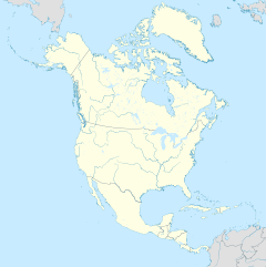
Almond is a small village in New York, United States. It's unique because it's located in two different counties: Allegany County and Steuben County. It's also part of two towns: Almond and Hornellsville. In 2010, about 466 people lived in Almond.
Contents
Village History: The Story of Almond
Early Settlers and Naming the Village
The first people to settle in the area, known as Karr Valley, arrived in 1796. They came from Luzerne County, Pennsylvania. Later, in 1806, Allegany County, New York was officially formed. The area that would become Almond was first part of the town of Alfred, New York. In 1821, Almond became its own separate town.
It's interesting to know that the village wasn't named after the almond nut! Instead, it was named after the Almond River in Scotland. Many of the early settlers came from near that river. People in the village still say the name with the Scottish pronunciation, which sounds more like "Ellmund."
Growth and Changes Over Time
In the early 1800s, Almond was a busy place. Many mills and factories were built along the creek and Main Street. However, the narrow valley limited how much the town could grow. By the 1840s, it had reached its maximum size.
Because of this, new businesses started moving to nearby towns like Hornell. By the early 1900s, Almond's economy had slowed down a lot. Old factories sometimes burned down, and their owners chose to rebuild in other places instead of in Almond.
Geography: Where Almond Is Located
Size and Natural Features
Almond is a small village. It covers about 0.6 square miles (1.5 square kilometers) of land. There is no water area within the village limits.
The Canacadea Creek flows right through the village. This creek was important for the early mills.
Major Roads and Transportation
Important roads also pass through Almond. The Southern Tier Expressway, which includes Interstate 86 and New York State Route 17, goes through the village. New York State Route 21 also runs through Almond.
Demographics: Who Lives in Almond
Population Changes Over the Years
The population of Almond has changed over time. Here's how many people have lived there according to the U.S. Census:
| Historical population | |||
|---|---|---|---|
| Census | Pop. | %± | |
| 1930 | 438 | — | |
| 1940 | 533 | 21.7% | |
| 1950 | 659 | 23.6% | |
| 1960 | 696 | 5.6% | |
| 1970 | 658 | −5.5% | |
| 1980 | 568 | −13.7% | |
| 1990 | 458 | −19.4% | |
| 2000 | 461 | 0.7% | |
| 2010 | 466 | 1.1% | |
| 2020 | 415 | −10.9% | |
| U.S. Decennial Census | |||
Notable Person
- Carol Fenner, an author, lived in Almond.
See Also
 In Spanish: Almond (villa) para niños
 | Laphonza Butler |
 | Daisy Bates |
 | Elizabeth Piper Ensley |


