Ambon, Maluku facts for kids
Quick facts for kids
Ambon
|
||
|---|---|---|
|
City
|
||
| City of Ambon Kota Ambon |
||
|
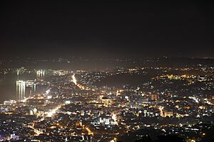
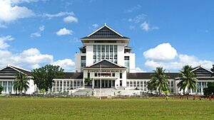
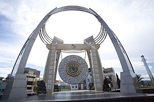
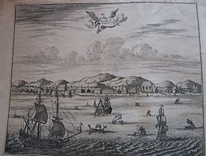
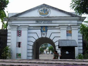
From top, left to right:
|
||
|
||
| Motto(s):
Bersatu Manggurebe Maju
|
||
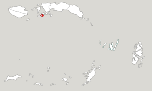
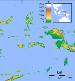
Location within Maluku
|
||
|
OpenStreetMap
|
||
| Country | ||
| Region | Maluku | |
| Province | ||
| Incorporated | 7 September 1575 | |
| Area | ||
| • Total | 359.45 km2 (138.78 sq mi) | |
| Elevation | 3 m (10 ft) | |
| Population
(mid 2023 estimate)
|
||
| • Total | 354,052 | |
| • Density | 984.983/km2 (2,551.09/sq mi) | |
| Area code | (+62) 911 | |
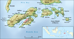
Ambon is the capital and largest city in the Indonesian province of Maluku. People sometimes call it Ambon Manise, which means "beautiful Ambon" in the local language. The city covers about 359.45 square kilometers. In mid-2023, about 354,052 people lived there.
Ambon is divided into five main areas called districts. It is also known as Indonesia's music city. In 2019, Ambon became the first city in Southeast Asia to be named a UNESCO City of Music.
Many different groups of people live in Ambon. These include original Moluccans (called Alifuru), Javanese, Balinese, and others from different parts of Indonesia. There are also people whose families came from other countries like China, Arabia, Spain, Germany, Portugal, and the Netherlands. Between 1999 and 2002, there were some difficult times in the city.
Contents
History of Ambon
Colonial Rule
Ambon was first taken over by Portugal in 1526. They named it Nossa Senhora de Anunciada. The Portuguese were later forced out by the Dutch in 1605.
Except for short times when the British ruled, the island stayed under Dutch control. This lasted until Indonesia became independent in 1945.
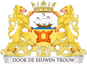
During the time of Dutch rule, Ambon was an important center. It was where the Dutch leader and military commander for the Maluku Islands lived. The city was protected by a fort called Fort Victoria. In the early 1900s, Ambon was described as a clean town with wide streets.
The people were divided into two main groups. One group had special rights because their ancestors had worked with the old Dutch East India Company. Besides the Dutch, there were also people from Arabia, China, and some Portuguese families. Ambon was a place where Christian missionaries worked. Because of this, many people in Ambon and nearby islands are Christians, while most of Indonesia is Muslim.
Conflicts After Independence
After Indonesia became independent, Ambon faced more challenges. In 1950, there was an uprising against Indonesian rule. This was started by a group that wanted to create their own country called the Republic of the South Moluccas. Indonesian troops entered the city and took back control within a few months. Many important buildings, like Fort Victoria, were damaged during this time.
In the late 1950s, there were more conflicts. During a rebellion in North Sulawesi, the USA provided support to the rebels. This included planes that attacked targets in and around Ambon. These attacks caused damage to military and commercial areas. One American pilot was captured, which showed the world that the USA was involved. After this, the USA stopped its support for the rebellion.
In the 1980s, many people from Java, mostly Muslim, moved to Ambon. This was part of a government plan to move people to less crowded areas.
Between 1999 and 2002, Ambon experienced conflicts between different religious groups. There was also more religious violence in 2011.
Geography and Climate
Land Features
Most of Ambon's land is hilly or steeply sloped. About 17% of the land is flatter.
Weather in Ambon
Ambon has a tropical rainforest climate. This means it's warm all year round and gets a lot of rain. There isn't a truly dry season. The month with the most rain is June, and the driest is November. Since Ambon is close to the equator, the temperature stays pretty much the same throughout the year. December is usually the warmest month, and July is the coolest.
| Climate data for Ambon, Maluku, Indonesia (Extremes: 1912-1936) | |||||||||||||
|---|---|---|---|---|---|---|---|---|---|---|---|---|---|
| Month | Jan | Feb | Mar | Apr | May | Jun | Jul | Aug | Sep | Oct | Nov | Dec | Year |
| Record high °C (°F) | 35.5 (95.9) |
35.5 (95.9) |
35.0 (95.0) |
33.9 (93.0) |
32.3 (90.1) |
30.5 (86.9) |
30.0 (86.0) |
30.5 (86.9) |
31.1 (88.0) |
32.8 (91.0) |
34.4 (93.9) |
35.5 (95.9) |
35.5 (95.9) |
| Mean daily maximum °C (°F) | 31.3 (88.3) |
31.4 (88.5) |
31.1 (88.0) |
30.7 (87.3) |
29.8 (85.6) |
28.5 (83.3) |
27.5 (81.5) |
27.8 (82.0) |
29.1 (84.4) |
30.3 (86.5) |
31.1 (88.0) |
31.5 (88.7) |
30.0 (86.0) |
| Daily mean °C (°F) | 27.0 (80.6) |
27.0 (80.6) |
26.9 (80.4) |
26.7 (80.1) |
26.4 (79.5) |
25.6 (78.1) |
25.0 (77.0) |
25.1 (77.2) |
25.7 (78.3) |
26.5 (79.7) |
27.0 (80.6) |
27.2 (81.0) |
26.3 (79.3) |
| Mean daily minimum °C (°F) | 24.1 (75.4) |
24.1 (75.4) |
23.8 (74.8) |
23.9 (75.0) |
24.0 (75.2) |
23.6 (74.5) |
23.2 (73.8) |
23.1 (73.6) |
23.3 (73.9) |
23.8 (74.8) |
24.1 (75.4) |
24.2 (75.6) |
23.8 (74.8) |
| Record low °C (°F) | 22.2 (72.0) |
22.8 (73.0) |
22.2 (72.0) |
21.6 (70.9) |
20.0 (68.0) |
20.5 (68.9) |
20.0 (68.0) |
19.4 (66.9) |
18.9 (66.0) |
18.9 (66.0) |
21.1 (70.0) |
20.0 (68.0) |
18.9 (66.0) |
| Average rainfall mm (inches) | 127 (5.0) |
119 (4.7) |
135 (5.3) |
279 (11.0) |
516 (20.3) |
638 (25.1) |
602 (23.7) |
401 (15.8) |
241 (9.5) |
155 (6.1) |
114 (4.5) |
132 (5.2) |
3,459 (136.2) |
| Average rainy days | 12 | 13 | 12 | 12 | 19 | 21 | 22 | 21 | 16 | 10 | 10 | 13 | 181 |
| Average relative humidity (%) | 79 | 80 | 83 | 85 | 87 | 86 | 85 | 84 | 83 | 81 | 80 | 82 | 83 |
| Mean monthly sunshine hours | 192 | 186 | 211 | 177 | 158 | 120 | 115 | 112 | 150 | 192 | 219 | 202 | 2,034 |
| Source 1: Deutscher Wetterdienst | |||||||||||||
| Source 2: Danish Meteorological Institute | |||||||||||||
Administrative Districts
Ambon city is divided into five main areas called districts (kecamatan). Each district has its own administrative center. These districts are made up of different types of villages. Some are urban villages (kelurahan), and others are traditional villages (negeri or desa).
| Name of District (kecamatan) |
Area in km2 |
Pop'n Estimate mid 2023 |
Admin centre |
No. of villages |
|---|---|---|---|---|
| Nusaniwe | 88.35 | 91,415 | Amahusu | 13 |
| Sirimau | 86.81 | 147,996 | Karang Panjang | 14 |
| Teluk Ambon (Ambon Bay) | 93.68 | 44,525 | Wayame | 8 |
| Baguala | 40.11 | 60,022 | Passo | 7 |
| Leitimur Selatan (South Leitimur) |
50.50 | 10,094 | Leahari | 8 |
In the Maluku Islands, some areas in Ambon still have a special status called "states." These are led by traditional leaders known as kings and queens.
Religion
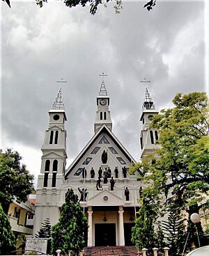
In mid-2023, about 354,052 people lived in Ambon. Most people in Ambon are Christians, with Protestants being the largest group. A smaller number are Catholics. The second largest religious group is Muslim. There are also a few people who follow other religions.
| Religions in Ambon | ||||
|---|---|---|---|---|
| Religion | Percent | |||
| Protestant | 58.37% | |||
| Islam | 39.02% | |||
| Catholic | 2.41% | |||
| Others | 3% | |||
Economy
Ambon's economy has been growing steadily. In 2014, the economy grew by almost 6%. The total value of goods and services produced in Ambon was about 9.9 trillion Indonesian Rupiah in 2014. This shows that the city's economy is getting stronger.
The average income per person in Ambon also increased. In 2014, it was about 25.16 million Rupiah (around $1,836 US dollars). The number of people living in poverty in Ambon is quite low, at 4.42%. This is the lowest poverty rate in the entire Maluku province.
Many different parts of the economy are doing well. The electricity and gas sector contributed the most to the economy's growth in 2014.
Education
Most people in Ambon can read and write, with a literacy rate of 99.63% in 2010. However, the number of children going to school in Ambon City was lower than the national average in 2010. By 2011, more students were enrolling in schools at all levels.
Ambon has many places for higher education. There are 17 colleges and universities in the city.
State-owned institutions
- Pattimura University
- Ambon State Polytechnic
Private Institutions
- College of Protestant Christianity Ambon
- Trinity College of Administrative Sciences
- Abdul Aziz Kataloka College of Administrative Sciences
- Rutu Nusa College of Economics Management
- Pasapua College of Health
- University of Darussalam Ambon
- Christian University of Indonesia Maluku
- Maritime Academy Maluku
- Caritas Secretary and Management Academy
- Ambon College of Computer Sciences
- Indonesian Islamic Religion Institute Ambon
- Industrial Academy ( AKPER RUKMIT ) Ambon
- Evangelical Theology College Indonesia
- Bethel Theology College Ambon
- St. Yohanes College Ambon
Places of Interest
- Merah Putih Bridge
- Monument of Pattimura, Lapangan Merdeka
- Monument of Christina Martha Tiahahu, Karang Panjang
- Pattimura Stadium
- Ambon Plaza
- Liang beach
- Natsepa beach
- Santai Beach Resort
- Pintu Kota beach
- Galala-Poka Ferry crossing
- Batu Merah
- Ambon Bay at sunset
- Museum Siwalima at Batu Capeu
- Pukul Sapu Dance at Morela and Mamala (after seven days of Muslim's Eid al-Fitri)
- Siwang Paradise
Transportation
Ambon is served by Pattimura International Airport.
See Also
Twin Towns – Sister Cities
Ambon is connected with these cities:
 Darwin, Australia
 Vlissingen, Netherlands
 | Stephanie Wilson |
 | Charles Bolden |
 | Ronald McNair |
 | Frederick D. Gregory |


