Amicombe Hill facts for kids
Quick facts for kids Amicombe Hill |
|
|---|---|

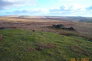
Amicombe Hill. Looking over from Fur Tor to Green Tor.
|
|
| Highest point | |
| Elevation | 584 m (1,916 ft) |
| Prominence | 36 m (118 ft) |
| Parent peak | High Willhays |
| Listing | Dewey, Tump |
| Geography | |
| Location | Devon, England |
| Parent range | Dartmoor |
| OS grid | SX566872 |
| Topo map | OS Landranger 191, Explorer 28N |
Amicombe Hill, also known as the Devil's Dome, is a tall hill in North Dartmoor in the southwest English county of Devon. It stands 584 meters high. This makes it the sixth highest peak in Devon and Dartmoor.
Exploring Amicombe Hill
Amicombe Hill is in the northern part of Dartmoor. It is known for being a wild and quiet place. Most of this hill is inside a special military training area. This means you can only visit it at certain times.
What Does Amicombe Hill Look Like?
The hill forms a long, curved ridge. The West Okement River flows to its east. To the west and southwest, you'll find Rattle Brook. The very top of the hill is a rocky outcrop called a tor. There is also a flagpole there.
Near the main summit, you can find another tor called Kitty Tor. On the steep eastern side of the hill, there are more interesting rocks. One of these is a logan rock, which is a huge rock that can be rocked back and forth. To the west, you might see the old remains of a building called Bleak House and other old ruins.
Nearby Peaks
Amicombe Hill is surrounded by other important peaks in Dartmoor:
- Great Links Tor is about 1.5 kilometers (about 1 mile) to the west-southwest. It is 586 meters high.
- High Willhays is Dartmoor's highest peak. It stands 621 meters tall. It is about 2 kilometers (about 1.2 miles) northeast of Amicombe Hill.
 | Anna J. Cooper |
 | Mary McLeod Bethune |
 | Lillie Mae Bradford |

