Anctoville facts for kids
Quick facts for kids
Anctoville
|
|
|---|---|
|
Part of Aurseulles
|
|
 |
|
| Country | France |
| Region | Normandy |
| Department | Calvados |
| Arrondissement | Bayeux |
| Canton | Les Monts d'Aunay |
| Commune | Aurseulles |
| Area
1
|
17.48 km2 (6.75 sq mi) |
| Population
(2019)
|
1,081 |
| • Density | 61.84/km2 (160.17/sq mi) |
| Time zone | UTC+01:00 (CET) |
| • Summer (DST) | UTC+02:00 (CEST) |
| Postal code |
14240
|
| Elevation | 62–158 m (203–518 ft) (avg. 90 m or 300 ft) |
| 1 French Land Register data, which excludes lakes, ponds, glaciers > 1 km2 (0.386 sq mi or 247 acres) and river estuaries. | |
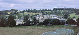
Anctoville was once a small town, or commune, located in the Calvados area of Normandy, in north-western France. It was officially joined with a new commune called Aurseulles on January 1, 2017.
Contents
Where is Anctoville Located?
Anctoville is about 30 kilometers (18 miles) south-west of a bigger city called Caen. It's also about 5 kilometers (3 miles) north-west of Villers-Bocage. The area is known as the Bessin and sits in the Seulles valley.
Several roads pass through Anctoville, making it easy to get around. The D67 road goes through the main village, connecting it to Saint-Germain-d'Ectot in the north and Villers-Bocage in the south-east. The D92 road also crosses the commune from south-west to north-east. There are also the D33 and D173A roads in the north-east. Most of the land around Anctoville is used for farming, with only a couple of small forest areas in the north.
Several small streams flow through or along the edges of Anctoville. The Ruisseau des Landes forms part of the northern border. The Le Candon stream flows through the area, and Le Seulles stream forms part of the southern border before flowing near the village. These streams eventually meet up.
 |
Saint-Germain-d'Ectot | Longraye | Vendes |  |
| Livry | Saint-Louet-sur-Seulles | |||
| Caumont-l'Evente | Amayé-sur-Seulles | Villers-Bocage |
A Look at Anctoville's History
The name Anctoville comes from Asketillville, which means "Anquetil farm." It's similar to the name Ancretteville-sur-Mer.
Before 1616, Anctoville was known as Coisnières or Cornières. A man named Olivier Foulognes, who was the King's butler, bought the land and managed to get the name changed. The oldest record of the Coisnières area dates back to the 12th century. It was a document from Henry, King of England and Duke of Normandy.
During World War II, in June 1944, a big battle called the Battle of Villers-Bocage took place nearby. A German army headquarters was located in Orbois castle, which is in Anctoville. British soldiers from the 61st reconnaissance battalion helped free Anctoville on August 1, 1944. These events even inspired a part of the video game Call of Duty 2!
In 1973, Anctoville joined together with three smaller towns: Feuguerolles-sur-Seulles, Orbois, and Sermentot. Even after joining, these smaller towns kept some of their own local identity.
How Anctoville was Governed
Anctoville used to have its own local government with a mayor. The town council was made up of fifteen members. Seven members represented Anctoville itself. The other towns that joined Anctoville also had their own representatives and a special "delegated mayor" for their area.
List of Mayors
| From | To | Name | Job |
|---|---|---|---|
| ? | 2001 | Albert Marie | |
| 2001 | 2017 | Gérard Leguay | Farmer |
Who Lives in Anctoville?
The people from Anctoville are called Anctovillais (for boys and men) or Anctovillaises (for girls and women). Back in 1806, Anctoville had 1,210 people living there. When the four towns merged in 1973, their combined population was 2,608 in 1836.
| Historical population | ||||||||||||||||||||||||||||||||||||||||||||||||||||||||||||||||||||||||||||||||||||||||||||||||||||||||||||||||
|---|---|---|---|---|---|---|---|---|---|---|---|---|---|---|---|---|---|---|---|---|---|---|---|---|---|---|---|---|---|---|---|---|---|---|---|---|---|---|---|---|---|---|---|---|---|---|---|---|---|---|---|---|---|---|---|---|---|---|---|---|---|---|---|---|---|---|---|---|---|---|---|---|---|---|---|---|---|---|---|---|---|---|---|---|---|---|---|---|---|---|---|---|---|---|---|---|---|---|---|---|---|---|---|---|---|---|---|---|---|---|---|---|
|
|
|||||||||||||||||||||||||||||||||||||||||||||||||||||||||||||||||||||||||||||||||||||||||||||||||||||||||||||||
| Source: EHESS and INSEE | ||||||||||||||||||||||||||||||||||||||||||||||||||||||||||||||||||||||||||||||||||||||||||||||||||||||||||||||||
What is Anctoville's Economy Like?
The main way people make a living in Anctoville is through farming. In 1998, there were 46 farms in the area. Most of the farming involves raising cattle for milk and meat. Farmers also grow crops like forage (food for animals) and grain.
Culture and Important Buildings
Anctoville has some interesting old buildings and places.
Civil Heritage
- The Pierre Rayer Orphanage was started in 1883. It was built in an 18th-century castle with some newer parts added later. Today, it serves as a home for children who need social support.
Religious Heritage
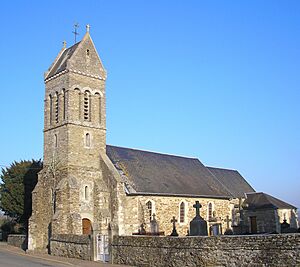
- The Church of Saint Peter at Feuguerolles is a very old church, with parts dating back to the 12th century.
- The Church of Saint-Aubin at Sermentot also has parts from the 12th century.
- The Church of Saint Peter at Orbois is from the Roman era and 14th century. Inside, it has a special statue of the Madonna and Child from the 15th century, which is considered a historical object.
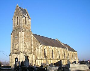
- The Church of Saint Nicolas in Anctoville was built in 1956 and is recognized as a historical monument.
Famous People from Anctoville
- Marie Rayer was the daughter of a doctor named Pierre François Olive Rayer. She left her property to the town to help create an orphanage for children.
- Jean-Claude Hallais (born in 1948) is a famous horse driver who won a big race called the Prix d'Amerique in 1992. His team was based in Anctoville.
See also
 In Spanish: Anctoville para niños
 | William Lucy |
 | Charles Hayes |
 | Cleveland Robinson |


