Angara facts for kids
Quick facts for kids Angara |
|
|---|---|
 |
|
 |
|
| Physical characteristics | |
| Main source | Lake Baikal 51°52′01″N 104°49′05″E / 51.867°N 104.818°E |
| River mouth | Yenisey 58°06′07″N 92°59′28″E / 58.102°N 92.991°E |
| Length | 1,849 km (1,149 mi) to 1,779 km (1,105 mi) |
| Basin features | |
| Progression | Yenisey→ Kara Sea |
| Basin size | 1,039,000 km2 (401,000 sq mi) to 1,056,000 km2 (408,000 sq mi) |
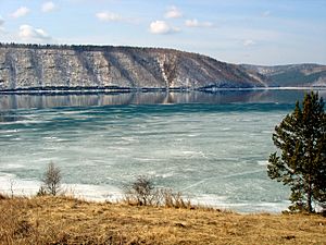
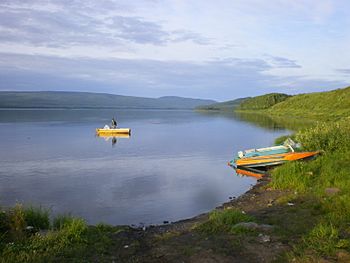
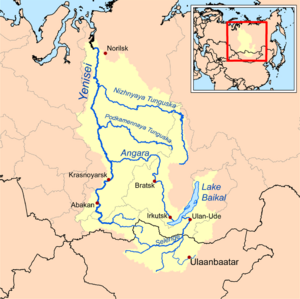
The Angara River is a very important river in Siberia, a large region in Russia. It starts from Lake Baikal, which is the deepest lake in the world! The Angara is the only river that flows out of Lake Baikal.
This river then flows into the Yenisey River, which is one of the longest rivers in the world. The Angara River is about 1,849 kilometres (1,149 mi) (about 1,149 miles) long. Its basin, the area of land that drains into it, is huge, covering about 1,039,000 square kilometres (401,000 sq mi) (about 401,000 square miles).
Contents
Journey of the Angara River
The Angara River begins its journey from Lake Baikal near a small town called Listvyanka. It flows north through several cities in the Irkutsk Oblast region of Russia. These cities include Irkutsk, Angarsk, Bratsk, and Ust-Ilimsk.
After passing these cities, the river crosses a mountain range called the Angara Range. Then, it turns west and enters another Russian region called Krasnoyarsk Krai. Finally, the Angara River joins the mighty Yenisey River near a place called Strelka. This meeting point is about 40 kilometres (25 mi) (25 miles) southeast of the city of Lesosibirsk.
Dams and Power Plants on the Angara
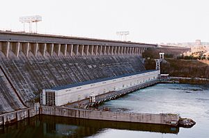
Since the 1950s, four large dams have been built on the Angara River. These dams are used to create electricity using the river's powerful flow. This is called hydroelectric power.
The four main dams are:
- The Irkutsk Dam: This dam creates the Irkutsk Reservoir. This reservoir floods the river valley from its start at Lake Baikal all the way to Irkutsk. It even makes the water level in Lake Baikal a little higher.
- The Bratsk Dam: This is another huge dam that forms the Bratsk Reservoir.
- The Ust-Ilimsk Dam: Located at Ust-Ilimsk, this dam creates the Ust-Ilimsk Reservoir.
- The Boguchany Dam: This dam is found near the town of Kodinsk.
Building these dams and their reservoirs caused many villages along the Angara River and its smaller rivers to be flooded. Many farms in the river valley were also covered by water. This changed the lives of the people who lived there.
How Boats Travel on the Angara
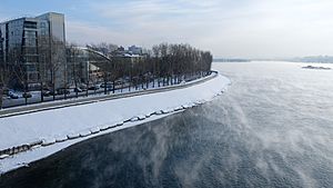
You can travel by boat on some parts of the Angara River, but not all the way from Lake Baikal to the Yenisey River. This is because the dams do not have special "locks" or "lifts" for boats to pass through.
Here are the parts where boats can travel:
- From Lake Baikal to Irkutsk.
- From Irkutsk to Bratsk.
- On the Ust-Ilimsk Reservoir.
- From the Boguchany Dam (near Kodinsk) all the way to where the river joins the Yenisey River.
There used to be fast-flowing parts (rapids) between the Ust-Ilimsk Dam and the Boguchany Dam. However, after the Boguchany Dam was finished and its reservoir filled up, some of these parts became calm enough for boats.
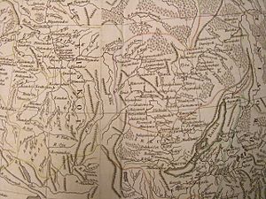
Even though you can't travel the whole length by boat today, the Angara River and its branch, the Ilim, were very important a long time ago. Around the 1630s, they were key water routes for Russian explorers and settlers moving into Siberia. These routes connected the Yenisey River with Lake Baikal and the Lena River. However, after roads and the Trans-Siberian Railway were built, the river became less important for transportation.
Rivers Joining the Angara
Many smaller rivers flow into the Angara River along its path. These are called tributaries. Here are some of the largest ones, listed from the start of the Angara to its end:
- Irkut (joins from the left side)
- Kitoy (joins from the left side)
- Belaya (joins from the left side)
- Oka (joins from the left side)
- Iya (joins from the left side)
- Ilim (joins from the right side)
- Kova (joins from the left side)
- Koda (joins from the right side)
- Chadobets (joins from the right side)
- Mura (joins from the left side)
- Irkeneyeva (joins from the right side)
- Taseyeva (joins from the left side)
See Also
 In Spanish: Río Angará para niños
- List of rivers of Russia
- Lena-Angara Plateau
- Yenisey Range
 | Aurelia Browder |
 | Nannie Helen Burroughs |
 | Michelle Alexander |


