Annagh Hill facts for kids
Quick facts for kids Annagh Hill |
|
|---|---|
| An tEannach Meaning Marsh or Bog | |

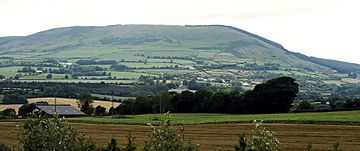
Annagh Hill, from the southeast
|
|
| Highest point | |
| Elevation | 454 m (1,490 ft) |
| Prominence | 231 m (758 ft) |
| Listing | Marilyn |
| Geography | |
| Location | Wexford, Ireland |
| Parent range | Wicklow Mountains |
| OSI/OSNI grid | T100680 |
| Topo map | OSi Discovery 62 |
Annagh Hill is a mountain located in the northern part of County Wexford, Ireland. Its name, An tEannach, comes from the Irish language and means "marsh" or "bog". It is part of the larger Wicklow Mountains range.
Annagh Hill stands at 454 meters (about 1,490 feet) tall. This makes it a significant landmark in its area. It is also known as a "Marilyn," which is a special term for a hill or mountain in the British Isles that rises at least 150 meters (about 492 feet) above the land around it.
Where is Annagh Hill Located?
Annagh Hill is found in the beautiful countryside of County Wexford. It is separated from another mountain called Croghan Mountain to its north. This separation happens at a place known as the "Wicklow Gap." Don't get this confused with another famous Wicklow Gap located in County Wicklow!
What Does Annagh Hill Look Like?
Most of Annagh Hill is covered in tall, green coniferous trees. These are the types of trees that stay green all year round, like pine or fir trees. The only part of the hill not covered in these trees is its southeastern side.
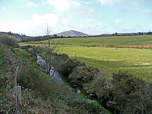
From the top of Annagh Hill, you can look down over two small villages. These are Monaseed and Hollyfort. They are located to the south of the hill, across a small valley. A stream called the Blackwater stream flows through this valley.
 | William L. Dawson |
 | W. E. B. Du Bois |
 | Harry Belafonte |


